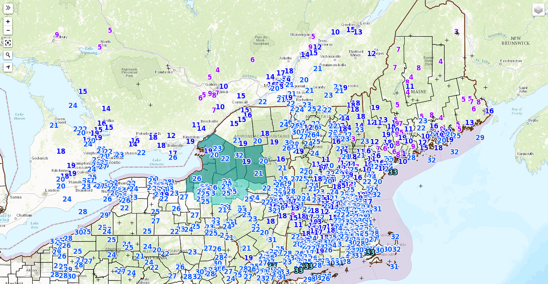
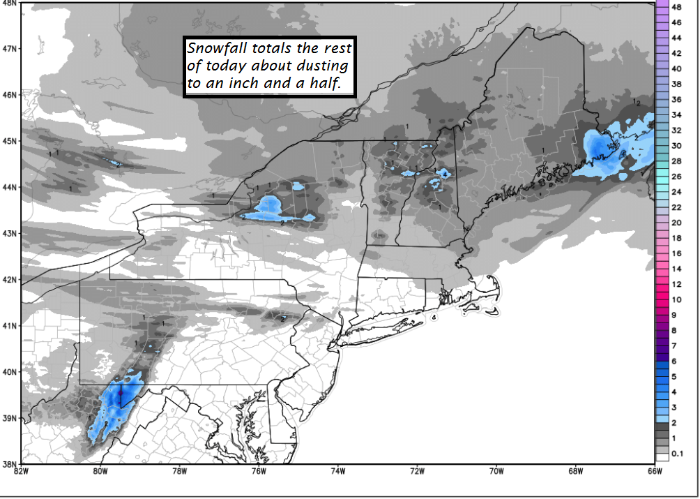
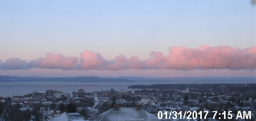
TONIGHT: Cloudy. Occasional accumulating snow showers or flurries. Around an inch or two of accumulation. A low in the mid to upper teens. Light winds.
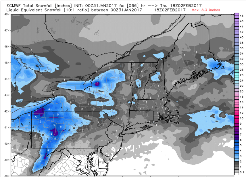
Winter Weather Advisory Noon tomorrow thru 4 AM Wednesday morning…
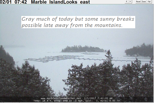
TOMORROW: Cloudy and gray. Periods of light snow likely with 1 to locally 4” of accumulation. Snow mixing with sleet Rutland south later in the day. Temperatures in the mid 20s. Southeast winds increasing 10 to 15 mph.
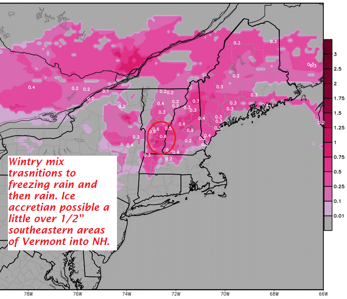
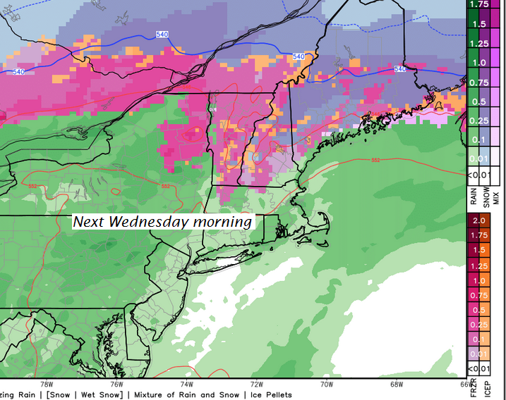
TUESDAY NIGHT: Overcast. Sleet and wet snow transitions to periods of freezing rain and rain with treacherous travel and some glazing likely. Temperatures in the mid 20s rising toward the freezing mark by day break. Southeast winds 10 to 15 mph.
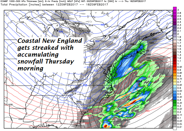
WEDNESDAY: Clouds with rain showers taper off toward late morning. Hazardous travel likely in the morning…sub-freezing ground temperatures. Milder in the afternoon & blustery with intervals of sunshine. A high in the 40s. Wind becoming westerly 10 to 25 mph with higher gusts.
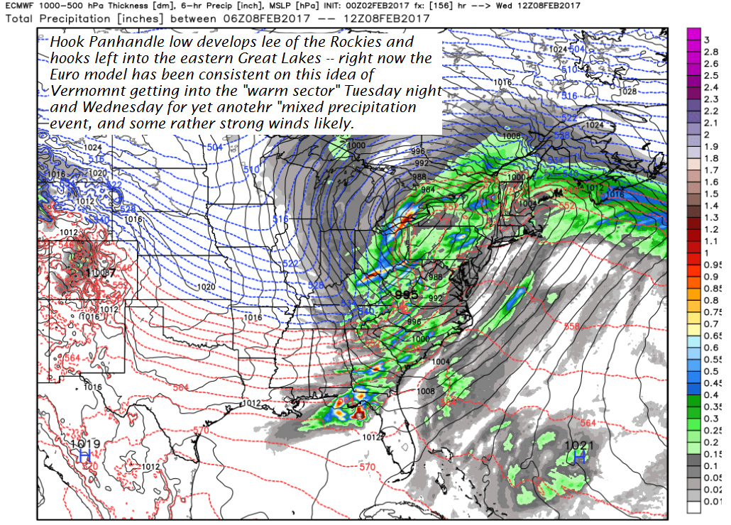
Looking Further ahead…
WEDNESDAY NIGHT: Partly cloudy with scattered flurries. A low in the mid single digits to around the low teens.
THURSDAY: A few morning flurries, otherwise lots of high clouds. Turning colder, with a high in the mid teens to around 20.
FRIDAY: Chance for a morning flurry, then lots of sunshine but frigid. A low 5 below to 10 above. A high in the mid teens to near 20.
SATURDAY: Filtered sunshine. A low around zero. A high in the mid 20s.
Average lows in the single digits. Normal highs in the upper 20s to low 30s.
RH/2-6[end]