
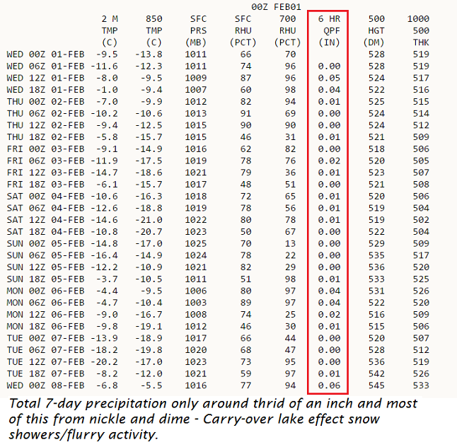
· Carry-over lake effect will be in style and where the more persistent bands set up like mother nature’s snow gun.
· Meteorological Output Stat’s or (MOS) from the mighty Euro model.
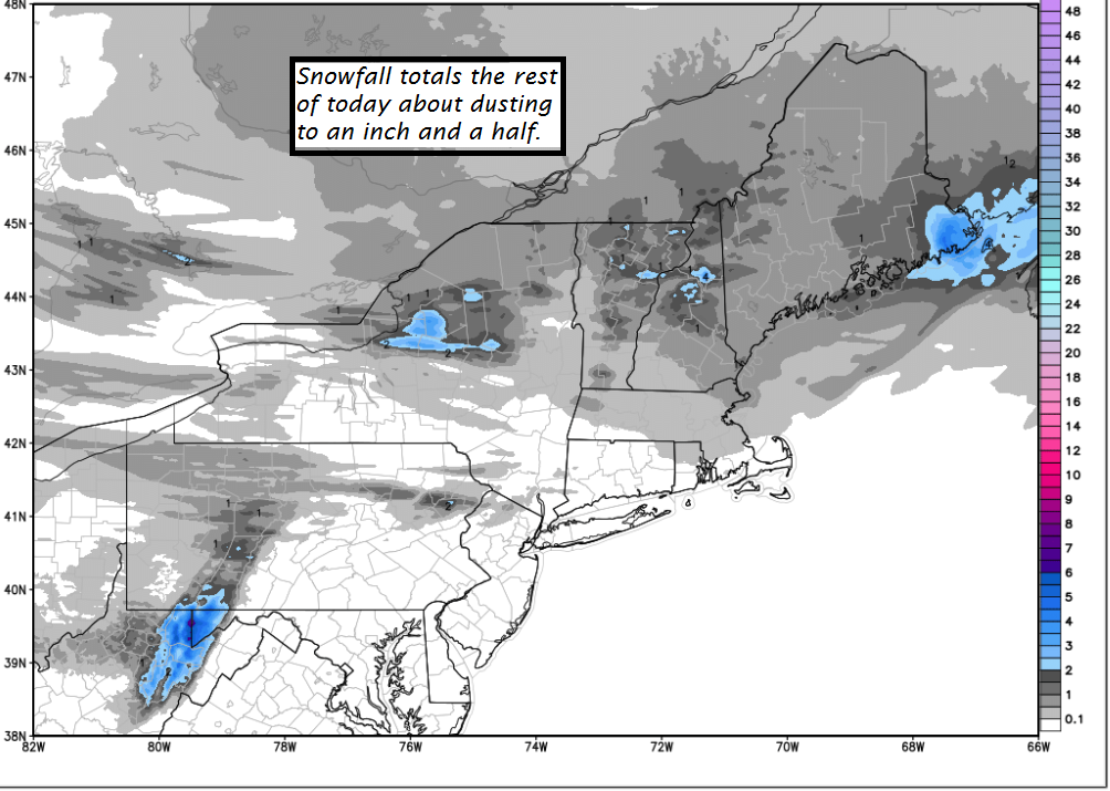
TODAY: Intermittent light accumulating snow through mid day, tapering off to scattered snow showers and valley flurries. Totally accumulation 1 to 2 inches. Breaks of late afternoon sunshine with a high in the low 30s. West breeze 10 mph.
TONIGHT: Scattered clouds in the evening with a few stray flurries. Cloudy periods overnight with scattered snow showers or flurries with a dusting to an inch. A low in the teens. Light southwest winds.
THURSDAY: Partly to mostly cloudy with occasional flurries or mountains snow showers. A dusting to an inch. A high 20 to 25. West to northwest winds 10 to 20 mph.
Looking Further ahead…
THURSDAY NIGHT: Partly cloudy. Scattered flurries. A low 5 above to 5 below.
FRIDAY: Mostly cloudy. Maybe a late day flurry. A high 20 to 25.
SATURDAY: Chance for a morning flurry, then partly to mostly sunny. A low 5 above to 5 below. A high in the low to mid teens.
SUNDAY: Morning sun followed by increasing afternoon clouds leading to a chance for late day snow showers. Frigid morning with a low 5 below to 5 above. A high 25 to 30.
MONDAY: Chance of snow showers or flurries otherwise more clouds than sun.A low in the mid teens. A high in the low to mid 20s.
Average lows in the mid to upper single digits. Normal highs in the mid 20s to around 30.
RH/2-1[end]
