
· Couple different plumes of Lake moisture streaming far southern and far northern Vermont with good chunk of the state in-between – still expect an occasional passing flurry.
· Temperatures below this morning – not quite discernable is lake effect thermal gradient with effects down-wind of not only moisture but temperatures slihgly elevated warmer.
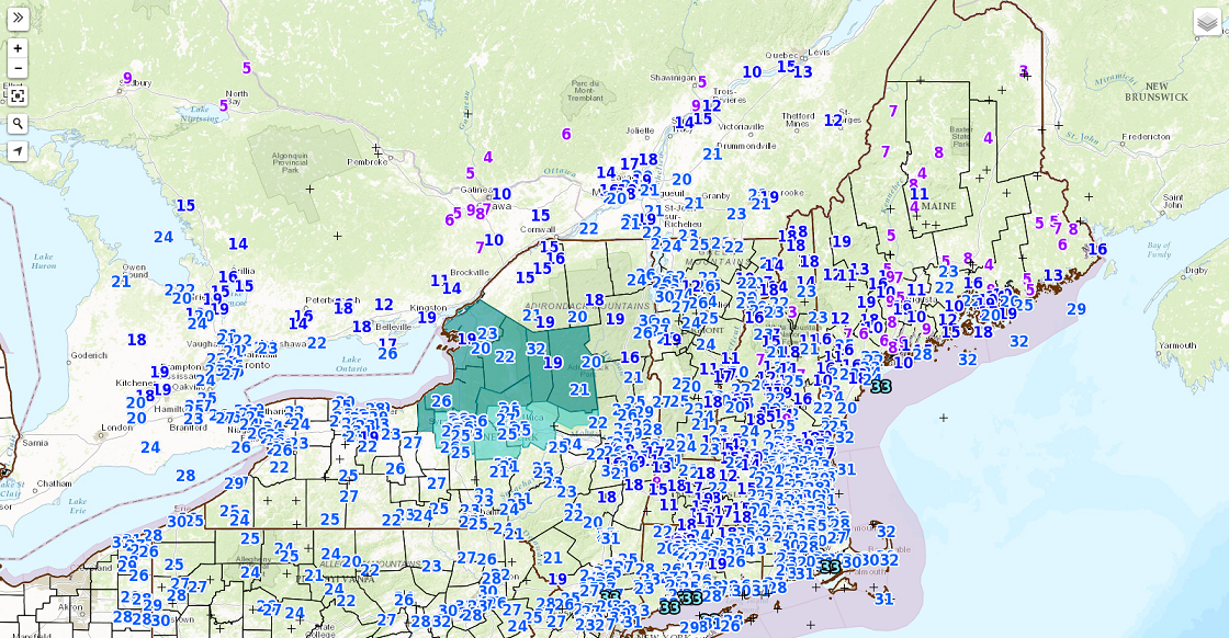
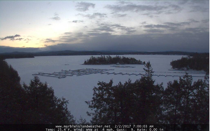
· Picturesque morning with snows capes into the Champlain Valley.
Now the ugly part —
· Yuck – too damn warm aloft!
TODAY: Mixed clouds and sunshine especially away for the Green Mountains. Chance for flurries especially far northern areas with minor accumulation. A high 25 to 30. West to northwest winds 10 to 20 mph.
TONIGHT: Partly cloudy. Scattered flurries. A low in the single digits. West winds 10 mph.
FRIDAY: Mostly cloudy. Flurries with just a skiff of accumulation. A high 20 to 25. West winds 10 to 15 mph.
Looking Further ahead…
FRIDAY NIGHT: Partly cloudy. Scattered flurries. A low 5 above to 5 below.
SATURDAY: Chance for a morning flurry, then partly to mostly sunny. A high in the mid teens to low 20s.
SUNDAY: Morning sun followed by increasing afternoon clouds with scattered snow showers or flurries. A low around 10. A high in the mid 20s.
MONDAY: Chance of morning snow showers or flurries otherwise more clouds than sun.A low in the mid teens. A high in the upper teens to low 20s.
TUESDAY: Clouding up with periods of light accumulating snow developing in the afternoon. A low in the single digits. A high in the 20s.
Average lows in the mid to upper single digits. Normal highs in the mid 20s to around 30.
RH/2-2[end]
