

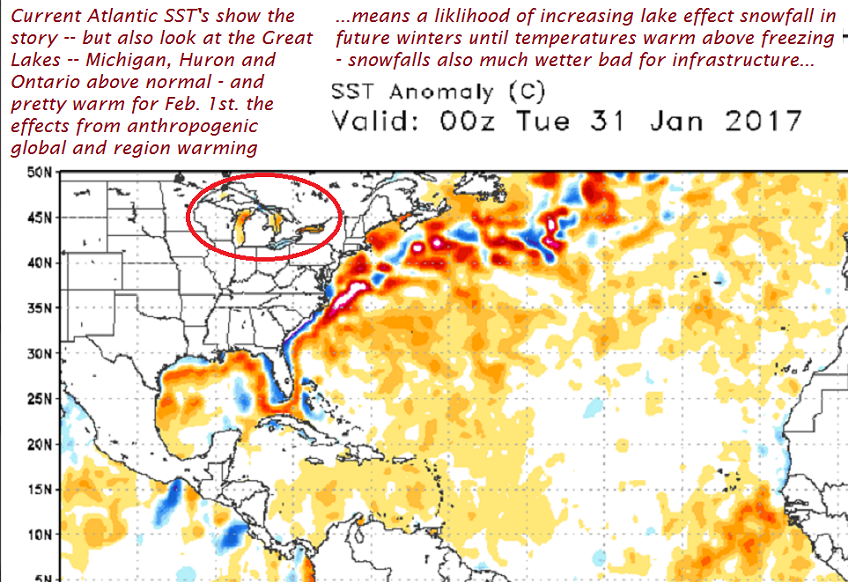
Above – Carry-over lake effect continues – this probably the new normal for many winters to come.

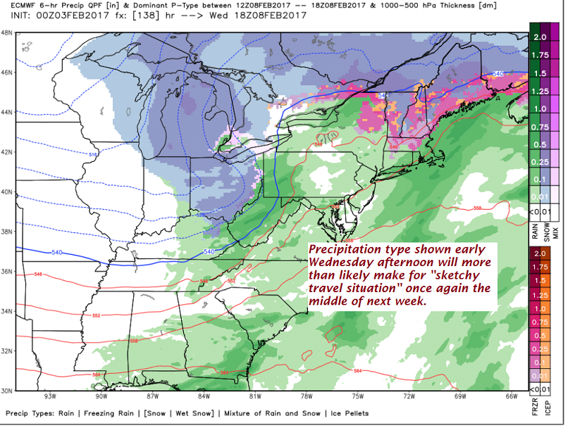
More ugliness in weather middle of next week –
TODAY: Partial morning sun then lots of afternoon clouds with scattered flurries and northern mountain snow showers. A dusting to an inch accumulation northern areas otherwise just a skiff of accumulation. A high 20 to 25. West winds 10 to 15 mph.
TONIGHT: Partly cloudy. Widely scattered flurries. A low 10 above to 5 below. West winds 10 mph.
SATURDAY: Partial morning sun then mostly cloudy with a stray mountain flurry. A high 20 to 25. West winds 10 to 25 mph.
Looking Further ahead…
SATURDAY NIGHT: Fair with high cloudiness. A low in the mid teens.
SUNDAY: Filtered sunshine through high clouds, except cloudy northern areas with occasional afternoon mountain snow showers & valley flurries. A high 25 to 30.
MONDAY: Chance of morning snow showers or flurries otherwise mixed clouds and sun.A low 15 to 20. A high in the mid 20s.
TUESDAY: Morning sun then clouding up. A rising chance for light accumulating snow or snow showers. A low 10 to 15. A high in the 20s.
WEDNESDAY: Gray. Wet snow likely…transitioning to light mixed precipitation with hazardous travel possible. A low in the 20s. A high in the mid 30s to around 40. Blustery with gusty west to southwest winds later in the afternoon.
THURSDAY: Mainly cloudy and Gray. A chance for wintry mix changing back to all snow with light to moderate accumulation. A low in the teens. A high in the 20s. Blustery west to southwest winds
Average lows in the mid to upper single digits. Normal highs in the mid 20s to around 30.
RH/2-3[end]
