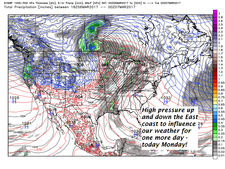
· MARCH WEATHER CAN BE CRAZY – Illustration in point just this morning with an occluded frontal system cuasing crazy ups and downs in temp.
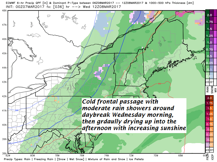
· This is the first front — of what will be three frontal passage playing and incrementally colder tune over the next few days.
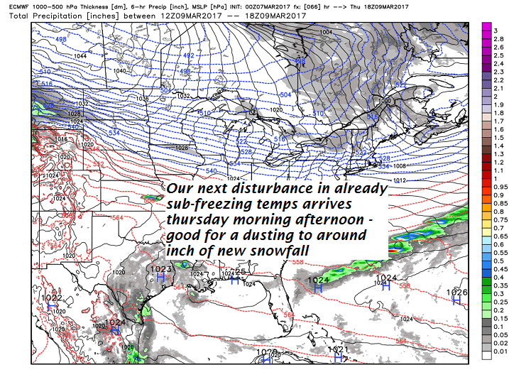
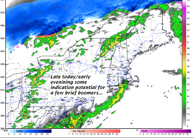
· We should dry out this evening…before another Clipper-like disturbance encroaches proving a rising chance for snow showers/flurries and minor coating of snow for Thursday morning Commute – Heads Up!
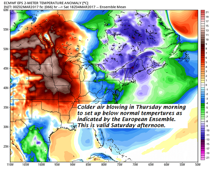
· Below as storm that comes out of the Mid Atlantic states pushes out to sea…it draws in really cold air for this weekend – very much like last weekend.
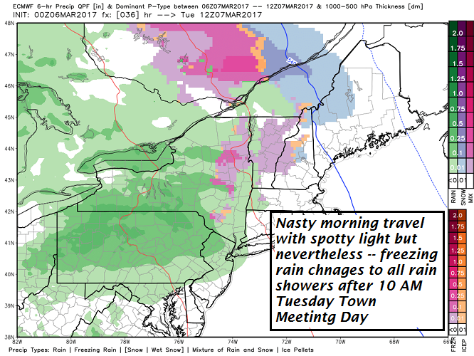
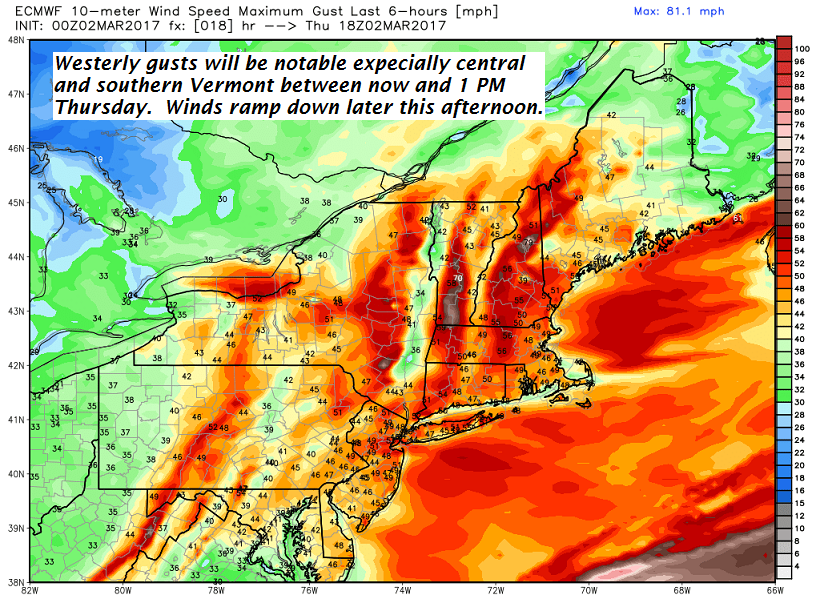
TODAY: Rain showers mixed with a few wet snow flakes across the higher elevations this morning. A few passing showers this afternoon, otherwise clouds mixing with periods of sunshine and breezy and milder. A high 45 to 50. Southwest breeze developing 10 to 20 mph.
TONIGHT: Scattered clouds this evening, then clouding up with a rising chance for flurries and a light coating of snow. A low in the mid to upper 20s. Winds becoming westerly 10 to 20 mph.
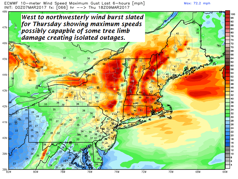
THURSDAY: Mostly cloudy, blustery and colder. Good chance for accumulating snow showers or flurries. A dusting to an inch. A high in the low 30s. Gusty northwest winds 15 to 30 mph with higher gusts across the hills.
Looking Further ahead…
THURSDAY NIGHT: Becoming mostly clear with high cloudiness developing overnight. A low in the mid teens.
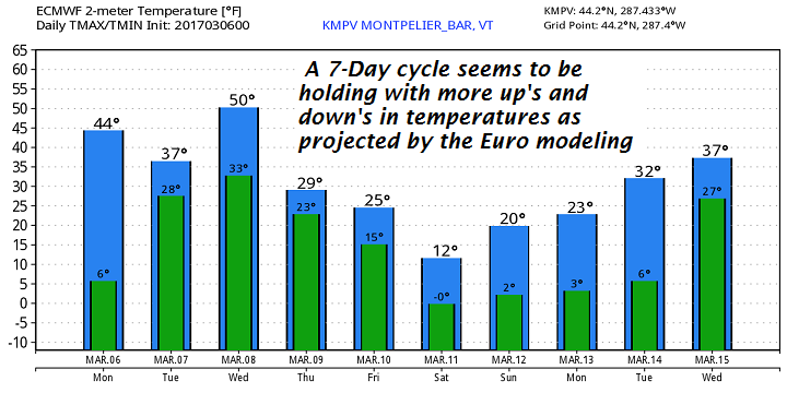
FRIDAY: Morning sunshine followed by cloudy periods in the afternoon. Chance for a few mountain flurries. Blustery at times with lowered wind chills. A high upper 20s to low 30s.
SATURDAY: Partly sunny & frigid. Blustery at times lowering wind chills. A low zero to 10 below. A high around 10 above.
SUNDAY: Sunny and continued well below normal. A low zero to 10 below. A high in the mid teens.
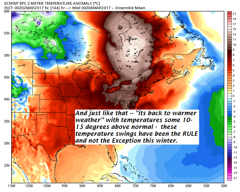
MONDAY: Bright sunshine and blue skies with a few high clouds later on. A low around zero. A high in the mid 20s.
Average lows in the teens. Normal highs 35 to 40.
RH/3-8[end]