
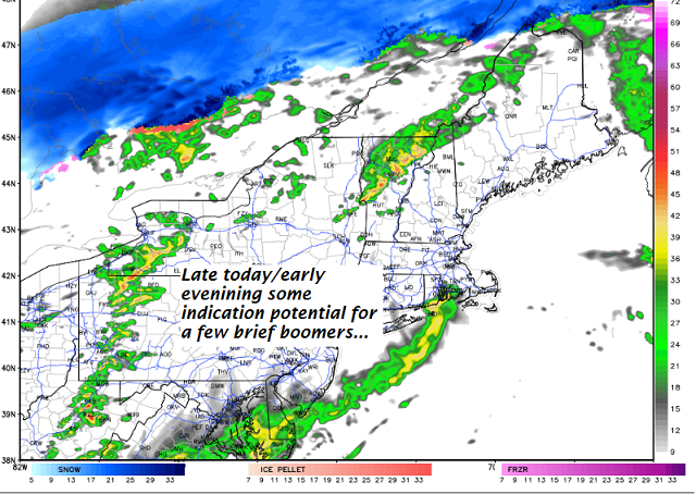
· Out of season thunderstom activity was “possible” not certain with best chances later today or early this evening in what will be a very mild warmer air mass on this first day of March.

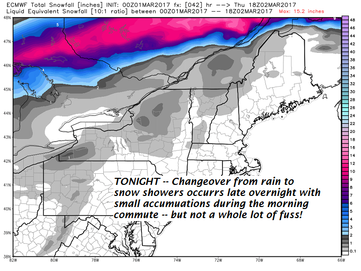
· Snowflakes in the air perhaps not sticking that much on the ground tomorrow morning based on timing of coldest working in.
· Temperatures were likely to fall between 4 AM through Noon Wednesday as blustery winds blow in a shot of more seasonable Canadian air.
· Sugaring conditions to take a respite but a minor warm up indicated middle of next week again
TODAY: Mainly cloudy and gray, but very mild. Rain showers with a threat for a rumble or two of thunder this afternoon. Balmy…with record highs of in the mid 50s to low 60s. South winds 10 to 20 mph with higher gusts possible.
TONIGHT: Scattered or occasional rain showers…maybe a rumble or two of thunder this evening. Rain showers… changing over to snow showers or flurries toward daybreak. Less than an inch accumulation. A low around 25. Southwest winds 10 to 20 mph.
THURSDAY: Blustery and colder. Scattered light snow showers or flurries exiting in the afternoon to intervals of sun late. Temperatures falling through the upper and mid 20s. Increasing west to northwest winds 10 to 25 mph with higher gusts.
Looking Further ahead…
THURSDAY NIGHT: Mostly clear and chilly. A low in the low to mid teens.
FRIDAY: Partly to mostly sunny but rather cold. A high in the mid 20s.
SATURDAY: Sunshine giving way to high clouds. Cold. A low 5 to 15 above. A high in the teens.
SUNDAY: Mostly sunny and not as cold. A low in the single digits. A high 25 to 30.
MONDAY: Clouds with a chance for light snow showers. A low in the 20s. Highs in the 30s.
Average lows in the upper single digits to mid teens. Normal highs in the mid 30s.
RH/3-1[end]
