
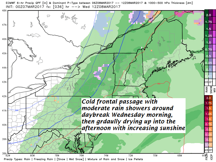
· Heaviest rain showers track through Wednesday about daybreak –
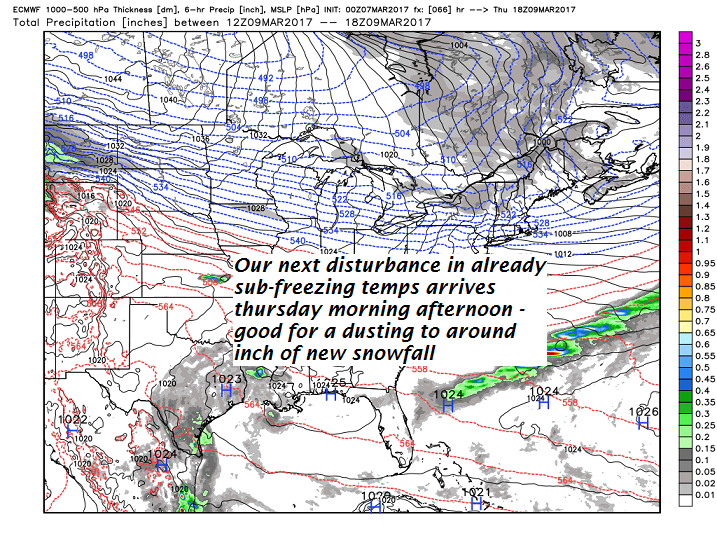
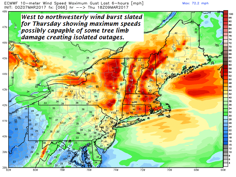
· With temperatures cold enough aloft and surface…next disturbance delivers some snow possibly in squally fashion with a fairly intense west to northwest winds.
· Don’t be too surprised if NWS delivers more Wind Chill Advisories this weekend…as we have the conditions being advertised for this.
· Those gusts will deliver another round of COLD ARCTIC AIR for this weekend with Saturday being the absolute coldest.
TODAY Town Meeting Day: Cloudy & gray. Spotty freezing rain making for slick spots through 9 AM, then the occasional light rain shower. Temperatures gradually warm up into the upper 30s to about 40. Southeast winds 10 to 20 mph.
TONIGHT: Cloudy. Rain showers likely, possibly mixing with few wet snow flakes in the high terrain. A low around 35. South winds 10 mph.
WEDNESDAY: Rain showers through late morning tapering to scattered leftover sprinkles in the afternoon with increasing amounts of sunshine. Mild with a high 45 to 50. Southwest breeze developing 10 to 20 mph.
Looking Further ahead…
WEDNESDAY NIGHT: Scattered clouds in the evening, then clouding up with a rising chance for flurries and light coating of snow. A low in the mid 20s.
THURSDAY: Mostly cloudy, blustery and colder. Good chance for accumulating snow showers or flurries. A dusting to an inch. A high in the low 30s. Gusty northwest winds lowering wind chills.
FRIDAY: Morning sunshine followed by cloudy periods in the afternoon. Blustery at times with lowered wind chills. A low in the mid teens. A high around 25.
SATURDAY: Partly sunny & frigid. Blustery at times lowering wind chills. A low zero to 10 below. A high around 10 above.
SUNDAY: Sunny and continued well below normal. A low around zero. A high 15 to 20.
Average lows in the teens. Normal highs 35 to 40.
RH/3-7[end]
