
· Snow showers were moving through during the morning commute…
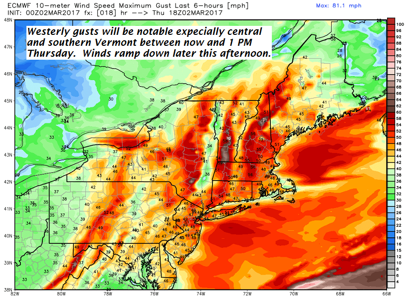
Strong and gusty westerly winds pushing east out of New York arrive this morning and last into as portion of the afternoon…
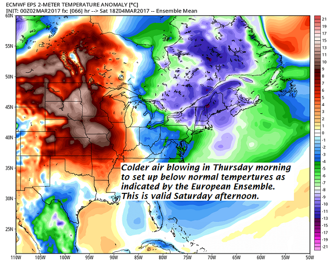
· The Cold front of this Thursday morning…will deliver colder than normal temperatures into the weekendwith the coldest day likely to be Satruday…followed by a moderation Sunday afternoon…
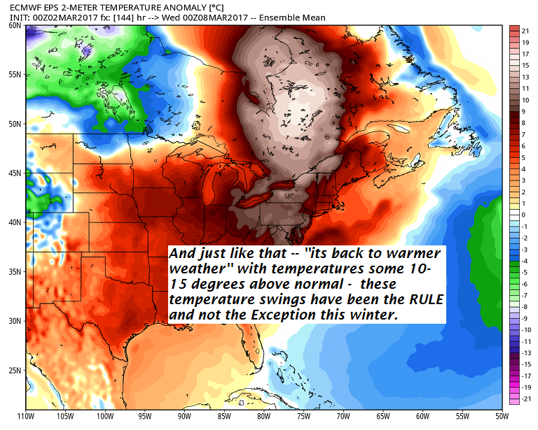
· Looky what’s around the corner! More warmth!
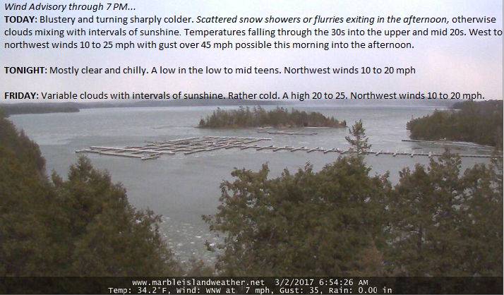
Wind Advisory through 7 PM…
TODAY: Blustery and turning sharply colder. Scattered snow showers or flurries exiting in the afternoon, otherwise clouds mixing with intervals of sunshine. Temperatures falling through the 30s into the upper and mid 20s. West to northwest winds 10 to 25 mph with gust over 45 mph possible this morning into the afternoon.
TONIGHT: Mostly clear and chilly. A low in the low to mid teens. Northwest winds 10 to 20 mph
FRIDAY: Variable clouds with intervals of sunshine. Rather cold. A high 20 to 25. Northwest winds 10 to 20 mph.
Looking Further ahead…
FRIDAY NIGHT: Scattered clouds. Frigid. A low 5 below to 10 above.
SATURDAY: Morning clouds with a stray mountain flurry or two, mixing with more sunshine in the afternoon. Blustery at times and very cold with lowered wind chills. A high 10 to 15.
SUNDAY: Blue skies and bright sunshine. A very cold start with a low 5 below to 10 above. A high 20 to 25.
MONDAY: Sunshine giving way to more clouds. A threat for a snow shower or flurry. A low 5 to 15. Temperature rebounding into the mid 30s to mid 40s.
TUESDAY: Clouding up with a chance for rain showers and breezy to windy. A low new 32. A high around 50.
Average lows in the upper single digits to mid teens. Normal highs in the mid 30s.
RH/3-2[end]
