
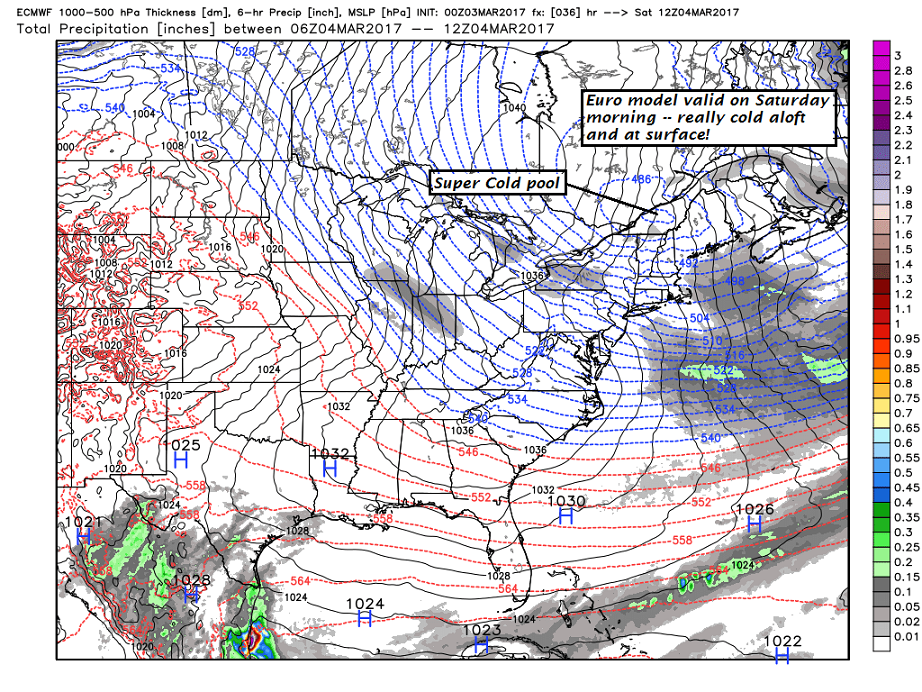
· One of the better things about colder arctic chunks of air that will center line over us Satruday – is the clarity to the atmosphere barring any nebulouse looking diamond dust flurries…
· Coldest pool of air arrives first part of Saturday…
· Early next week – We see a mild intrusion. This will touch off more sap runs for sugarers.

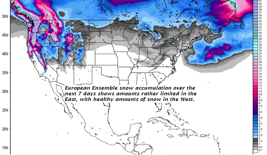
SNOW LOVERS – forgetaboutit! Below next 7 days snow accumulation…
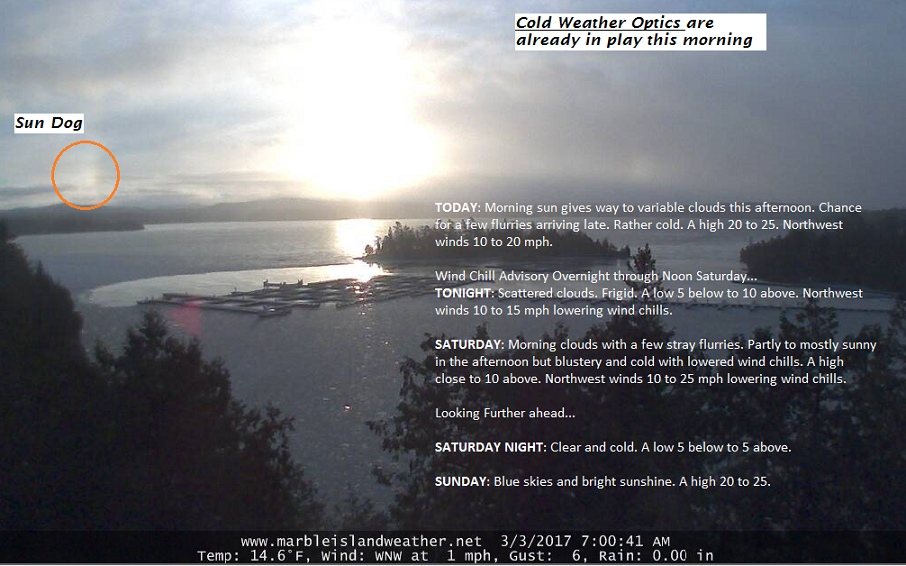
TODAY: Morning sun gives way to variable clouds this afternoon. Chance for a few flurries arriving late. Rather cold. A high 20 to 25. Northwest winds 10 to 20 mph.
Wind Chill Advisory Overnight through Noon Saturday…
TONIGHT: Scattered clouds. Frigid. A low 5 below to 10 above. Northwest winds 10 to 15 mph lowering wind chills.
SATURDAY: Morning clouds with a few stray flurries. Partly to mostly sunny in the afternoon but blustery and cold with lowered wind chills. A high close to 10 above. Northwest winds 10 to 25 mph lowering wind chills.
Looking Further ahead…
SATURDAY NIGHT: Clear and cold. A low 5 below to 5 above.
SUNDAY: Blue skies and bright sunshine. A high 20 to 25.
MONDAY: Sunshine filtered through high clouds at times, but otherwise becoming much more milder. A low 5 to 10. Temperature rebounding into the low and mid 40s.
TUESDAY: Mainly cloudy and gray. Chance for rain beginning as mixed precipitation and slick travel possible in the morning. Breezy at times. A low 25 to 30. A high in the low to mid 40s.
WEDNESDAY: Chance for leftover rain showers…exiting in the afternoon to periods of sunshine . A low around 32. A high 45 to 50.
Average lows 10 to 15. Normal highs around 35.
RH/3-3[end]
