
Wind Chill Advisory Overnight through Noon Saturday…
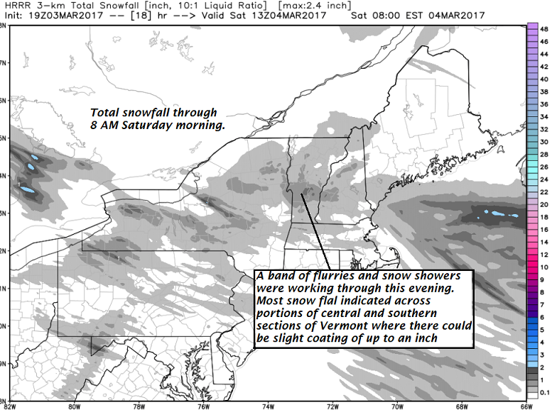
TONIGHT: A few flurries this evening especially toward southern Vermont, Otherwise scattered clouds. Frigid. A low zero to 5 above. Northwest winds 10 to 15 mph lowering wind chills.
TOMORROW: Some morning clouds with a few stray flurries. Mostly sunny in the afternoon but blustery and cold with lowered wind chills. Frigid temperatures with a high 5 to 10 above. Northwest winds 10 to 25 mph.
SATURDAY NIGHT: Clear and cold. A low 5 below to 5 above. Northwest winds 10 to 15 mph lowering wind chills.
SUNDAY: Blue skies and bright sunshine. A high in the upper teens to mid 20s. Northwest winds around 10 mph.
Looking Further ahead…
SUNDAY NIGHT: Mostly clear. A low 5 to 10.
MONDAY: Sunshine filtered through high clouds at times, but otherwise becoming much more milder. Temperature rebounding into the low and mid 40s.
TUESDAY Town Meeting Day: Mainly cloudy and gray. Chance for rain showers beginning as a brief period of freezing rain and slick travel in the morning. Breezy at times. A low 25 to 30. A high 40 to 45.
WEDNESDAY: Chance for rain showers…exiting in the afternoon to partial sunshine with a leftover sprinkles or two. A low around 32. A high 45 to 50.
Average lows 10 to 15. Normal highs around 35.
RH/3-3[end]
