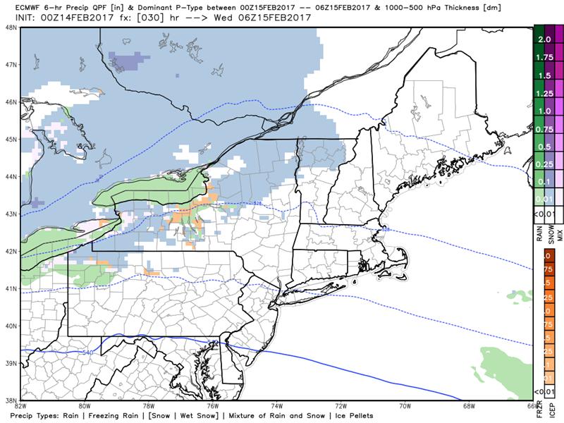
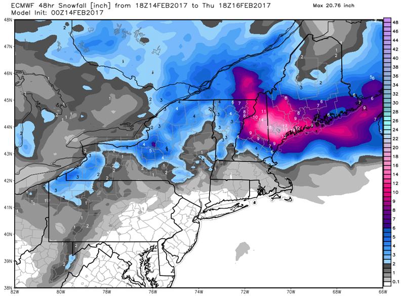
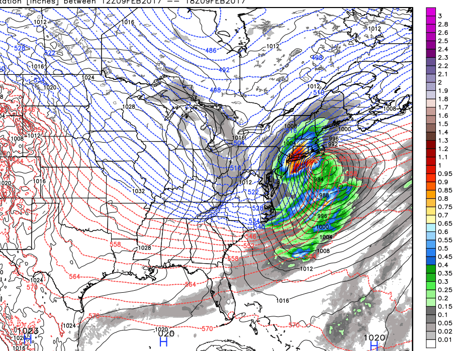
Winter Storm Warnings – North Central and NE Kingdom with Winter Weather Advisory elsewhere…through Thursday…
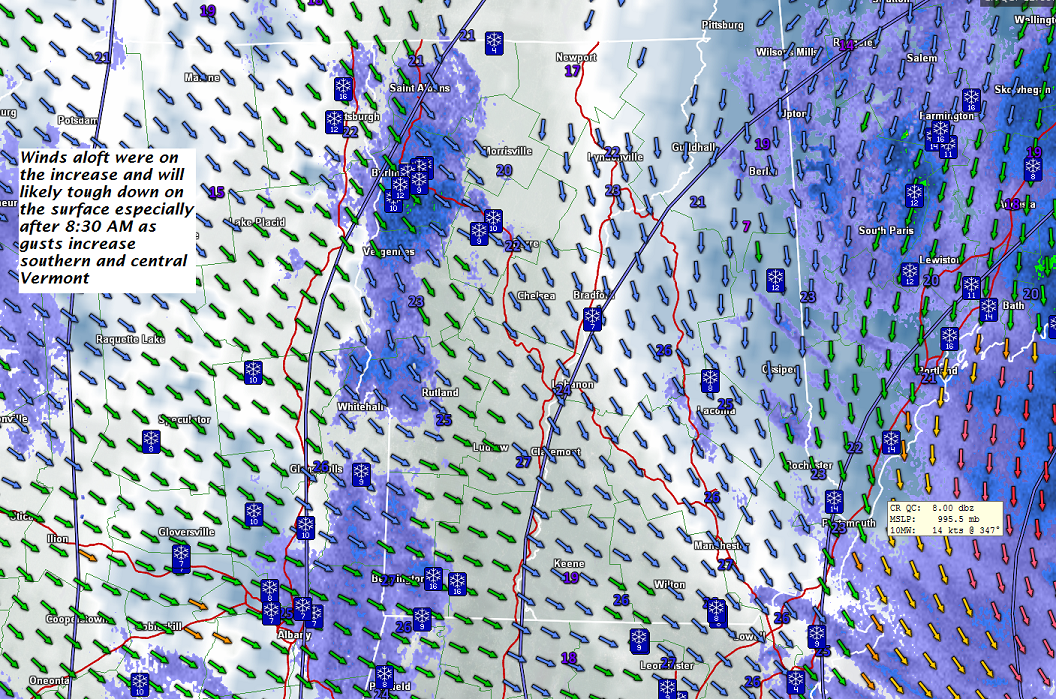
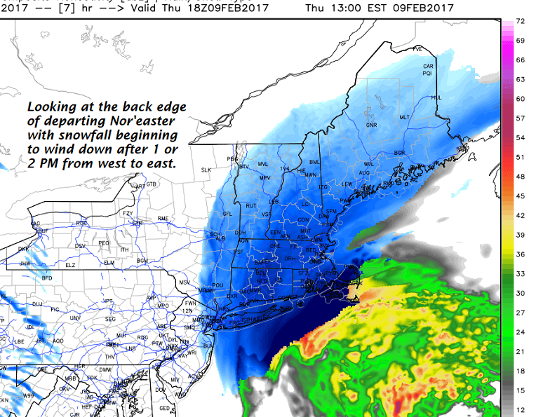
TONIGHT: Periods of snow. Accumulation 3 to 9” with the most toward Northeast Kingdom. A low around 20. Light northwest winds.
TOMORROW: Mainly cloudy & Blustery. Scattered leftover snow showers or flurries winding down in the morning with a dusting to an inch. A high in the mid 20s. Northwest winds 10 to 25 mph with higher gusts with localized blowing and drifting.
THURSDAY NIGHT: Partly to mostly cloudy. Scattered mountain snow showers and flurries co0ntinued blustery. A low near 15. Northwest winds 10 to 20 mph lowering wind chills.
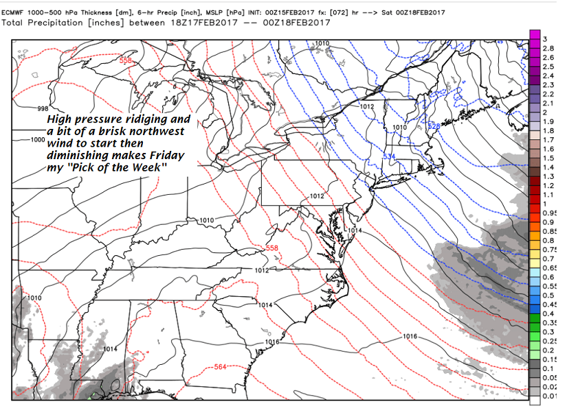
FRIDAY: Pick of the week – Morning clouds then mostly sunny but blustery. A high in the mid 20s. Northwest winds 10 to 20 mph gradually diminishing.
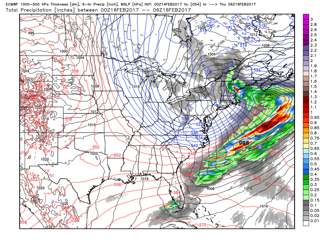
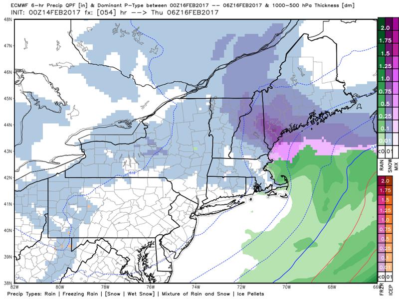
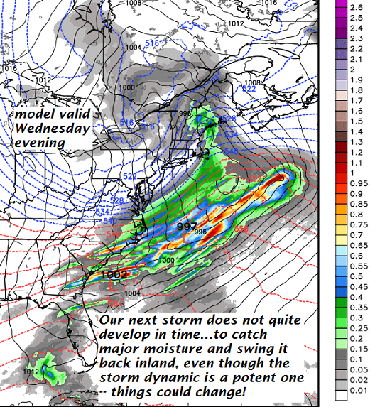
Looking Further ahead…
FRIDAY NIGHT: Mostly clear with some high clouds. A low in the single digits.
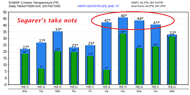
SATURDAY: Lots of sunshine but a few afternoon clouds. Milder. A high 40 to 45. Possible sap run.
SUNDAY: Partly to mostly sunny & milder. Possible sap run. A low around 30. A high in the 40s.
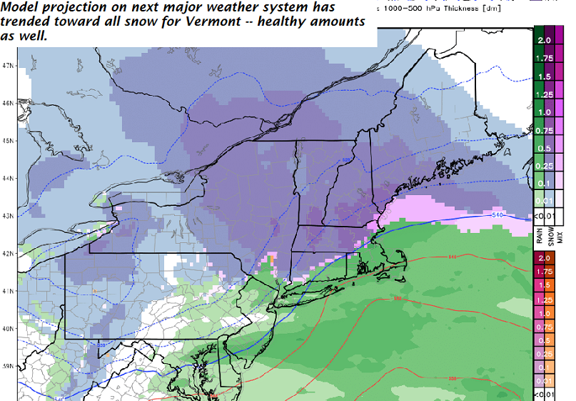
MONDAY: Scattered morning snow showers and flurries exiting to intervals of afternoon sun. A low 25 to 30. A high around 32.
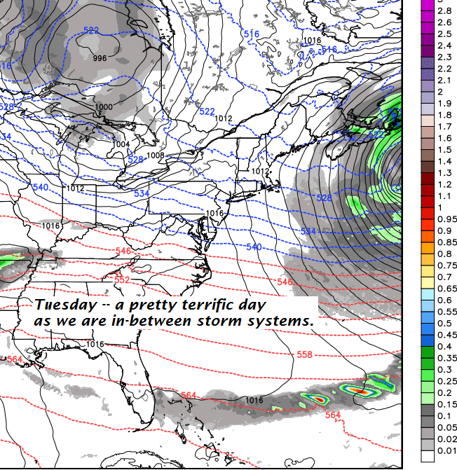
TUESDAY: Sunshine becoming filtered by high clouds. A low in the single digits. A high around 35.
Average lows in the mid single digits to low teens. Normal highs in the upper 20s to low 30s.
RH/2-15[end]