
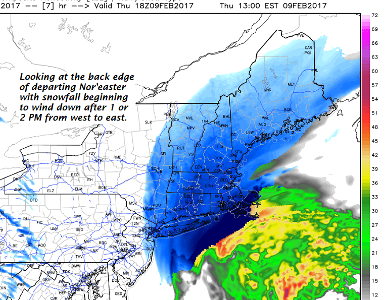
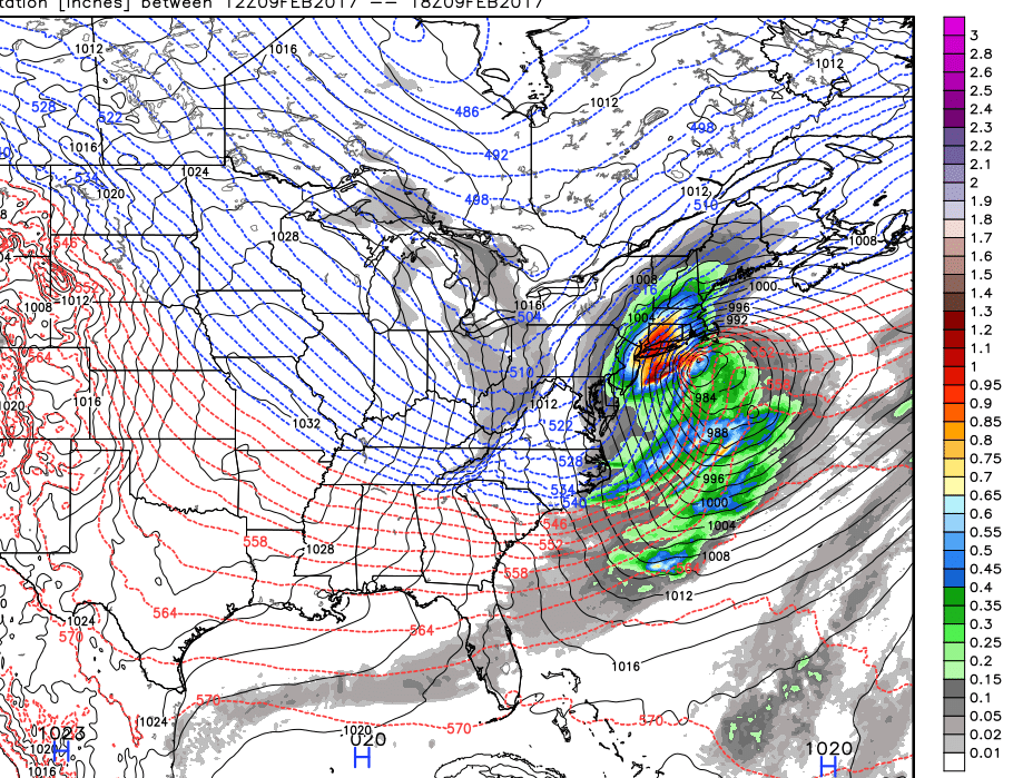
· Depicted precipitation working through southern New England…
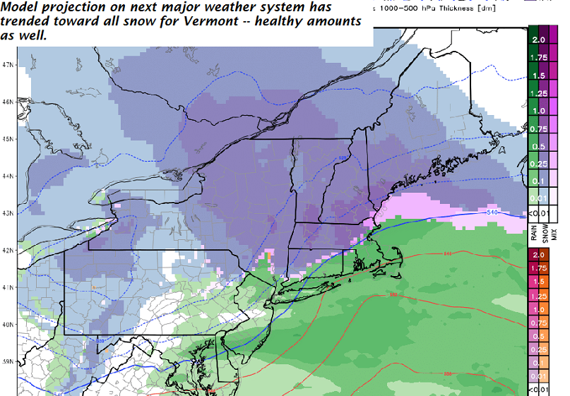
· After a weak disturbance good for a dusting to 2” Friday night into the Saturday evening – our next bigger system arrives Sunday into Monday.
· Model trends have been colder keeping this system snow rather than a mix advertised less the 24 hours ago.
TODAY: Gray with occasional light snow, tapering off mid to late afternoon. An inch to 3” inches with higher amounts southern and eastern areas. Temperatures holding in the teens. North to northwest winds 10 to occasionally 20 mph.
TONIGHT: Clearing but cold! A low in the single digits below zero. Northwest winds 10 mph with lowered wind chills.
FRIDAY: Widely scattered flurries otherwise intervals of sunshine and frigid!A high around 5 to 10 above. Northwest winds 10 to 20 mph lowering wind chills
Looking Further ahead…
FRIDAY NIGHT: Cloudy. Chance for light snow showers up to an inch of fluffy accumulation. A low in the single digits above zero
SATURDAY: Clouds…with a good chance for light accumulating snow showers. A high in the teens.
SUNDAY: Gray. A good chance for snow with potential for few to several inches of accumulation. A risk for mixed precipitation making for hazardous travel. A low 10 to 15. A high in the mid 20s to near 30.
MONDAY: Mainly cloudy. Scattered leftover snow showers. A low in the teens. A high in the 20s.
TUESDAY: Partly to mostly sunny. A low in the single digits. A high 25 to 30.
WEDNESDAY: Filtered sunshine through high clouds. A low 15 to 20. A high around 30.
Average lows in the single digits. Normal highs in the upper 20s to low 30s.
RH/2-9[end]
