
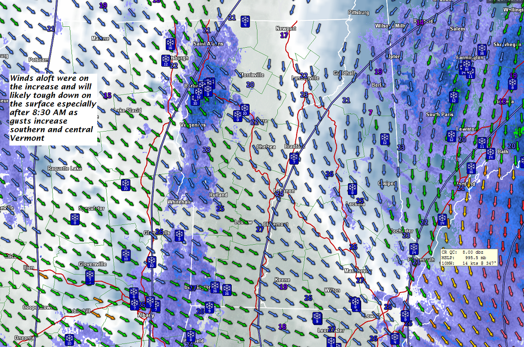
· As current storm system winds down in snowfall…winds will flare up out of the northwest and produce localized white-outs, unloading trees and with considerable blowing and drifting.
· The winds were most aloft but will mix downward onto valley floors and kick up at times ferociously across central and southern Vermont
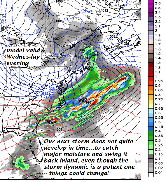
Next weather maker – not a big snow producer, but still a 1 to locally 3” amounts of additional snowfall – however things could evolve better if moisture stream stronger.
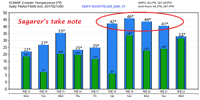
Temperature forecast going into the middle part of next week – Sugarer’s take note.
Winter storm Warning expires early this evening…
TODAY: Occasional snow showers and flurries gradually winding down this morning. Additional accumulation dusting to 2“. A few breaks of sun possible away for the mountains with a leftover stray flurry or two. Blustery northwest winds with blowing and drifting snow causing white-outs in exposed areas. Total storm accumulation 7 to 13”. A high in the low to mid 20s. Northwest winds picking up this morning at 10 to 25 mph with higher gusts across hills.
TONIGHT: Partly to mostly cloudy, slight chance for a stray flurry. A low 5 to 10 above. Northwest winds 10 to 15 mph.
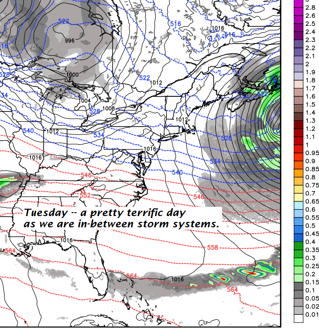
TUESDAY: Pretty nice day! Filtered sunshine through high clouds. A high in the mid 20s. Light winds.
Looking Further ahead…
TUESDAY NIGHT: A rising chance for light snow showers after midnight. Minor accumulation. A low around 20.
WEDNESDAY: Frequent mountain snow showers and flurries. A high reaching into the low to mid 30s.
THURSDAY: Mostly cloudy with scattered mountains snow showers and valley flurries. A low upper teens to low 20s. A high in the mid to upper 20s.
FRIDAY: Pick of the week – Morning clouds giving way to lots of afternoon sunshine. A low in the teens. A high in the mid 20s.
SATURDAY: A few morning clouds…otherwise mostly sunny, gorgeous and much milder. A sap run possible for Sugarer’s with a high in the upper 30s to mid 40s.
Average lows in the mid single digits to low teens. Normal highs in the upper 20s to low 30s.
RH/2-13[end]
