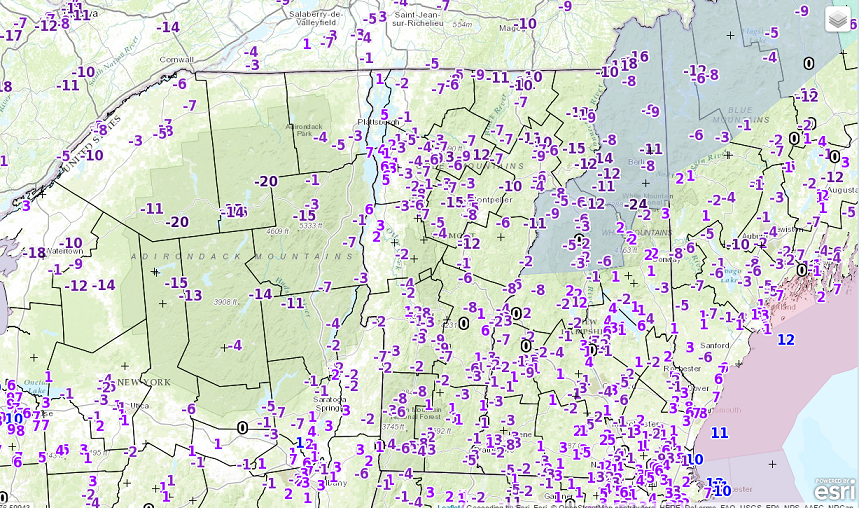
· Two hands on the wheel, Rocks in your pockets, Hold onto that hair piece, Hat Day for Donald Trump with screaming winds out of the south today. Gusts may reach over 60 mph in a few location and this will no doubt take out a few trees and the potential for power lines.
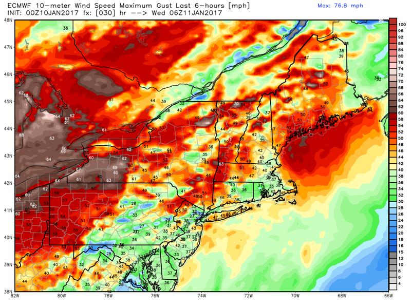
· Plan for interruptions in power have batteries, candles, lanterns etc ready to go if you live west of the Green Mountains and especially in the Champlain Islands and adjacent Chittenden, Franklin counties.
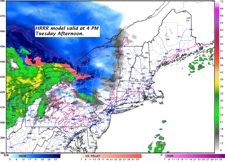
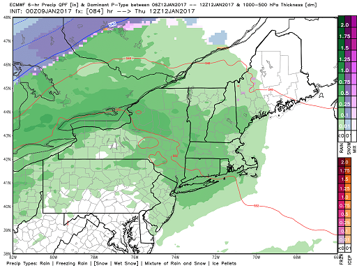
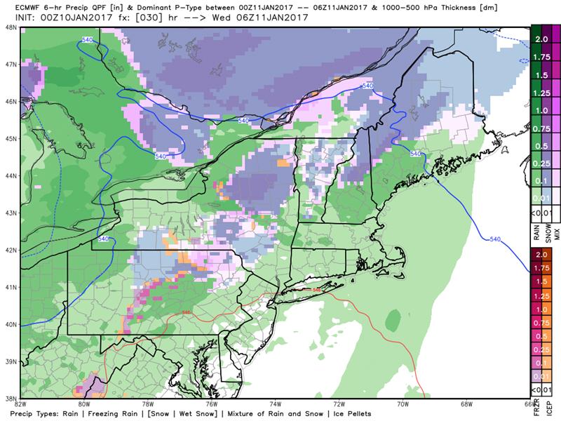
· Additionally – wet snow mixing with sleet and rain combo overnight with a dusting valley floors to locally 3” higher Greens and Northeast Kingdom highlands.
· Just as quick as this blows in, it moves out even quicker early Wednesday after daybreak with a few sprinkles. Then we dry up and the sun should come out – have your sun-glasses.
· Next system for Wednesday night with another shot for slick travel.
High Wind Warning Champlain Valley and Wind Advisories along and west of the Green Mountains…3 PM through 3 AM Wednesday.
TODAY: Periods of morning sunshine, then cloudy. Wet snow developing late today, making for slick travel with up to a slushy inch possible. A late day high about 32 degrees. Increasing south winds 10 to 25 mph in the afternoon.
TONIGHT: A wintry mix…changing to rain with pockets of freezing rain…exiting around day break. A period of hazardous travel likely with snow and sleet accumulation a trace to locally 3 inches. Temperatures rising through the 30s. Gusty south winds 10 to 25 mph with higher gusts across the hills.
WEDNESDAY: Any early sprinkles exiting, then becoming partly to mostly sunny and mild. A high 40 to 45. Southwest winds 10 to 25 mph.
Looking Further ahead…
WEDNESDAY NIGHT: Fair early, then thickening clouds. A rising chance for rain after midnight. A low in the mid 30s.
Full Wolf Moon 6:34 AM Thursday
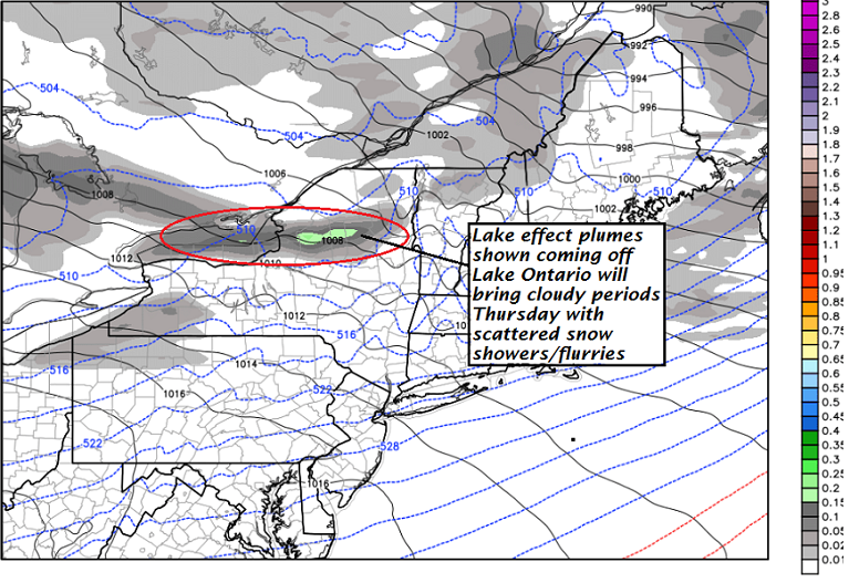
THURSDAY: Mainly cloudy. Periods of light rain. Areas of fog. A high 45 to 50.
FRIDAY: Chance for a leftover flurry or mountain snow shower, otherwise partly cloudy. A low 20 to 25. A high 25 to 30.
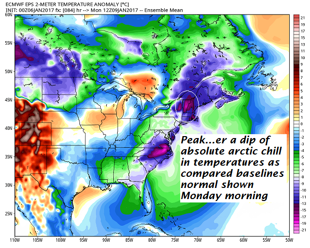
SATURDAY: Filtered sunshine through high cloudiness but colder. A low 5 below to 5 above. A high 20 to 25.
SUNDAY: Mostly sunny. Seasonably cold. A low around 10. A high in mid 20s.
Average lows in the single digits. Normal highs mid to upper 20s.
RH/1-10-17[end]