
Watch post storm slick spots for area roads this morning, but with temperatures climbing at least back into the mid 30s and likely warmer near 40, we’ll see things slush up and melt out.
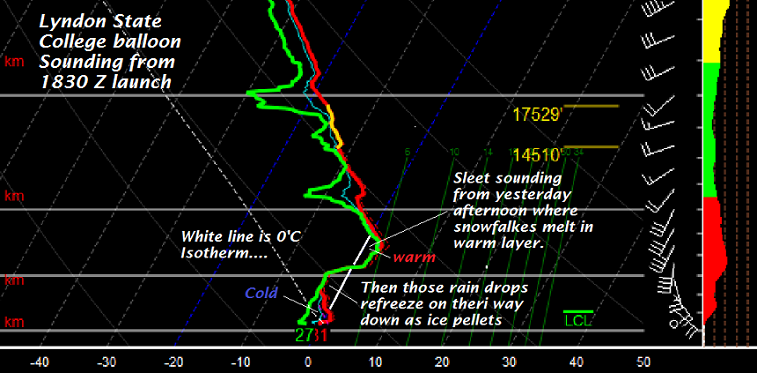
Below Balloon sounding launched at Lyndon State College showing a sleet sounding – problem was this all displaced northeast and temperatures were warmer aloft so ended with much more rain.
Glazing on trees across the higher terrain was enough to cause a few power outages. 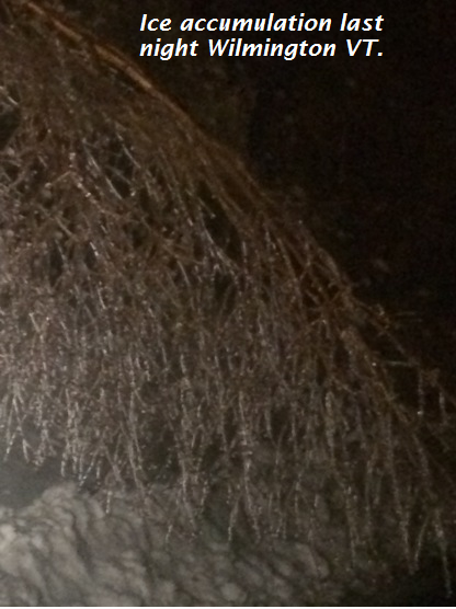
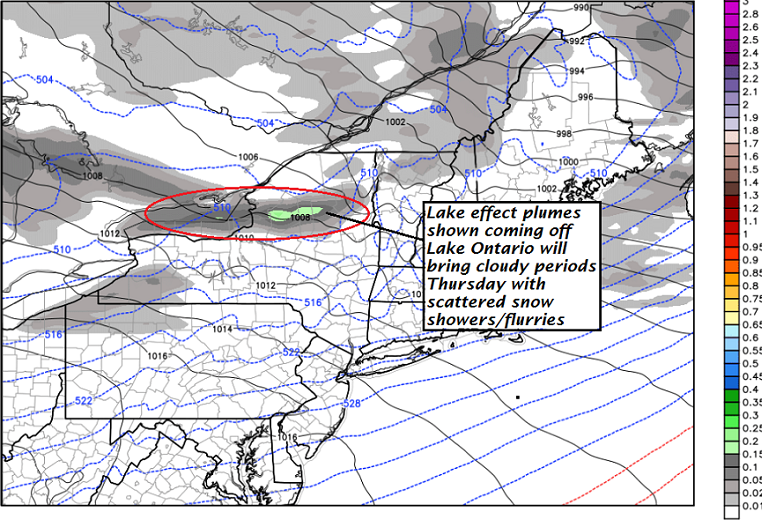
Precipitation limited the rest of today but upticks somewhat tonight with incoming colder air over warmer waters and lake effect streamers drive east then northeast especially affecting northern Vermont.
TODAY: Considerable cloudiness most of the day giving way to partial clearing. A better chance for a few mountain snow showers and valley flurries late today. A high in the mid 30s to around 40. Southwest winds 10 to occasionally 20 mph.
TONIGHT: Partly cloudy. Good chance for leftover flurries/mountain snow showers. A low in the mid teens. South to southwest winds across the hills 10 to 20 mph.
THURSDAY: Sunshine with a few cloudy periods. Scattered flurries or light snow showers northern areas. Colder. A high in the mid 20s. West to southwest winds 10 to 20 mph.
Looking Further ahead…
THURSDAY NIGHT: Partly cloudy. Chance for flurries. A low zero to 5 above.
FRIDAY: Periods of sun northern areas more clouds to the south. A high in the low 20s.
SATURDAY: Partly to mostly sunny. Colder.A low zero to ten below. A high in the upper teens to low 20s.
SUNDAY: Sunshine…mixing with clouds late. Chance for late day flurries.A low 10 to 15 below. A high in the teens.
MONDAY: Partly to mostly sunny.Frigid morning lows 10 to 20 below. A high in the teens.
Average lows mid single digits to around 10 above. Normal highs 25 around 30.
RH/1-3-17[end]
