
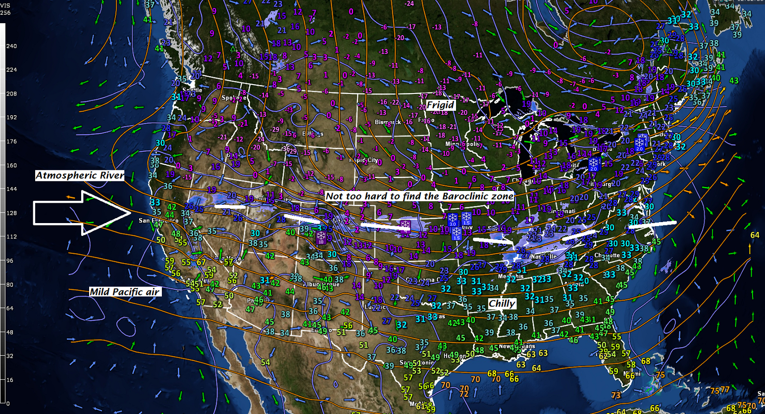
· This Observation Synoptic analysis map explains it all right now it’s a very zonal flow west to east with an “Atmospheric River” entering Califorina with nearly and east to west baroclinic zone (where temperature differential most contrast between cold to the north and warm to the south.
· Progressively colder conditions…eventually good for ice fishing some areas later this weekend – caveat here…only those areas that are typically safe this time of year, but with recent warm oscillations, may have thinner ice than what we expect. Please be safe Ice Fishing…
· With arctic air = sunshine becomes more abundant 
TODAY: Sunshine with a few cloudy periods. Scattered flurries or light snow showers northern areas. A minor coating possible. Colder. A high in the mid 20s. West to southwest winds 10 to 20 mph.
TONIGHT: Partly cloudy. Chance for flurries with a fluffy dusting to an inch possible. A low around zero. Southwest winds 5 to 15 mph.
FRIDAY: Partly to mostly sunny. A high around 20. West winds 10 to 15 mph.
Looking Further ahead…
FRIDAY NIGHT: Scattered clouds. A low 5 to 15 below.
SATURDAY: Sunny but with increasing high clouds in the afternoon. Cold. A high around 20.
SUNDAY: A few diamond dust flurries, otherwise partly sunny. A low zero to 10 below. A high around 15.
MONDAY: Partly to mostly sunny.Frigid morning lows 10 to 25 below. A high in the teens.
TUESDAY: A few morning flurries, sunshine mixing with clouds. A low around 10. A high in the upper 20s.
WEDNESDAY: Cloudy & much milder. A chance for periods of light rain, pockets of freezing rain producing hazardous travel in spots. A morning low 25 to 30. A high in the mid 40s.
Average lows in the single digits to around 10 above. Normal highs 25 around 30.
RH/1-5-17[end]
