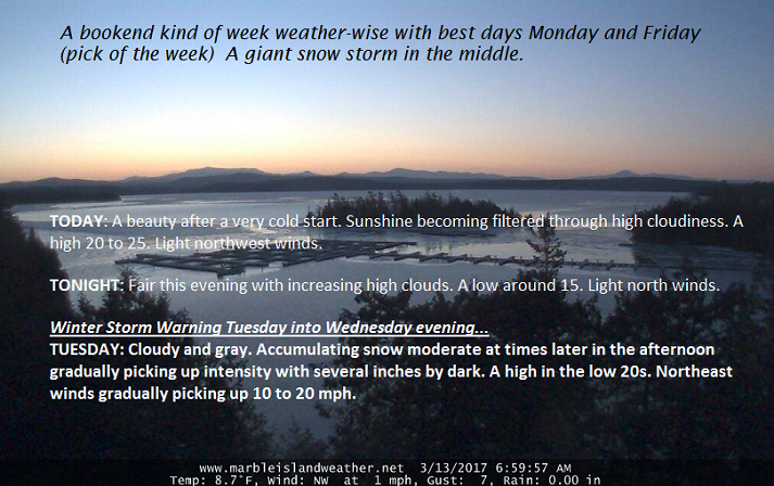
March 13th, 2017
TONIGHT: Fair with increasing high clouds. A low around 15. Light north winds.
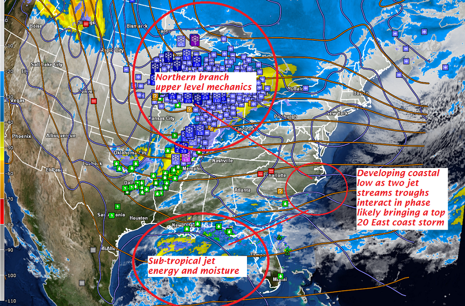
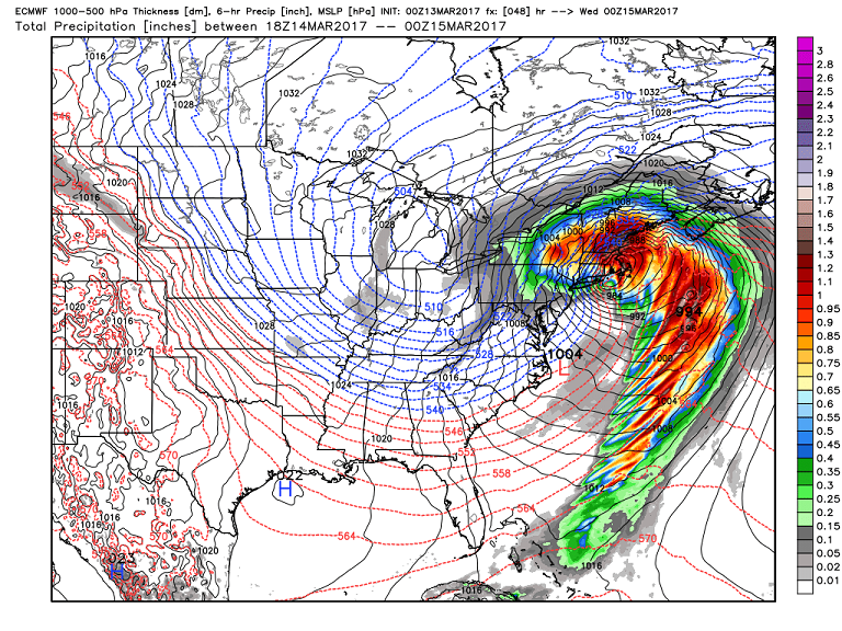
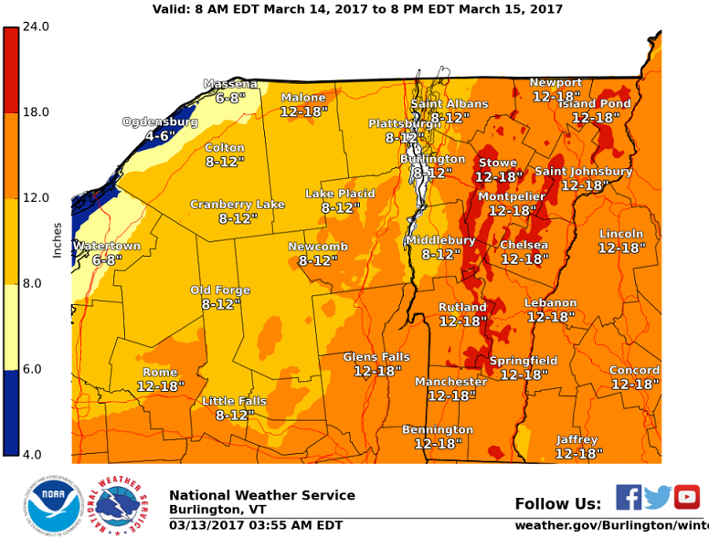
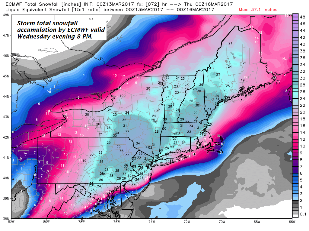
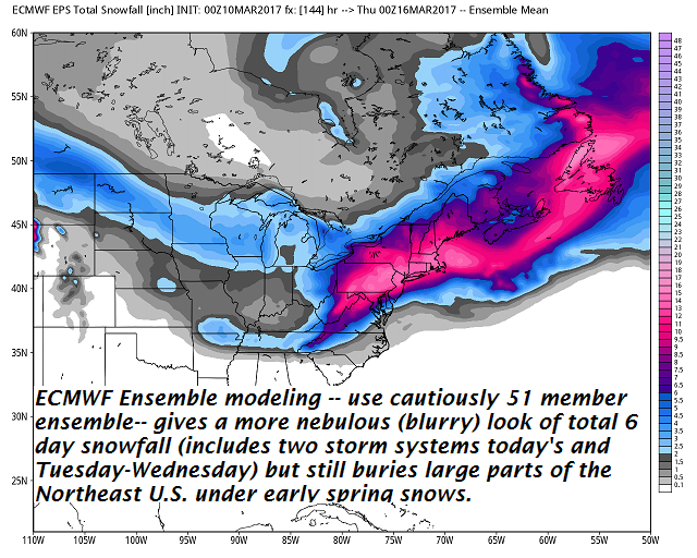
Winter Storm Warning 7 AM Tuesday into Wednesday evening…
TOMORROW: Cloudy and gray. Accumulating snow moderate to heavy at times in the afternoon with several or more inches by dark. A high in the low 20s. Northeast winds gradually picking up 10 to 20 mph.
TUESDAY NIGHT: Snow – moderate to heavy at times additional 8 to 16 inches possible. Temperatures in the low to mid teens. Blowing and drifting snow likely with white-out conditions and treacherous travel with low visibility. North winds 10 to 25 mph.
WEDNESDAY: Accumulating snow… becoming much lighter with additional 1 to 3”. Temperatures in the upper teens to mid 20s. Gusty northwest winds with considerable blowing and drifting and white-outs. Total accumulation 1 to 2 feet, with locally higher amounts in the mountains. Northwest winds 10 to 20 mph.
Looking Further ahead…
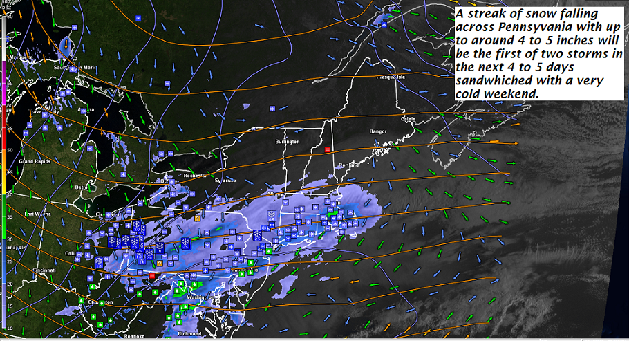
WEDNESDAY NIGHT: Periods of light snow or snow showers with additional 1 to 2” A low in the single digits.
THURSDAY: Mostly cloudy. Accumulating snow showers near the mountains otherwise scattered valley flurries winding down. A in the upper teens to low 20s. Gusty northwest winds with minor blowing and drifting.
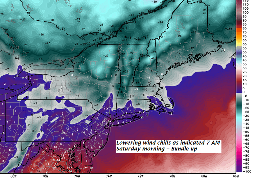
FRIDAY: Pick of the week – blue skies and bright sunshine. A low in the single digits with a high of about 30.
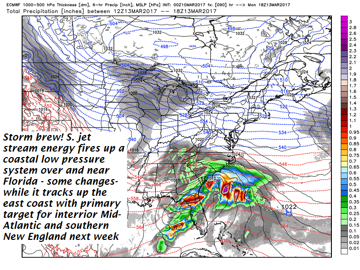
SATURDAY: Cloudy. A rising chance for more snow…possibly moderate amounts. A low 15 to 20. A high 25 to 30.
Average lows in the teens. Normal highs mid 30s to low 40s.
RH/3-13[end]