
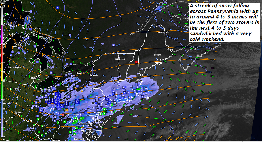
· Southbound travelers to run into snow coated roads as a wet snowfall track across portions of the NE. and S. New England States today. This system draws in the colder air and may activate afew snow showers/squalls/flurries Friday afternoon locally
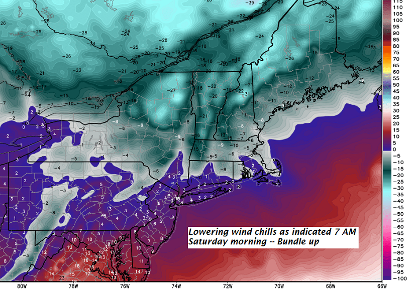
· The big draw! A piece of modified arctic chill drops into Vermont lowering wind chills later tonight and tomorrow – as projected by modeling for about the last 5 days.
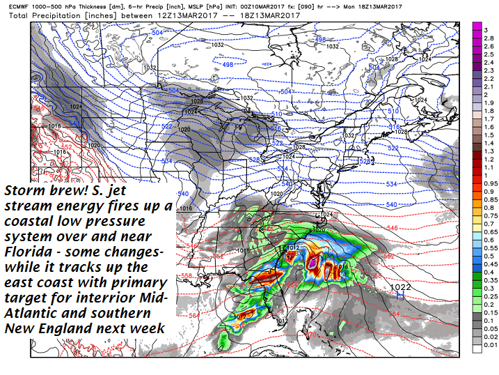
· A SIGNIFICANT STORM TO BREW! Central and northern Vermont likely more fringe effects with hot zone for parts of Mid-Atlantic/ S. New England…
· What about the Washington Cherry Blossoms?? – Climate change which they are denial about – will prove its point this weekend/next week.
TODAY: Partial morning sunshine, followed by cloudy periods this afternoon. Scattered flurries…maybe a snow squall in the afternoon. Blustery at times. A high in the low 30s. Northwest winds 10 to 20 mph.
Wind Chill Advisory overnight into early afternoon Saturday…
TONIGHT: Partly cloudy. Scattered “diamond dust” flurries with a “skiff of accumulation”. A low zero to 5 below. Northwest winds 10 to 15 mph with lowered wind chills to minus 25.
SATURDAY: Partly sunny & frigid. Diamond dust flurries but little if any accumulation. Bitterly cold with a high around 5 above. Northwest winds flare up 10 to 20 mph in the afternoon lowering wind chills.
Looking Further ahead…
SATURDAY NIGHT: Clearing and bitterly cold. A low zero to 10 below.
Full Worm Moon 10:54 AM Sunday
SUNDAY: Sunny but still very cold. A high near 15.
MONDAY: A beauty after a very cold start. Lots of sunshine followed by increasing high cloudiness. A low zero to 10 above. A high around 20.
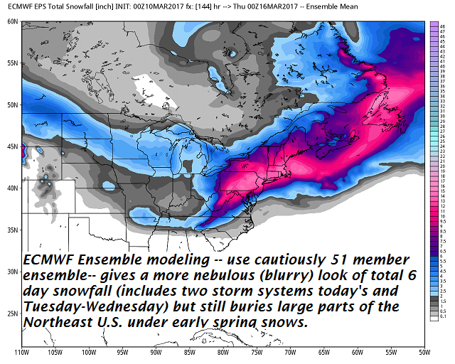
TUESDAY INTO WEDNESDAY: Cloudy and gray. Accumulating snow likely developing. Light to potentially moderate snowfall. Lows in the teens with highs in the 20s to around 30.
Average lows in the teens. Normal highs mid 30s to low 40s.
RH/3-10[end]
