March 20th, 2017 –
TONIGHT: Thickening clouds after a fair and dry evening. A rising chance for a few flurries toward daybreak northern areas. A low in the upper teens to low 20s. Little wind.
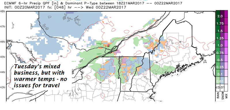
TOMORROW: Considerable cloudiness. a couple wet snow or rain showers mainly in the afternoon. No accumulation. A high in the upper 30s to low 40s producing a sap run Light southwest winds.
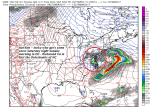
TUESDAY NIGHT: Fair or partly cloudy in the evening then clouding up. A rising chance for a snow shower or snow squall. A dusting to a couple of inches especially near the mountains. A low 10 to 15. Northwesterly winds becoming 10 to 25 mph overnight.
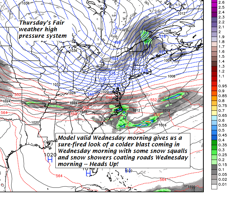
WEDNESDAY: A morning snow squall or snow shower exiting in the afternoon with dusting to an inch. Blustery, sharply colder. A high in the upper teens. Gusty northwesterly winds 10 to 25 mph lowering wind chills.
Looking Further ahead…
WEDNESDAY NIGHT: Clear and cold. A low 5 below to 10 above.
THURSDAY: Sunshine becoming filtered through high clouds. A high in the mid 20s.
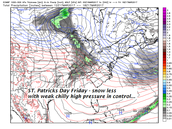
FRIDAY: Intervals of morning sunshine. Clouding up in the afternoon leading to a chance for light accumulating snow showers. A low 10 to 15. A high in the mid 30s.
SATURDAY: Mainly cloudy. Chance for snow showers. A low near 30. A high around 35.
Average lows 20 to 25. Normal highs 40 to 45.
RH/3-20[end]