
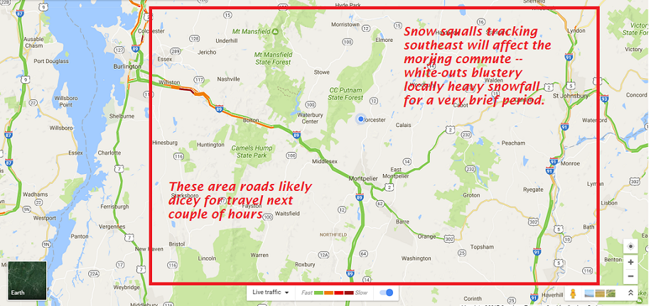
· By definition a snow squall from a “snow shower” is a concentrated briefly moderate to heavy burst of snow, typically in unstable conditions that often line up perpendicular to the flow or in streaks with the flow cold air advection. Snow squalls typically produce “white-outs” and coat area roads very quickly. Seems we meet these criteria this morning.
· Lake Effect snow squalls usually in the first half of winter can be impressive with enhanced amounts of snow.
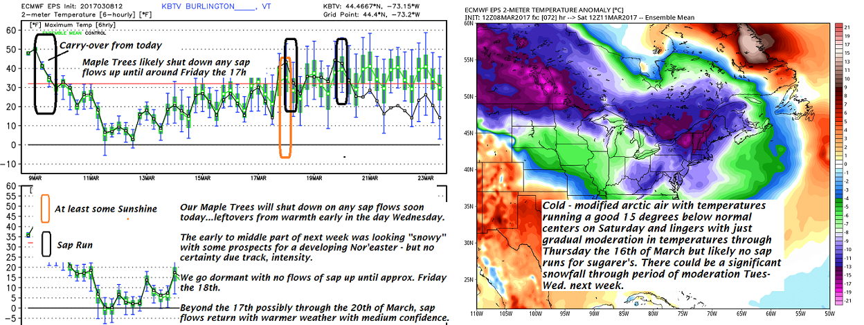
Below is the Sugaring forecast for one of my clients who I consult with. Sugaring is very “weather dependent” especially to temperature. Sugaring conditions will go back to “sleepy time” give hard working folks a little breather. See below —
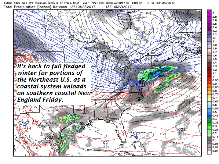
· Winter is back for a lot of the NE U.S. – a coastal low delivers some decent southern New England snows Friday.
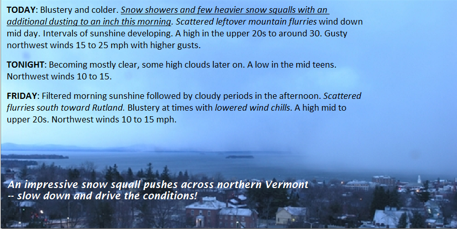
TODAY: Blustery and colder. Snow showers and few heavier snow squalls with an additional dusting to an inch this morning. Scattered leftover mountain flurries wind down mid day. Intervals of sunshine developing.A high in the upper 20s to around 30. Gusty northwest winds 15 to 25 mph with higher gusts.
TONIGHT: Becoming mostly clear, some high clouds later on. A low in the mid teens. Northwest winds 10 to 15.
FRIDAY: Filtered morning sunshine followed by cloudy periods in the afternoon. Scattered flurries south toward Rutland. Blustery at times with lowered wind chills. A high mid to upper 20s. Northwest winds 10 to 15 mph.
Looking Further ahead…
FRIDAY NIGHT: Partly cloudy. Scattered “diamond dust” flurries with a “skiff of accumulation”. Well below normal in temperature. A low zero to 10 below.
SATURDAY: Partly sunny & frigid. Blustery at times lowering wind chills. Frigid. A high around 5 above.
Full Worm Moon 10:54 AM Sunday
SUNDAY: Sunny but still very cold. A low zero to 10 below. A high near 15.
MONDAY: A beauty after a very cold start. Lots of sunshine followed by increasing high cloudiness. A low around zero degrees. A high in the upper teens to near 20.
TUESDAY: Chance for snow, potentially moderate to significant amounts. A low in the single digits, with a high in the upper 20s.
Average lows in the teens. Normal highs 35 to 40.
RH/3-9[end]
Roger Hill
Weathering Heights Consulting
186 MacKenzie Dr.
Worcester VT 05682
| Virus-free. www.avast.com |
