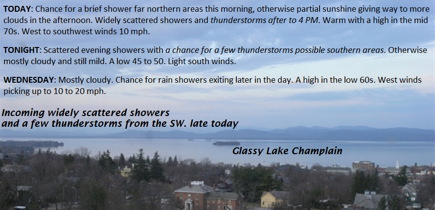
TONIGHT: Scattered evening showers. Chance for a few thunderstorms south of the Barre Montpelier area this evening, Otherwise mostly cloudy and still mild. A low in the 40s. Light south winds.
TOMORROW: Clouds with a couple rain showers through mid day then exiting to partly to mostly sunny skies. A high in the upper 50s to low 60s. West winds picking up to 10 to 15 mph.
WEDNESDAY NIGHT: Clear skies in the eve4ning then clouding up overnight. A few rain showers mixing with wet snow flakes higher northern mountains. A low 35 to 40. Light west winds.
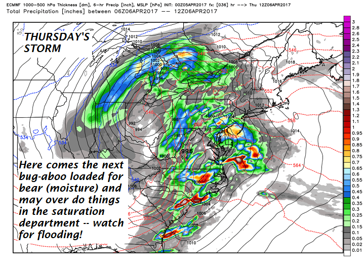
THURSDAY: Chance for a morning sprinkle northern areas. Otherwise clouds giving way to intervals of late afternoon sunshine. A high in the upper 40s. Northwest winds 10 to 20 mph.
Looking Further ahead…
THURSDAY NIGHT: Mostly clear and moonlit. A low 25 to 30.
FRIDAY: Pick of the week. Blue skies and bright sunshine. A high in the mid 50s.
SATURDAY: Filtered sunshine through high cloudiness. A low 32 to 35 A high in the upper 50s to mid 60s
SUNDAY: Lots of clouds with “April showers”. A low in the 50s. A high in the upper 50s to mid 60s.
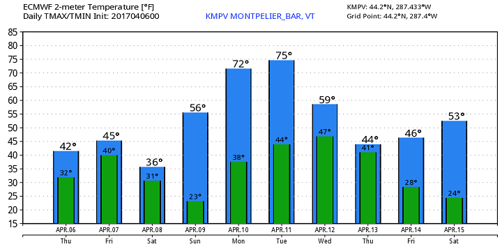
Average lows around 32. Normal highs in the low to mid 50s
RH/4-11[end]