
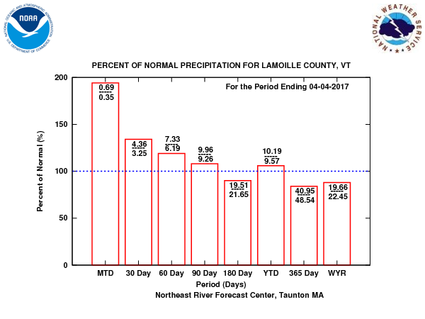
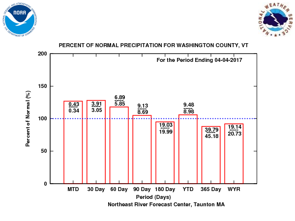
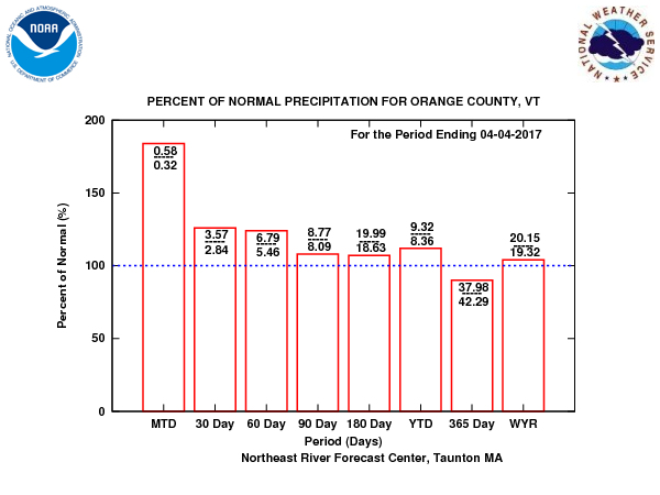
See rainfall precipitation snow melt below – we have been catching up on water supply and water table issues.
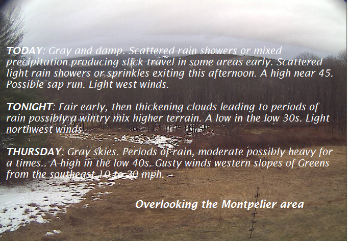
TODAY: Gray and damp. Scattered rain showers or mixed precipitation producing slick travel in some areas early. Scattered light rain showers or sprinkles exiting this afternoon. A high near 45. Possible sap run. Light west winds.
TONIGHT: Fair early, then thickening clouds leading to periods of rain possibly a wintry mix higher terrain. A low in the low 30s. Light northwest winds.
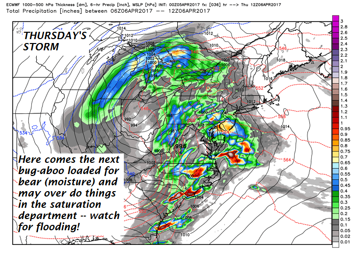
Flood Watch in effect Thursday through Saturday…
THURSDAY: Gray skies. Periods of rain, moderate possibly heavy for a times.. A high in the low 40s. Gusty winds western slopes of Greens from the southeast 10 to 20 mph.
Looking Further ahead…
THURSDAY NIGHT: Fair early then clouding up. A low 35 to 40.
FRIDAY: Scattered light rain showers or sprinkles. Maybe an interval of afternoon sunshine. A high near 45.
SATURDAY: Morning snow showers with a dusting to 2” possible. Otherwise a few intervals of afternoon sunshine developing. A low around 32. A highs in the upper 30s.
SUNDAY: Mostly sunny, gorgeous and spring-like temperatures. A low 20 to 25. A high 55 to 60.
MONDAY: Sunshine becoming filtered through high clouds. A low 35 to 40. A high near 70.
TUESDAY: Mostly sunny and very mild with a few high clouds. A low 45 to 50. A high in the 70s.
Average lows in the upper 20s to around 30. Normal highs in the upper 40s to low 50s
RH/4-5[end]
