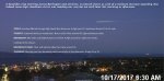
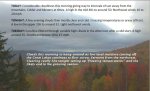
TONIGHT: Scattered clouds northern areas, otherwise clear. Not so cold. A low in the upper 30s to low 40s. Light southwest winds.
TOMORROW: Blue skies and bright Autumn sunshine. A high around 65. Light west winds.
WEDNESDAY NIGHT: Clear with patchy valley fog. A low around 45. Light south winds.
THURSDAY: Morning sun then becoming partly sunny later in the afternoon. Turning breezy. A high mid to upper 60s. Southwest breeze picks up 10 to 25 mph.
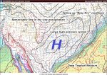
Looking further ahead…
THURSDAY NIGHT: Chance for sprinkles far northern Vermont, otherwise partly cloudy. A low 40 to 45.
FRIDAY: Sunshine mixed with patchy high clouds.Cooler but seasonable. A high 55 to 60.
SATURDAY: Sunshine mixed with high cloudiness.A low 35 to 40. A high near 70.
SUNDAY: Partly to mostly sunny with high cloudiness, and above normal in temperature. A low around 50. A high in the low 70s.
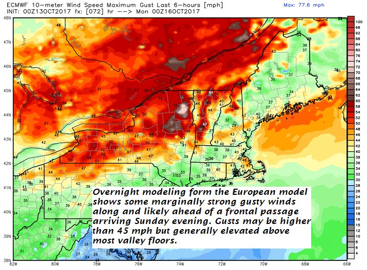
MONDAY: Morning fog burns off, then partly to mostly sunny and very mild and breezy. A low around 50. A high in the low 70s.
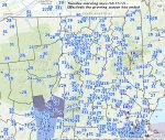
Average lows low to mid 30s. Normal highs mid to upper 50s.
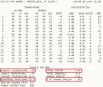
RH/10-17[end]
| Virus-free. www.avast.com |