
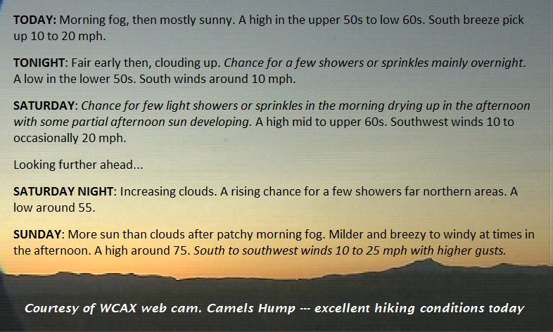
TODAY: Morning fog, then mostly sunny. A high in the upper 50s to mid 60s. South breeze pick up 10 to 25 mph strongest near Lake Champlain.
TONIGHT: Fair early then, clouding up. Chance for a few showers or sprinkles mainly overnight. A low in the lower 50s. South winds around 10 occasionally 20 mph especially western VT.
SATURDAY: Chance for few light showers or sprinkles in the morning drying up in the afternoon with some partial afternoon sun developing. A high mid 60s to around 70 warms pots. Southwest winds 10 to occasionally 20 mph.
Looking further ahead…
SATURDAY NIGHT: Increasing clouds. A rising chance for a few showers far northern areas. A low around 55.
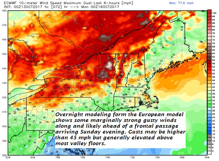
SUNDAY: More sun than clouds after patchy morning fog. Milder and breezy to windy at times in the afternoon. A high around 75. South to southwest winds 10 to 25 mph with higher gusts.
MONDAY: Sun and clouds. blustery and sharply colder. Temperatures held into the 40s.
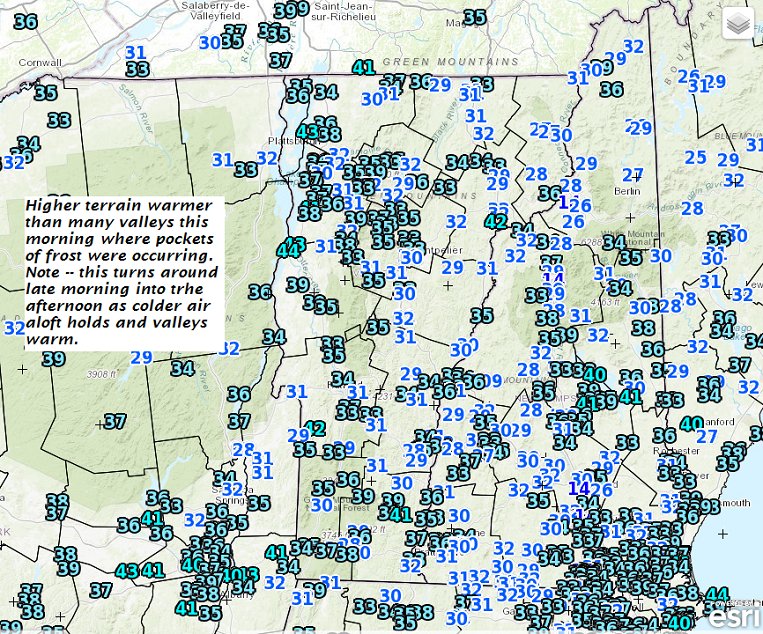
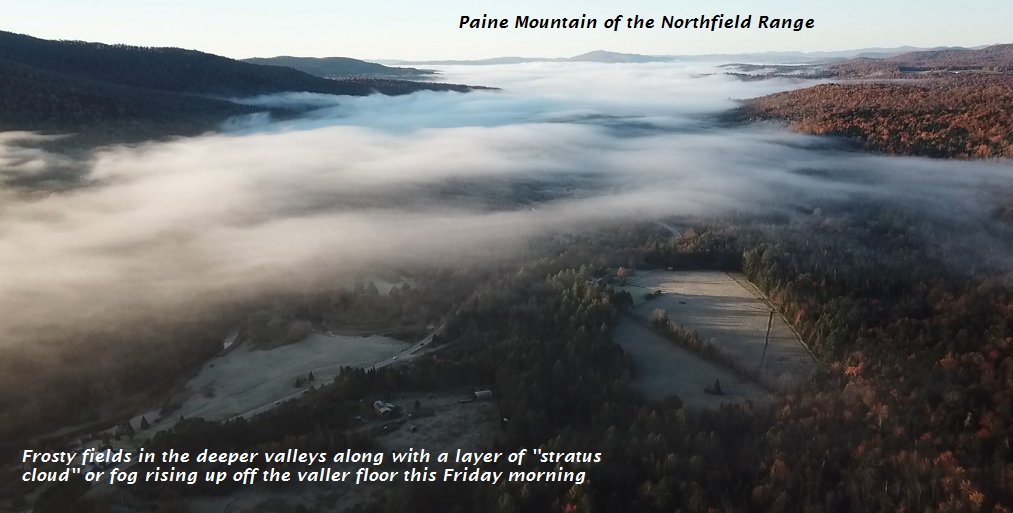
TUESDAY: Morning low clouds and fog with a killing freeze, then partly to mostly sunny. A low 25 to 30. A high about 50.
WEDNESDAY: Bright sunshine and blue skies. A morning low 30 to 35. A high in the upper 40s to around 50.
THURSDAY: Filtered sun through high clouds. A low around 45. A high in the 60s.
Average low 35 to 40. Normal highs mid to upper 50s.
RH/10-12 [end]
| Virus-free. www.avast.com |
