Updated Thursday morning Forecast — April 26th, 2018

TODAY: Occasional light rain tapering to scattered showers later this afternoon. Otherwise gray and murky or misty, maybe a late day break of sun. A high in the mid 50s. Light west breeze.

TONIGHT: Chance for a leftover shower exiting northern areas. Otherwise becoming partly to mostly cloudy. Patchy river valley fog. A low in the mid to upper 30s. Light southwest winds.

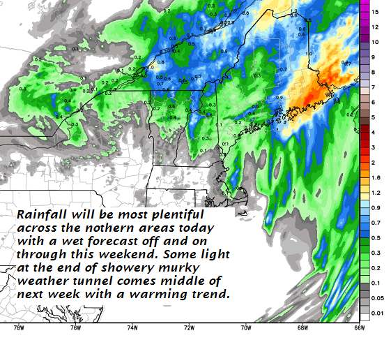
FRIDAY: Considerable cloudiness. Occasional light rain. A high 55 to 60. South breeze 10 to 15 mph.

Looking further Ahead…

FRIDAY NIGHT: Mainly cloudy. Continued showery. A low in the mid 40s.

SATURDAY: Clouds mixing with intervals of sun. Scattered rain showers developing in the afternoon. A high in the low to mid 60s.

SUNDAY: Mainly gray with scattered rain showers. A low 40 to 45. A high in the 50s.

MONDAY: Considerable cloudiness. Chance for more showers. A low in the 32 to 35. A high in the 50s beginning of a warming trend.

Average lows upper 30s to around 40. Normal highs in the in the low 60s.

Virus-free. www.avast.com

Updated Friday Evening Forecast — April 6th, 2018

TONIGHT: Variable cloudiness. Snow showers taper to scattered flurries late this evening. Some additional minor accumulation. A low around 25. Southwest breeze 10 to 15 mph.

TOMORROW: Morning clouds with scattered flurries northern areas. Intervals of afternoon sun.A high near 35. West winds picking up 10 to 25 mph with few higher gusts in the afternoon.

SATURDAY NIGHT: Mostly clear with a few high clouds. A low 15 to 20. Light winds.

SUNDAY: Morning sun then partly to mostly cloudy. Isolated mountain flurries. A high near 35. Northwest winds 10 to 15 mph.

Looking further Ahead…

SUNDAY NIGHT: Becoming mostly clear. A low 15 to 20.

MONDAY: Morning sunshine then high cloudiness. A high 35 to 40.

TUESDAY: Mainly gray. Chance for snow or rain showers. A low 20 to 25. A high near 40.

WEDNESDAY: Chance for snow or rain showers. Breaks of sun. A low mid to upper 20s. A high around 45.

THURSDAY: A low around 30. A high near 50.

Average lows mid 20s to low 30s. Normal highs in the upper 40s to mid 50s.

RH/4-6[end]

Virus-free. www.avast.com

Updated Friday Morning Forecast — April 6th, 2018

TODAY: Morning sun then clouding up. Accumulating wet snow showers, mixed with rain valley floors arriving later this afternoon. Accumulation around an inch especially higher terrain”. A high mid to upper 30s. South winds picking up 10 to 15 mph.

TONIGHT: Variable cloudiness. Occasional flurries or mountain snow showers, with minor slushy accumulation. A low around 25. Southwest breeze 10 to 15 mph.

SATURDAY: Morning clouds with scattered flurries northern areas. Intervals of afternoon sun.A high in the mid to upper 30s. West winds picking up 10 to 25 mph with few higher gusts in the afternoon.

Looking further Ahead…

SATURDAY NIGHT: Mostly clear with a few high clouds. A low 15 to 20.

SUNDAY: Morning sun then partly to mostly cloudy. Isolated mountain flurries. A high 30 to 35.

MONDAY: Morning sunshine then high cloudiness. A low 15 to 20. A high around 40.

TUESDAY: Mainly gray. Chance for snow or rain showers. A low in the upper 20s. A high near 40.

WEDNESDAY: Chance for snow or rain showers. Breaks of sun. A low mid to upper 20s. A high around 40.

Average lows mid 20s to low 30s. Normal highs in the upper 40s to mid 50s.

RH/4-6[end]

Virus-free. www.avast.com

Updated Thursday Evening Forecast — April 5th, 2018

TONIGHT: Clear except for increasing high clouds overnight. A low mid teens to low 20s. Light southwest winds.

TOMORROW: Gray skies. Accumulating wet snow showers, mixing with rain valley floors spreading south to north late morning on. Accumulation 1 to 2 locally more in the higher terrain”. A high mid to upper 30s. South winds 10 to 20 mph.

FRIDAY NIGHT: Mostly cloudy. Periods of light accumulating snow showers about an inch additional accumulation. A low around 25. Southwest breeze 10 to 15 mph.

SATURDAY: Morning clouds with scattered flurries northern areas. Intervals of afternoon sun.A high in the mid to upper 30s. West winds picking up 10 to 25 mph with few higher gusts.

Looking further Ahead…

SATURDAY NIGHT: A low 15 to 20.

SUNDAY: Sunshine giving way to more clouds in the afternoon. Stray mountain flurries. A high 30 to 35.

MONDAY: Morning sun giving way to increasing clouds. A low 15 to 20. A high around 40.

TUESDAY: Mainly gray. Chance for snow or rain showers. A low in the upper 20s. A high near 40.

WEDNESDAY: Chance for snow or rain showers. Breaks of sun. A low mid to upper 20s. A high around 40.

Average lows mid 20s to low 30s. Normal highs in the upper 40s to mid 50s.

RH/4-5[end]

Virus-free. www.avast.com

Updated Thursday morning forecast — April 5th, 2018

TODAY: A few leftover flurries this morning exiting to increasing sunshine this afternoon. Blustery, well below normal in temperature. A high in the lower 30s. West to northwest winds 10 to 25 mph with higher gusts this morning gradually diminishing.

TONIGHT: Clear except for increasing high clouds overnight. A low upper teens to low 20s. Light southwest winds.

FRIDAY: Gray skies. Chance for accumulating wet snow mixing…with rain valley floors arriving in the afternoon. Accumulation 1 to 2”. A high mid to upper 30s. South winds 10 to 15 mph.

Looking further Ahead…

FRIDAY NIGHT: Mostly cloudy. Periods of light accumulating snow or snow showers. A low in the 20s.

SATURDAY: Morning clouds chance for a flurry, then periods of afternoon sun.A high around 40.

SUNDAY: Sunshine giving way to more clouds in the afternoon. Chance for mountain snow showers and valley flurries. A low upper teens to low 20s. A high in the low to mid 30s.

MONDAY: Morning sun giving way to increasing clouds. A low near 15. A high mid 30s to low 40s.

TUESDAY: Overcast and gray. Chance for light accumulating snow. A low in the 20s. A high upper 30s to near 40.

WEDNESDAY: Chance for snow showers or flurries, then intervals of sun. A low 25 to 30. A high around 40.

Average lows mid 20s to low 30s. Normal highs in the upper 40s to mid 50s.

RH/4-5[end]

Virus-free. www.avast.com

Updated Wednesday Evening Forecast — April 4th, 2018

Wind Advisory 5 PM Through 5 AM Thursday

TONIGHT: Mostly cloudy. Blustery to windy. Scattered mountain flurries. A low mid teens to low 20s. Gusty westerly winds 10 to 25 with gusts over 45 mph across the elevated terrain.

TOMORROW: Partly to mostly sunny. Much colder & continued blustery. A high 32 to 35. West to northwest winds 10 to 25 mph with higher gusts.

THURSDAY NIGHT: Mostly clear in the evening, then increasing high clouds. A low upper teens to low 20s. Light southwest winds.

FRIDAY: Gray skies. Chance for accumulating wet snow mixing…with rain valley floors arriving in the afternoon. Accumulation 1 to 2”. A high mid to upper 30s. South winds 10 to 15 mph.

Looking further Ahead…

FRIDAY NIGHT: Mostly cloudy. Periods of light accumulating snow or snow showers. A low in the 20s.

SATURDAY: Morning clouds chance for a flurry, then periods of afternoon sun.A high around 40.

SUNDAY: Sunshine giving way to a few cloudy periods. Chance for mountain snow showers and valley flurries. A low upper teens to low 20s. A high in the low to mid 30s.

MONDAY: Mostly sunny. A low near 15. A high mid 30s to low 40s.

TUESDAY: Filtered morning sun then thickening clouds leading to a chance for accumulating snow in the afternoon. A low in the 20s. A high upper 30s to near 40.

Average lows mid 20s to low 30s. Normal highs in the upper 40s to mid 50s.

RH/4-4[end]

Virus-free. www.avast.com

Updated Wednesday morning forecast — April 4th, 2018

TODAY: Cloudy. Occasional rain, or rain showers. Isolated rumble of thunder toward southern areas. Breaks of sun developing this afternoon. Milder. A high 50 to 55. Winds becoming southwesterly 10 to 20 mph.

Wind Advisory 5 PM Through 5 AM Thursday

TONIGHT: Mostly cloudy. Blustery to windy. Scattered mountain flurries. A low mid teens to low 20s. Gusty westerly winds 10 to 25 with gusts over 45 mph across the elevated terrain.

THURSDAY: Partly to mostly sunny. Much colder & blustery with a high just 30 to 35. West to northwest winds 10 to 25 mph with higher gusts.

Looking further Ahead…

THURSDAY NIGHT: Mostly clear in the evening, then increasing high clouds. A low 20 to 25.

FRIDAY: Gray skies. Chance for accumulating wet snow mixing…with rain valley floors late . Accumulation 1 to locally 4” with more possible at the ski resorts. Blustery at times. A high in the 30s.

SATURDAY: Morning clouds chance for a flurry, then periods of afternoon sun.A low in the 20s. A high around 40.

SUNDAY: Sunshine giving way to a few cloudy periods. Chance for mountain snow showers and valley flurries. A low mid teens to low 20s. A high 35 to 40.

MONDAY: Mostly sunny. A low in the teens. A high in the mid 30s to low 40.

Average lows mid 20s to low 30s. Normal highs in the upper 40s to mid 50s.

RH/4-4[end]

Virus-free. www.avast.com

Updated Tuesday Evening forecast — April 3rd, 2018

TONIGHT: Cloudy. Rain or a wintery mix this evening… changing to rain overnight. Watch for slick spots east of the Green Mountains mainly before midnight. A low close to 32. Southeast winds 10 to 20 mph.

TOMORROW: Cloudy but a break or two of sun possible. Occasional rain, or rain showers. Maybe a rumble of thunder toward southern areas. Areas of fog. Milder. A high 50 to 55. Winds becoming southwesterly 10 to 20 mph.

Wind Advisory 5 PM Through 5 AM Thursday

WEDNESDAY NIGHT: Mostly cloudy. Blustery to windy. Scattered mountain flurries. A low mid teens to low 20s. Gusty westerly winds 10 to 25 with gusts over 40 mph across the elevated terrain.

THURSDAY: Partly to mostly sunny. Much colder & blustery with a high just 30 to 35. West to northwest winds 10 to 25 mph with higher gusts.

Looking further Ahead…

THURSDAY NIGHT: Mostly clear in the evening, then increasing high clouds. A low 20 to 25.

FRIDAY: Considerable cloudiness. Chance for accumulating snow mixing with rain valley floors. Becoming blustery to windy Friday night strong westerly wind gusts possible. A high around 40.

SATURDAY: Morning clouds chance for a flurry, then periods of afternoon sun.A low 20 to 25. A high in the upper 30s.

SUNDAY: Partly sunny. A low in the teens. A high near 40.

MONDAY: Mostly sunny. A low in the teens. A high in the mid 30s to low 40.

Average lows mid 20s to low 30s. Normal highs in the upper 40s to mid 50s.

RH/4-3[end]

Virus-free. www.avast.com

Updated Tuesday morning forecast — April 3rd, 2018

TODAY: Clouding up. A mix of rain, and slushy wet snow arrives late today. Watch for a few slick spots developing.. A high in the low to mid 40s. Light south wind.

TONIGHT: Cloudy. A wintry mix this evening… changing to rain with pockets of freezing rain. Watch for slick spots east of the Green Mountains mainly before midnight. A low close to 32. Southeast winds 10 to 20 mph.

WEDNESDAY: Cloudy but a break or two of sun possible. Occasional rain, or rain showers. Maybe a rumble of thunder toward southern areas. Areas of fog. Milder. A high in the mid 50s. Winds becoming southwesterly 10 to 20 mph.

Looking further Ahead…

WEDNESDAY NIGHT: Mostly cloudy and blustery to windy. Scattered mountain flurries. A low in the upper teens to low 20s. Strong westerly wind gusts possible.

THURSDAY: Partly to mostly sunny but very blustery and cold. A high in the low to mid 30s.

FRIDAY: Cloudy. Chance for accumulating snow mixing with rain valley floors. Becoming blustery to windy Friday night strong westerly wind gusts possible. A low 20 to 25. A high upper 30s to low 40s.

SATURDAY: Lots of clouds giving way to periods of afternoon sun.A low upper teens to mid 20s. A high in the upper 30s.

Average lows mid 20s to low 30s. Normal highs in the upper 40s to mid 50s.

RH/4-3[end]

Virus-free. www.avast.com

Updated Monday Evening Forecast — April 2nd, 2018

TONIGHT: Mostly clear this evening, then some high cloudiness overnight. A low in the mid 20s. Little wind.

TOMORROW: Clouding up. A rising chance for a wintry mix in the late afternoon. Snow accumulation less than an inch. A high in the low to mid 40s. Light south wind.

TUESDAY NIGHT: Cloudy. A wintry mix early, changing to rain. Watch for possible slick spots tomorrow evening east of the Green Mountains. A low 32 to 35. Southeast winds 10 to 20 mph.

WEDNESDAY: Cloudy but a break or two of sun possible. Periods of light rain. Areas of fog. Milder. A high in the mid to upper 50s. Winds becoming southwesterly 10 to 20 mph.

Looking further Ahead…

WEDNESDAY NIGHT: Mostly cloudy. Scattered mountain flurries. Blustery to windy. A low in the upper teens to low 20s. Strong westerly wind gusts possible.

THURSDAY: More sun than clouds but blustery to windy. Temperatures below normal. A high in the low to mid 30s.

FRIDAY: Cloudy. Chance for accumulating snow changing to a wintry mix. Becoming blustery to windy Friday night strong westerly wind gusts possible. A low 20 to 25. A high in the mid to upper 30s.

SATURDAY: Lots of clouds giving way to periods of afternoon sun.A low upper teens to mid 20s. A high near 35.

Average lows mid 20s to low 30s. Normal highs in the upper 40s to mid 50s.

RH/4-2[end]

Virus-free. www.avast.com