
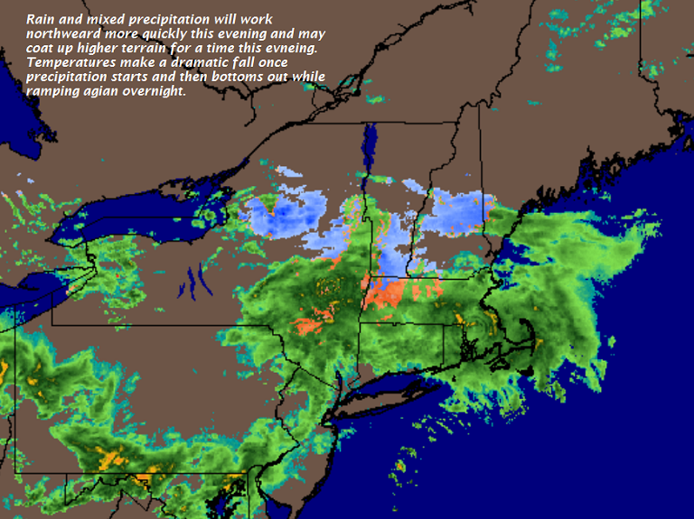
TONIGHT: Cloudy. Rain or a wintery mix this evening… changing to rain overnight. Watch for slick spots east of the Green Mountains mainly before midnight. A low close to 32. Southeast winds 10 to 20 mph.
TOMORROW: Cloudy but a break or two of sun possible. Occasional rain, or rain showers. Maybe a rumble of thunder toward southern areas. Areas of fog. Milder. A high 50 to 55. Winds becoming southwesterly 10 to 20 mph.
Wind Advisory 5 PM Through 5 AM Thursday
WEDNESDAY NIGHT: Mostly cloudy. Blustery to windy. Scattered mountain flurries. A low mid teens to low 20s. Gusty westerly winds 10 to 25 with gusts over 40 mph across the elevated terrain.
THURSDAY: Partly to mostly sunny. Much colder & blustery with a high just 30 to 35. West to northwest winds 10 to 25 mph with higher gusts.
Looking further Ahead…
THURSDAY NIGHT: Mostly clear in the evening, then increasing high clouds. A low 20 to 25.
FRIDAY: Considerable cloudiness. Chance for accumulating snow mixing with rain valley floors. Becoming blustery to windy Friday night strong westerly wind gusts possible. A high around 40.
SATURDAY: Morning clouds chance for a flurry, then periods of afternoon sun.A low 20 to 25. A high in the upper 30s.
SUNDAY: Partly sunny. A low in the teens. A high near 40.
MONDAY: Mostly sunny. A low in the teens. A high in the mid 30s to low 40.
Average lows mid 20s to low 30s. Normal highs in the upper 40s to mid 50s.
RH/4-3[end]
| Virus-free. www.avast.com |
