TODAY: Morning cloudiness giving way to increasing sunshine…late morning this afternoon. A high 40 to 45. Light west to southwest winds.
TONIGHT: Mostly clear this evening, then increasing high clouds. A low 20 to 25. Little wind.
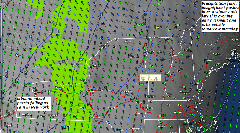
TUESDAY: Clouding up. A rising chance for wet snow mixing with rain valley floors arriving late in the afternoon. Snow accumulation a dusting to an inch mainly high terrain. A high in the upper 30s to near 40. Light south wind.
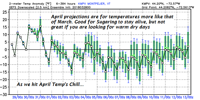
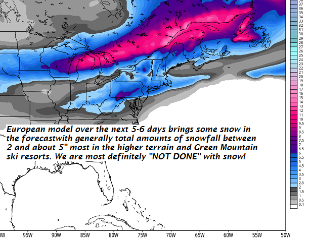
Looking further Ahead…
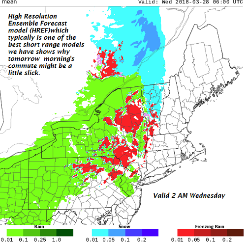
TUESDAY NIGHT: Periods of rain with a risk for spotty freezing rain. Slick travel possible in the evening east of the Green Mountains. A low 30 to 35.
WEDNESDAY: Lots of clouds. Periods of mostly light rain. Areas of fog. But milder with a high in the 50s.
THURSDAY: More sun than clouds but blustery to windy. Temperatures below normal. A low 20 to 25. A high 35 to 40.
FRIDAY: Cloudy with a chance for snow accumulation. A low in the 20s. A high in the 30s.
Average lows mid 20s to low 30s. Normal highs in the upper 40s to mid 50s.
RH/4-2[end]
| Virus-free. www.avast.com |