
TODAY: Cloudy. Occasional rain, or rain showers. Isolated rumble of thunder toward southern areas. Breaks of sun developing this afternoon. Milder. A high 50 to 55. Winds becoming southwesterly 10 to 20 mph.
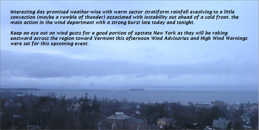
Wind Advisory 5 PM Through 5 AM Thursday
TONIGHT: Mostly cloudy. Blustery to windy. Scattered mountain flurries. A low mid teens to low 20s. Gusty westerly winds 10 to 25 with gusts over 45 mph across the elevated terrain.
THURSDAY: Partly to mostly sunny. Much colder & blustery with a high just 30 to 35. West to northwest winds 10 to 25 mph with higher gusts.
Looking further Ahead…
THURSDAY NIGHT: Mostly clear in the evening, then increasing high clouds. A low 20 to 25.
FRIDAY: Gray skies. Chance for accumulating wet snow mixing…with rain valley floors late . Accumulation 1 to locally 4” with more possible at the ski resorts. Blustery at times. A high in the 30s.
SATURDAY: Morning clouds chance for a flurry, then periods of afternoon sun.A low in the 20s. A high around 40.
SUNDAY: Sunshine giving way to a few cloudy periods. Chance for mountain snow showers and valley flurries. A low mid teens to low 20s. A high 35 to 40.
MONDAY: Mostly sunny. A low in the teens. A high in the mid 30s to low 40.
Average lows mid 20s to low 30s. Normal highs in the upper 40s to mid 50s.
RH/4-4[end]
| Virus-free. www.avast.com |
