
March 14th, 2017
· Blizzard of 2017 in progress.
· Strongest winds S Vermont high terrain – but locally strong gusts all higher terrain developing this afternoon into tonight especially Champlain Valley.
Winter Storm Warning into Wednesday evening…
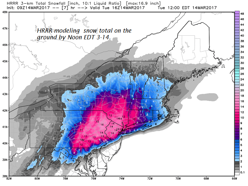
TODAY: Snow developing this morning becoming moderate to heavy before 1 PM as accumulation rates increase to over 1 inch per hour . Blowing and drifting snow likely with white-out conditions and treacherous travel with low visibility. A high in the lower 20s. Northeast winds gradually picking up 10 to 20 mph.
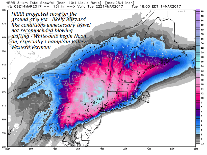
TONIGHT: Snow – moderate to heavy at times accumulation rates over 1 inch per hour this evening. Additional 8 to 16 inches possible. Temperatures in the low to mid teens. Blowing and drifting snow likely with white-out conditions and treacherous travel with low visibility. North winds 10 to 25 mph and gusty.
WEDNESDAY: Accumulating snow… becoming much lighter with additional 1 to locally 3”. Temperatures in the upper teens to mid 20s. Gusty northwest winds with considerable blowing and drifting and white-outs. Total accumulation 15 to 30 inches, with locally higher amounts in the mountains. Northwest winds 10 to 20 mph.
Looking Further ahead…
WEDNESDAY NIGHT: Occasional light snow showers or flurries. A dusting to an inch. Colder. A low in the single digits.
THURSDAY: Mostly cloudy. Scattered flurries winding down. A in the upper teens to low 20s. Gusty northwest winds with minor blowing and drifting.
FRIDAY: Pick of the week – blue skies and bright sunshine. A low in the single digits with a high of about 30.
SATURDAY: Cloudy. A rising chance for more snow…possibly moderate amounts. A low 15 to 20. A high 25 to 30.
Average lows in the teens. Normal highs mid 30s to low 40s.
RH/3-14[end]
