Updated Friday Evening Forecast — October 30th, 2020

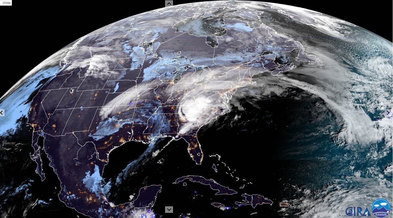
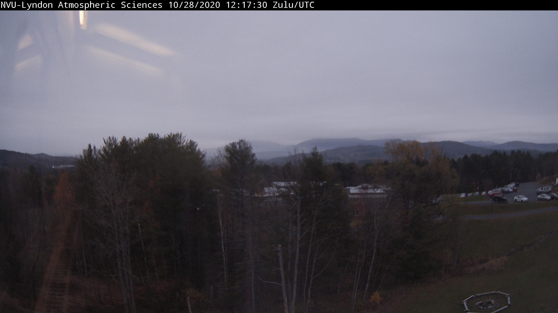
TONIGHT: Clear & fully moonlit. Cold and frosty. A low in the upper teens to low 20s. Light northwest winds.

Full Hunters Moon 2:49 PM

TOMORROW: Blue skies and bright sunshine. Chilly. A high in the low 40s. Light southwest winds.

HALLOWEEN:Clear moonlit skies and chilly. Temperatures falling through the 30s.Light south winds.

Fall Back 1 hour – (lose sleep) to EST

SATURDAY NIGHT: Mostly clear & fully moonlit.A low near 25. Light south winds.

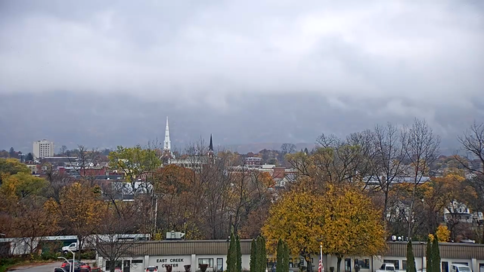
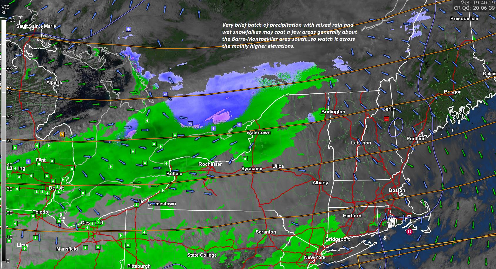
SUNDAY: Filtered sunshine, then increasing cloudiness. Rain showers likely late. Breezy to windy. A high 45 to 50. South breeze 10 to 20 mph.

Looking further ahead…

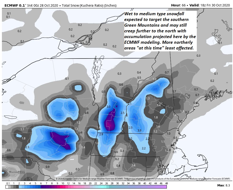
SUNDAY NIGHT: Mainly cloudy. Rain showers mix with accumulating wet snow showers. A low upper 20s.

MONDAY: Mostly cloudy, blustery to windy and colder. Lake Effect snow showers and a risk of snow squalls. Snow accumulation across northern areas possibly few inches. A high 40 to 45.

Election Day (sort of)

TUESDAY: Clouds, with a few break of sun. Scattered accumulating snow showers and flurries. Cold. A low around 20. A high only around 32.

WEDNESDAY: Morning clouds then afternoon sunshine. A low upper teens. A high in the 40s.

Average low ranging upper 20s to mid-30s, Average highs upper 40s to mid-50s.

RH/10-30 category forecast][end]

Updated Friday Morning Forecast — October 30th, 2020

TODAY: A few leftover snow showers southern areas exiting this morning. Cloudiness gives way to periods of afternoon sun. A high in the upper 30s. North winds 10 to 15 mph.

TONIGHT: Mostly clear or fully moonlit. Cold and frosty. A low in the upper teens to low 20s. Light northwest winds.

Full Hunters Moon 2:49 PM

SATURDAY: Blue skies and bright sunshine. Chilly. A high in the low 40s. Light southwest winds.

Looking further ahead…

HALLOWEEN:Clear moonlit skies and chilly. Temperatures falling through the 30s.

Fall Back 1 hour – (lose sleep) to EST

SATURDAY NIGHT: Clear, cold & fully moonlit.A low near 25.

SUNDAY: Filtered sunshine followed by lots of clouds. A rising chance for rain showers late. Breezy to windy from the south. A high 45 to 50.

MONDAY: Variably cloudy, blustery to windy and colder. Lake Effect snow showers and a risk of snow squalls. Some minor accumulation especially elevated terrain. A low upper 20s. A high around 40.

Election Day (sort of)

TUESDAY: Mixed sun and clouds. Chance for lingering mountain flurries. Frigid for this time of year. A low around 20. A high only around 32.

WEDNESDAY: Mixed sun and clouds. A low in the 20s. A high 45 to 50.

Average low ranging upper 20s to mid-30s, Average highs upper 40s to mid-50s.

RH/10-30 category forecast][end]

Updated Thursday Evening Forecast — October 29th, 2020

Winter Weather Advisory 8 PM thru 11 AM Friday for Windsor county and points south

TONIGHT: Rain & wet snow changing to accumulating light snow…but moderate at times far southern Greens. Dusting to an inch northern and central areas. 1 to 3” with locally more southern Green Mountain summits. A low upper 20s to around 30. North breeze 10 mph.

TOMORROW: A few leftover snow showers southern areas exiting in the morning to increasing amounts of sunshine. A high mid to upper 30s. North winds 10 mph.

FRIDAY NIGHT: Mostly clear or fully moonlit with a few clouds. Cold and frosty. A low in the upper teens to low 20s. Light northwest winds.

Full Hunters Moon 2:49 PM

SATURDAY: Blue skies and bright sunshine. Chilly. A high in the low 40s. Light southwest winds.

Looking further ahead…

HALLOWEEN:Clear moonlit skies and chilly. Temperatures falling through the 30s.

SATURDAY NIGHT: Clear, cold & fully moonlit.A low near 25.

SUNDAY: Filtered sunshine followed by lots of clouds. A rising chance for rain showers late. Breezy to windy from the south. A high upper 40s.

MONDAY: Variably cloudy, blustery and colder. Lake Effect snow showers and flurries. Some minor accumulation elevated terrain. A low near 25. A high 40 to 45.

TUESDAY: Mixed sun and clouds. Chance for lingering mountain flurries. Frigid for this time of year. A low around 20. A high only around 32.

Average low ranging upper 20s to mid-30s, Average highs upper 40s to mid-50s.

RH/10-29 category forecast][end]

Updated Thursday Morning Forecast — October 29th, 2020

TODAY: Overcast and gray. Spotty light rain develops this afternoon mixed with wet snow across elevated terrain. Remaining dry near the Quebec border. A high ranging thru the 40s. Light north winds.

Winter Weather Advisory 8 PM thru 11 AM Friday for Windsor county and points south

TONIGHT: Rain & wet snow changes to accumulating snow…moderate at times southern mountains. Dusting to an inch northern and central areas. 1 to 3” with locally more southern Green Mountain summits. A low 25 to 30. North breeze 10 mph.

FRIDAY: A few leftover snow showers southern areas exiting in the morning. Otherwise, increasingly sunny in the afternoon.A high mid to upper 30s. North winds 10 mph.

Looking further ahead…

FRIDAY NIGHT: Mostly clear or fully moonlit with a few clouds. Cold and frosty. A low in the upper teens to low 20s.

Full Hunters Moon 2:49 PM

SATURDAY: Blue skies and bright sunshine. Chilly. A high in the low 40s.

Halloween:Clear and fully moonlit. Temperatures in the 30s.

SUNDAY: Filtered sunshine followed by lots of clouds. A rising chance for rain showers later in the afternoon. Breezy to windy from the south. A low near 25. A high upper 40s near 50.

MONDAY: Variably cloudy, blustery and colder. Lake Effect snow showers and flurries. Some minor accumulation elevated terrain. A low near 25. A high 40 to 45.

TUESDAY: Mixed sun and clouds. Chance for lingering mountain flurries. Frigid for this time of year. A low around 20. A high only around 32.

Average low ranging upper 20s to mid-30s, Average highs upper 40s to mid-50s.

RH/10-29 category forecast][end]

Updated Wednesday Evening Forecast — October 28th, 2020

TONIGHT: Scattered rain showers dry up this evening. Otherwise partly to mostly cloudy. A low around 35. Light southwest winds.

TOMORROW: Lots of clouds. Spotty light rain develops in the afternoon mixed with wet snow flakes elevated terrain. A high 40 to 45. Light north winds.

THURSDAY NIGHT: Rain…changes to accumulating wet snow. Dusting to 3” northern and central areas, with up to 6”higher southern Greens. A low mid-20s. North breeze 10 mph.

FRIDAY: Occasional light snow or snow showers exiting in the morning. Increasingly sunny in the afternoon.A high mid to upper 30s. North winds 10 mph.

Looking further ahead…

FRIDAY NIGHT: Mostly clear with patchy valley fog. Cold and frosty. A low upper teens to low 20s

SATURDAY: Blue skies and bright sunshine. Chilly. A high around 40.

SUNDAY: Filtered sunshine followed by lots of clouds. A rising chance for rain showers in the afternoon. A low near 25. A high upper 40s.

MONDAY: Variably cloudy. Lake Effect snow showers and flurries. Some minor accumulation elevated terrain. A low 20 to 25. A high in the mid-40s.

Average low ranging upper 20s to mid-30s, Average highs upper 40s to mid-50s.

RH/10-28 category forecast][end]

Updated Wednesday Morning Forecast — October 28th, 2020

TODAY: Mainly cloudy with a few mountain flurries changing to sprinkles mid to late morning. Breaks of sun especially this afternoon. A high in the mid to upper 40s. Southwest breeze 10 to 15 mph.

TONIGHT: Partly to mostly cloudy. A low 32 to 35. Light west winds.

THURSDAY: Lots of clouds. Spotty light rain likely Barre-Montpelier area south later in the afternoon. A high near 45. Light northwest winds.

Looking further ahead…

THURSDAY NIGHT: Periods of evening rain changes to accumulating wet snow. About 2 to locally 6” higher southern Greens with a dusting to an inch” Barre-Montpelier area. A low mid-20s to near 30.

FRIDAY: Occasional light accumulating snow or snow showers central and southern areas exiting in the afternoon with partial clearing. A high in the upper 30s.

SATURDAY: Partly to mostly sunny but chilly. A low 20 to 25. A high near 40.

SUNDAY: Filtered sunshine followed by increasing cloudiness. A rising chance for rain showers in the afternoon. A low near 25. A high upper 40s to near 50.

MONDAY: Variable clouds. Scattered snow showers and flurries. Some minor accumulation elevated terrain. A low in the mid-20s. A high in the 40s.

Average low ranging upper 20s to mid-30s, Average highs upper 40s to mid-50s.

RH/10-28 category forecast][end]

Updated Tuesday Evening Forecast — October 27th, 2020

TONIGHT: Variably cloudy. Quick period of widely scattered rain showers mixed with wet snow high terrain exiting mid to late evening. A low in the lower 30s. Light southeast winds.

TOMORROW: Clouds, with possible breaks of sun. A few mountain sprinkles. A high in the mid to upper 40s. Southwest breeze 10 to 15 mph.

WEDNESDAY NIGHT: Becoming partly cloudy. A low around 35. Light west winds.

THURSDAY: Filtered sun then thickening clouds. Chance for spotty light rain far southern areas late. A high near 45. Light northwest winds.

Looking further ahead…

THURSDAY NIGHT: Periods of evening rain changes to accumulating wet snow. A 2 to locally 6” southern Greens with a dusting to 2” Barre-Montpelier area. A low in the upper 20s.

FRIDAY: Occasional light accumulating snow or snow showers central and southern areas exiting in the afternoon with partial clearing. A high in the mid to upper 30s.

SATURDAY: Partly to mostly sunny but chilly. A low 20 to 25. A high 35 to 40 about 15 degrees below normal.

SUNDAY: Filtered sunshine followed by increasing cloudiness. A rising chance for rain showers in the afternoon. A low near 25. A high in the mid-40s.

Average low ranging upper 20s to mid-30s, Average highs 50 to 55.

RH/10-26category forecast][end]

Updated Tuesday Morning Forecast — October 27th, 2020

TODAY: Clouds with some hints of sun developing away from the mountains. A high near 45. Northwest winds 10 mph.

TONIGHT: Scattered clouds to mostly clear. A low upper 20s to low 30s. Light southeast winds.

WEDNESDAY: Clouds, with possible breaks of sun. Widely scattered mountain sprinkles. A high in the mid to upper 40s. Southwest breeze 10 to 20 mph.

Looking further ahead…

WEDNESDAY NIGHT: Mostly clear. A low in the low to mid 30s.

THURSDAY: Morning sunshine, then thickening clouds. Chance for a shower of rain or wet snow developing late southern areas. A high in the mid-40s.

THURSDAY NIGHT: Chance for rain showers…changing to accumulating wet snow. A couple/few inches possible especially high terrain. A low near 30.

FRIDAY: Overcast. Chance for snow…possible moderate accumulation especially southern Vermont exiting late. Temperatures holding in the low 30s.

SATURDAY: Partly to mostly sunny but well below normal in temperature. A low around 20. A high only around 35 or about 15 to 20 degrees below normal.

Average low ranging upper 20s to mid-30s, Average highs 50 to 55.

RH/10-26category forecast][end]

Updated Monday Evening Forecast — October 26th, 2020

TONIGHT: Considerable cloudiness Scattered light rain showers areas of drizzle mixed with wet snowflakes higher northern terrain overnight exiting around daybreak. A low mid to upper 30s. Light winds becoming northwesterly 10 mph.

TOMORROW: Mainly cloudy. Maybe a late day sprinkle. A high 40 to 45. Northwest winds 10 mph.

TUESDAY NIGHT: Partly cloudy for a time then clouding up. A low upper 20s to around 30. Light southeast winds.

WEDNESDAY: Clouds, with periods of sunshine developing away from the mountains. A high in the upper 40s. Southwest breeze 10 to 20 mph.

Looking further ahead…

WEDNESDAY NIGHT: Mostly clear. A low around 32.

THURSDAY: Morning sunshine gives way to lots of clouds later in the afternoon. A rising chance for rain showers southern & central areas. A high 45 to 50.

THURSDAY NIGHT: Chance for rain showers…changing to accumulating wet snow. A couple/few inches possible. A low near 32

FRIDAY: Overcast. Chance for snow…possible moderate accumulation especially central and southern. Temperatures falling into the 20s.

SATURDAY: Partly to mostly sunny but well below normal in temperature. A low around 20. A high only around 35 or about 15 to 20 degrees below normal.

Average low ranging upper 20s to mid-30s, Average highs 50 to 55.

RH/10-26category forecast][end]

Updated Monday Morning Forecast — October 26th, 2020

TODAY: Cloudy and gray. A brief period of wet snow showers changing to rain this morning. Minor accumulation grassy surfaces mainly higher terrain. Occasional rain showers this afternoon. A high reaching the mid-40s. Southeast winds 10 to 15 mph.

TONIGHT: Scattered rain showers mixed with wet snow flakes higher terrain before exiting. Otherwise lots of clouds. A low around 35. Light winds becoming northwesterly 10 mph.

TUESDAY: Mainly cloudy. Chance for a brief rain shower, mixed with a few wet snow flakes. A high low to mid 40s. Northwest winds 10 mph.

Looking further ahead…

TUESDAY NIGHT: Partly cloudy for a time then clouding up. A low upper 20s.

WEDNESDAY: Clouds with intervals of sun away from the mountains. A high in the mid-40s.

THURSDAY: Morning sunshine gives way to lots of clouds later in the afternoon. A rising chance for rain showers mixing with wet accumulating snow, especially southern and central areas. A dusting to 3” possible down to some valley floors. A low around 32. A high near 45.

FRIDAY: Considerable clouds. Chance for a lingering rain or snow shower. A low around 30. A high mid to upper 30s.

Average low ranging upper 20s to mid-30s, Average highs 50 to 55.

RH/10-26category forecast][end]