
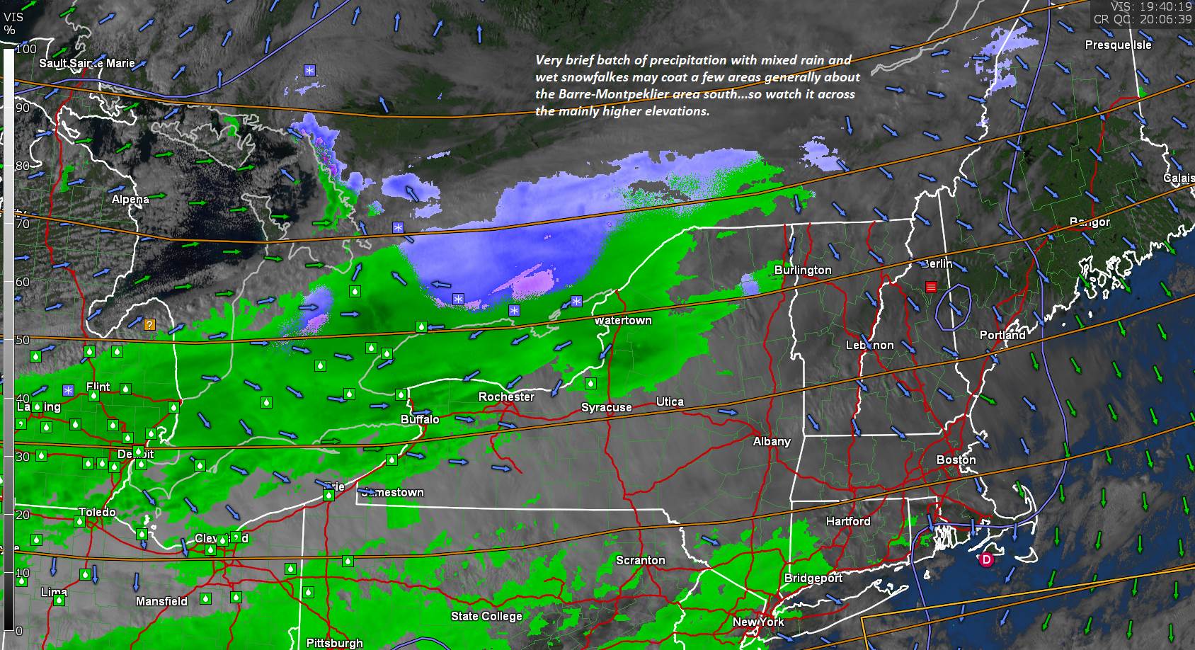
TONIGHT: Variably cloudy. Quick period of widely scattered rain showers mixed with wet snow high terrain exiting mid to late evening. A low in the lower 30s. Light southeast winds.
TOMORROW: Clouds, with possible breaks of sun. A few mountain sprinkles. A high in the mid to upper 40s. Southwest breeze 10 to 15 mph.
WEDNESDAY NIGHT: Becoming partly cloudy. A low around 35. Light west winds.
THURSDAY: Filtered sun then thickening clouds. Chance for spotty light rain far southern areas late. A high near 45. Light northwest winds.
Looking further ahead…
THURSDAY NIGHT: Periods of evening rain changes to accumulating wet snow. A 2 to locally 6” southern Greens with a dusting to 2” Barre-Montpelier area. A low in the upper 20s.
FRIDAY: Occasional light accumulating snow or snow showers central and southern areas exiting in the afternoon with partial clearing. A high in the mid to upper 30s.
SATURDAY: Partly to mostly sunny but chilly. A low 20 to 25. A high 35 to 40 about 15 degrees below normal.
SUNDAY: Filtered sunshine followed by increasing cloudiness. A rising chance for rain showers in the afternoon. A low near 25. A high in the mid-40s.
Average low ranging upper 20s to mid-30s, Average highs 50 to 55.
RH/10-26category forecast][end]
