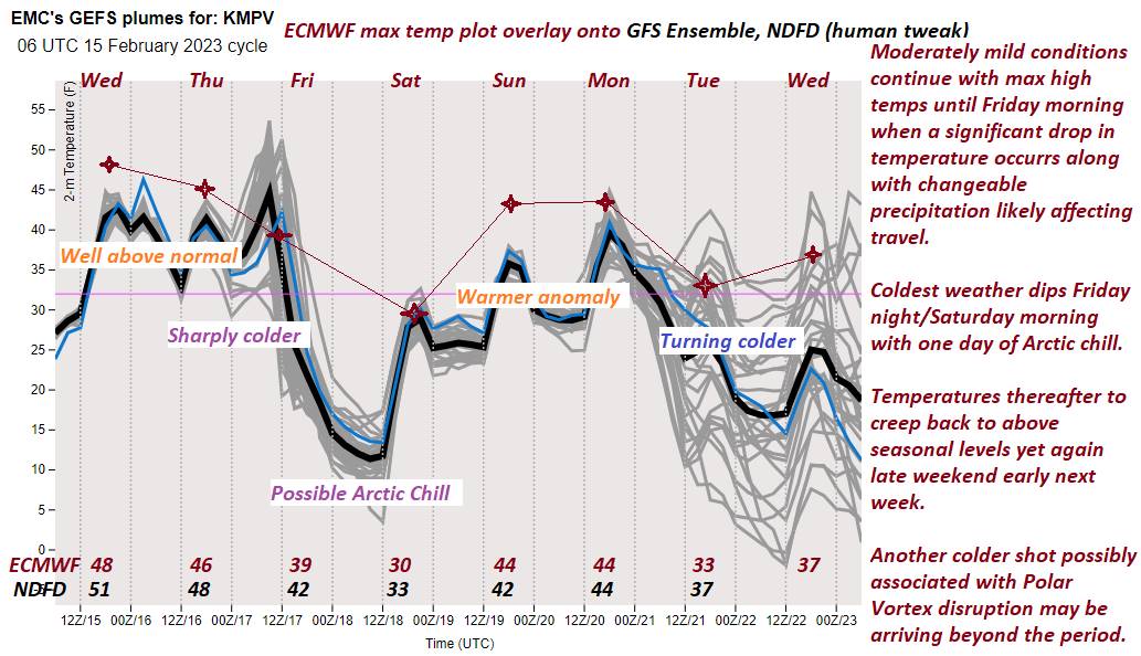
Winter Weather Advisory 1 AM thru 7 PM Friday…
TONIGHT: Overcast. Rising chance for light sprinkles. Rain showers transition to freezing rain mixing with sleet northwestern areas before daybreak with poor travel developing Champlain Valley and northern tier areas. A low ranging low to mid 30s northern and western areas, and in the mid to upper 30s central and southern areas. Light east winds.
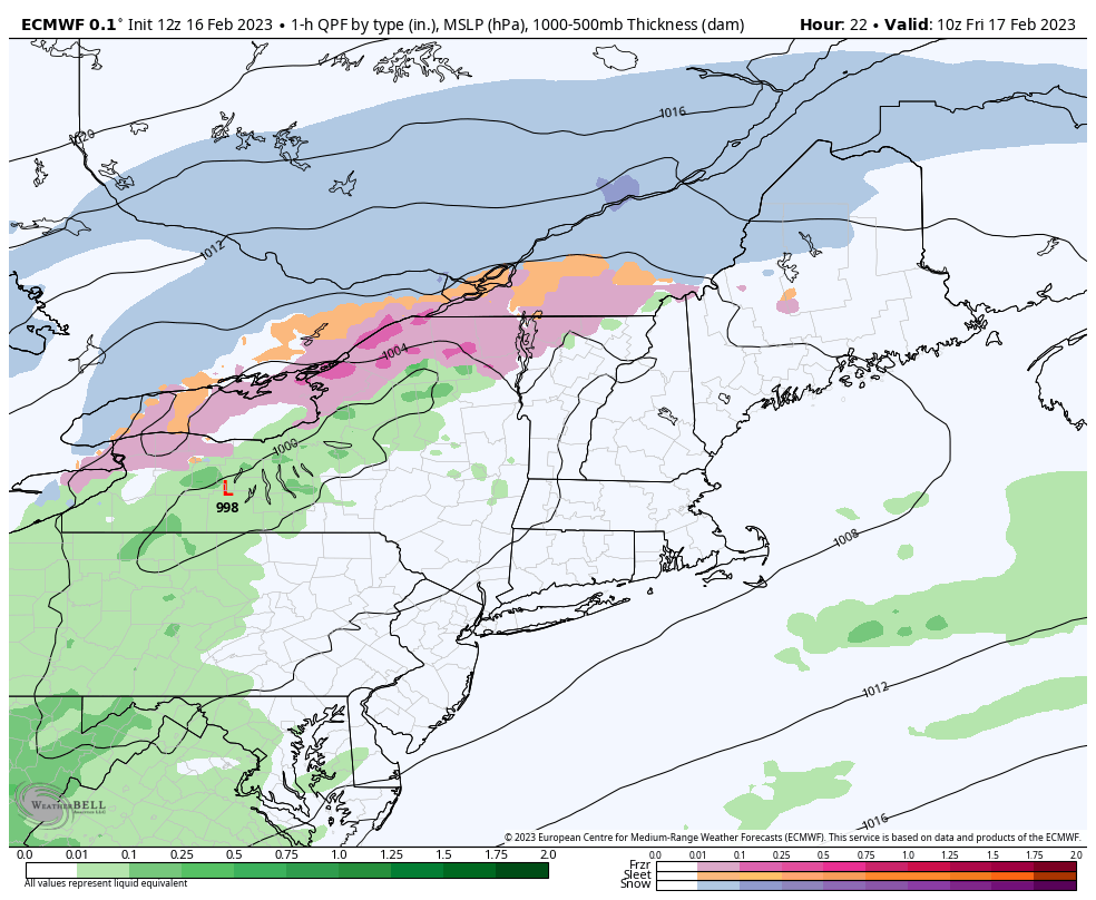
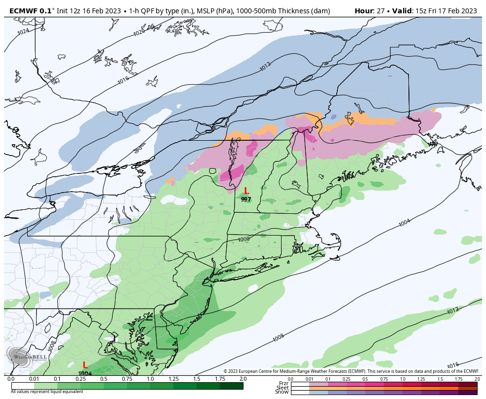
TOMORROW: Gray. Periods of freezing rain with light ice accretion northern and western Vermont. Rain showers eventually mixing with a wintry mix in the afternoon central and southern areas. Blustery. A morning high 30 to 35. Light northwest winds increasing to 10 to occasionally 20 mph & gusty in the afternoon.
FRIDAY NIGHT: Evening clouds with a few leftover flurries.Becoming mostly clear and frigid.A low zero to 10 above. Northwest winds 10 to 20 mph lowering wind chills in the evening falling off overnight.
SATURDAY: Periods of sunshine mixing with more clouds in the afternoon. A high 30 to 32. Light southwest winds.
Looking further ahead
SATURDAY NIGHT: Partly to mostly cloudy.A low 20 to 25
SUNDAY: Filtered sunshine clouding up in the afternoon. Warmer. A high 40 to 45.
MONDAY: Mostly cloudy. Scattered rain showers mixing with wet snow high terrain with minor accumulation. A low ranging upper 20s to mid-30s. A high 40 to 45.
Average lows upper digits to mid-teens. Average highs upper 20s to mid-30s.
Climatological winter ends March 9th… Vernal equinox March 20th as we start spring
RH/2-15forecast][end]