
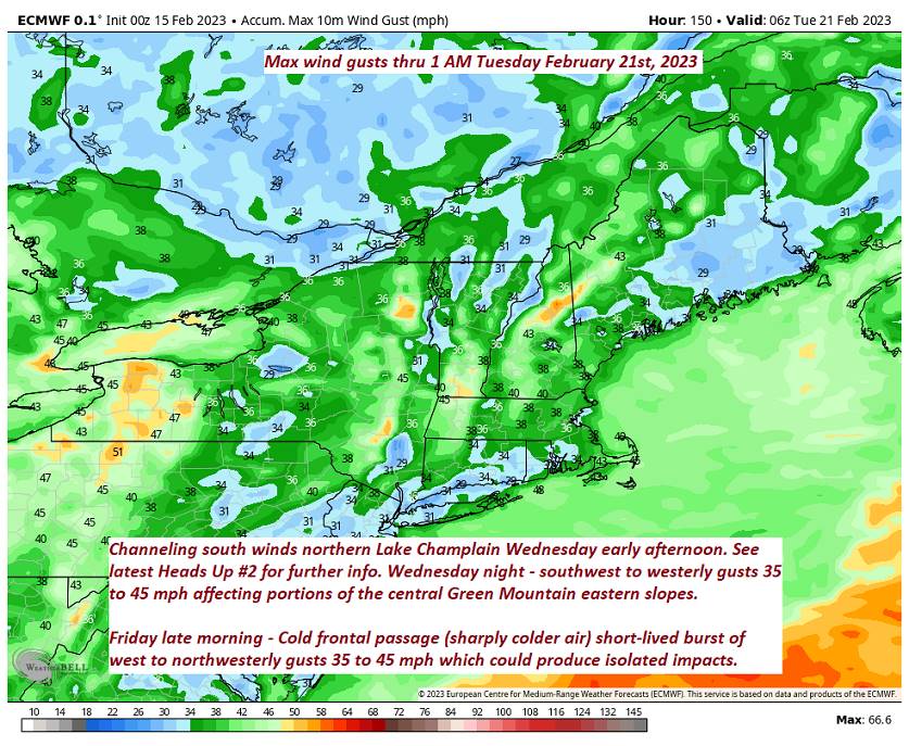
Wind Advisory late this evening thru 7 AM Thursday eastern slopes central & southern Green Mountains…
TONIGHT: Partly cloudy. Isolated sprinkles northern areas. Mild.A low in the mid to upper 30s. Southwest winds 10 to 20 mph shifting to westerly overnight with higher localized gusts central & southern Green Mountain eastern slopes.
TOMORROW: Mixed sun and clouds and mild. Chance for rain showers far south toward dark. A high in the mid-40s. Light west to southwest winds.
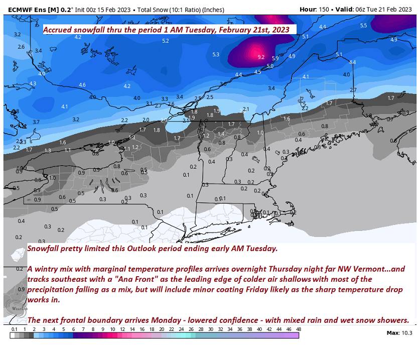
THURSDAY NIGHT: Cloudy. Rain showers southern areas, a wintry mix developing overnight with spotty freezing rain/sleet promoting slick travel far northern areas. A low 30 to 35. Light southeast winds.
FRIDAY: Gray with a wintry mix and slick travel developing…tapering to flurries. Minor accumulation. Somebreaks of afternoon sun, Blustery. An early high around 32 degrees then falling through the 20s and blustery. Northwest winds 10 to occasionally 20 mph & gusty.
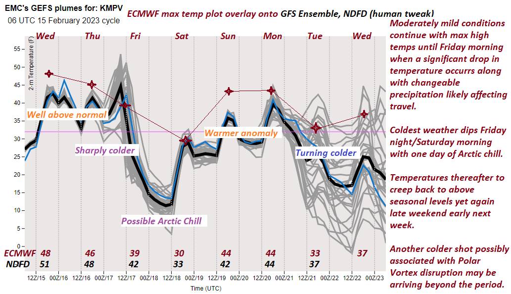
Looking further ahead
FRIDAY NIGHT: Becoming mostly clear and frigid.A low 5 below to 10 above.
SATURDAY: Filtered sunshine thru high clouds. A high around 32.
SUNDAY: Filtered sunshine then cloudy in the afternoon. Warmer. A low upper teens to mid-20s. A high near 45.
Average lows upper digits to mid-teens. Average highs upper 20s to mid-30s.
Climatological winter ends March 9th… Vernal equinox March 20th as we start spring
RH/2-15forecast][end]
