Updated Thursday Evening Forecast — November 19th, 2020

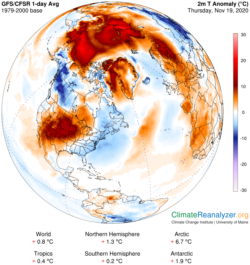
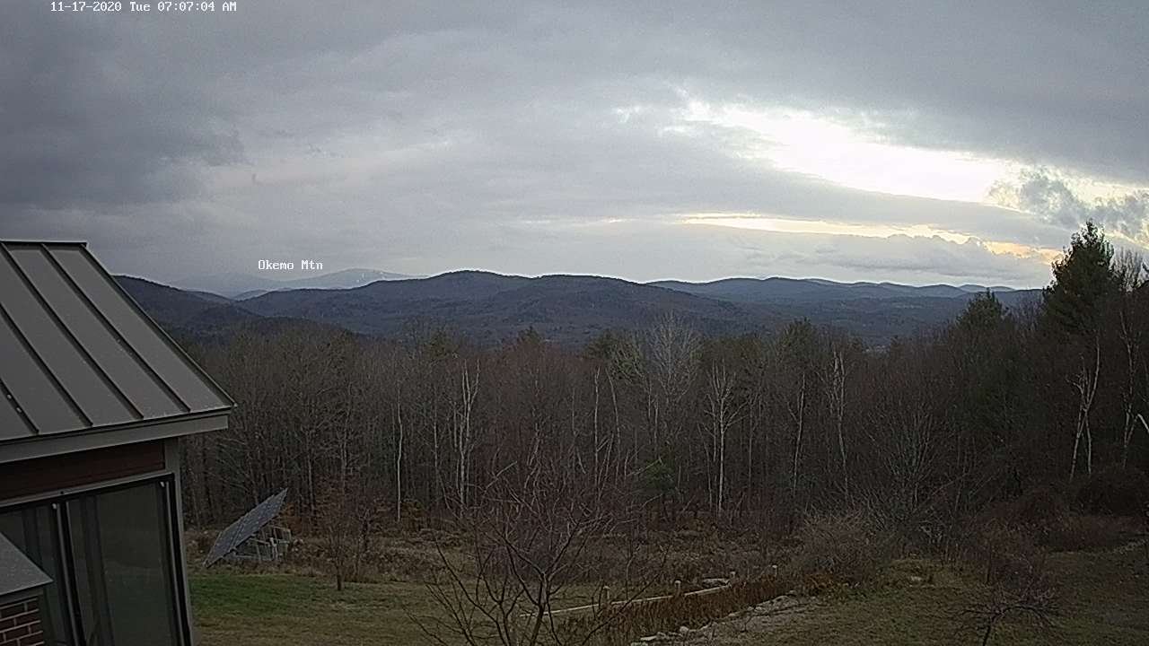
TONIGHT: Considerable high cloudiness. Temperatures holding around the mid-30s. South winds 10 mph.

TOMORROW: High cloudiness gives way lots of afternoon sunshine. Warmer. A high 50 to 55. South to southwest winds 10 to 15 mph.

FRIDAY NIGHT: Partly cloudy early then clouding up. Isolated sprinkles or flurries northern areas. A low in the mid-30s. Southwest winds 10 mph.

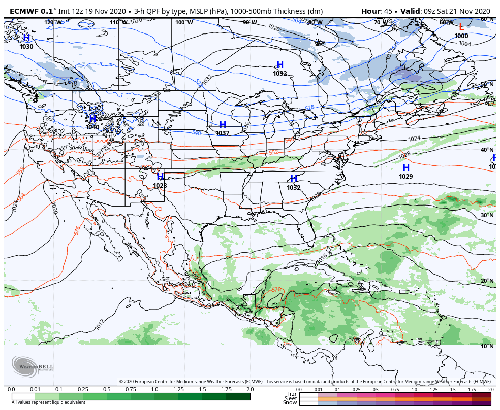
SATURDAY: Isolated sprinkles or flurries northern areas in the morning, otherwise considerable mainly high cloudiness. A high around 45. Light northwest winds.

Looking further ahead…

SATURDAY NIGHT: Partly cloudy. A low around 25.

SUNDAY: Morning sun then increasing clouds. A high in the mid to upper 30s.

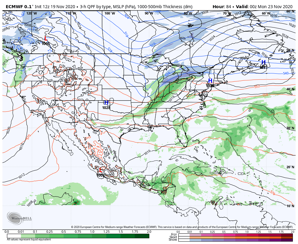
MONDAY: Cloudy. Chance for rain mixed with some snow accumulation higher terrain. A low around 32. A high 40 to 45.

TUESDAY: Morning clouds then increasing sunshine & colder. A low in the 20s. A high in the mid-30s.

Average low mid to upper 20s, Average highs upper 30s to near 45.

RH/11-19 category forecast][end]

Updated Thursday morning forecast — November 19th, 2020

TODAY: Variable high cloudiness with hints of sun now and then. A little milder. A high in the low 40s. South breeze 10 mph in the afternoon.

TONIGHT: Fair with high cloudiness. Cloudy near the Quebec border with a sprinkle or flurry. A low around 32. South winds 10 mph.

FRIDAY: Mixed clouds and sun. Milder. A high 50 to 55. South to southwest winds 10 to 15 mph.

Looking further ahead…

FRIDAY NIGHT: Partly cloudy. Isolated sprinkles or flurries near the Quebec border. A low 32 to 35.

SATURDAY: High cloudiness with hints of sun. A high around 45.

SUNDAY: Hints of morning sun then cloudy. A low around 25. A high in the mid to upper 30s.

MONDAY: Cloudy. Chance for rain perhaps a mix at onset in the morning. Chance for rain transitioning to periods of accumulating wet snow Monday night. A low around 32. A high 40 to 45.

TUESDAY: Morning clouds then increasing sunshine & colder. A low in the 20s. A high in the mid-30s.

Average low mid to upper 20s, Average highs upper 30s to near 45.

RH/11-19 category forecast][end]

Updated Wednesday Evening Forecast — November 18th, 2020

TONIGHT: Isolated mountain flurries exiting to mostly clear skies. High cloudiness overnight. Cold. A low upper teens to around 20. Light southwest winds.

TOMORROW: Variable high cloudiness with hints of sun now and then. A little milder. A high in the low 40s. South breeze 10 mph in the afternoon.

THURSDAY NIGHT: Fair with high cloudiness. A low around 32. South winds 10 mph.

FRIDAY: Mixed clouds and sun. Milder. A high pushing into the mid-50s. South to southwest winds 10 to 15 mph.

Looking further ahead…

FRIDAY NIGHT: Partly cloudy. Isolated sprinkles or flurries near the Quebec border. A low 32 to 35.

SATURDAY: High cloudiness with hints of sun. A high around 45.

SUNDAY: Hints of morning sun then cloudy. A low around 25. A high

35 to 40.

MONDAY: Cloudy. Chance for rain perhaps a mix at onset in the morning. A low around 32. A high 40 to 45.

Average low mid to upper 20s, Average highs upper 30s to near 45.

RH/11-18 category forecast][end]

Updated Wednesday Morning Forecast — November 18th, 2020

TODAY: Occasional flurries…drying up toward mid-day. Some partial afternoon sunshine but cold. A high upper 20s to near 30 or about 10 to 15 degrees below normal. Northwest winds 10 to 20 mph.

TONIGHT: Mostly clear this evening, high cloudiness overnight. Cold. A low upper teens to around 20. Light southwest winds.

THURSDAY: Filtered sunshine with high cloudiness. A little milder. A high in the upper 30s to near 40. South breeze 10 to 15 mph in the afternoon.

Looking further ahead…

THURSDAY NIGHT: Fair with high cloudiness. A low 32 to 35.

FRIDAY: Mixed clouds and sun. Milder. A high pushing into the mid-50s.

SATURDAY: High cloudiness with hints of sun. A low 32 to 35. A high around 45.

SUNDAY: Hints of morning sun then cloudy. Slight chance for a sprinkle/flurry near the Quebec border. A low 25 to 30. A high 35 to 40.

MONDAY: Cloudy. Chance for rain or snow showers. A low 30 to 35. A high 40 to 45.

Average low mid to upper 20s, Average highs upper 30s to near 45.

RH/11-18 category forecast][end]

Updated Tuesday Evening Forecast — November 17th, 2020

TONIGHT: Lots of clouds. An occasional flurry or mountain snow shower. Dusting to an inch making for slick travel near the mountains. A low upper teens to lower 20s. Northwest winds 10 mph.

TOMORROW: A few more flurries in the morning. Some partial late day sunshine but cold. A high upper 20s to near 30. Northwest winds 10 to 20 mph.

WEDNESDAY NIGHT: Mostly clear in the evening then more clouds overnight. Cold. A low around 20. Light southwest winds.

THURSDAY: Filtered sunshine with high cloudiness. A little milder. A high around 40. South breeze 10 to 15 mph in the afternoon.

Looking further ahead…

THURSDAY NIGHT: Fair with high cloudiness. A low 32 to 35.

FRIDAY: Mixed clouds and sun. Milder. A high pushing to near 55.

SATURDAY: High cloudiness with hints of sun. A low around 35. A high 45 to 50.

SUNDAY: More clouds than sun. Slight chance for a rain shower mixed with wet snowflakes. A low near 30. A high 35 to 40.

Average low mid-20s to around 30, Average highs in the low to mid 40s

RH/11-17 category forecast][end]

Updated Tuesday Morning Forecast — November 17th, 2020

TODAY: More clouds than sun. Scattered snow showers or flurries. A skiff of snow especially higher terrain. Watch for slick spots this morning. A high near 35. Northwest winds 10 to 20 mph.

TONIGHT: Mostly cloudy. An occasional flurry. Light coatings down to valley floors making for slick travel. A low 20 to 25. Northwest winds 10 mph.

WEDNESDAY: Widely scattered morning flurries, giving way to partial late day clearing. Well below normal. A high upper 20s to near 30. Northwest winds 10 to 25 mph.

Looking further ahead…

WEDNESDAY NIGHT: Mostly clear with few high clouds overnight. Cold. A low upper teens to low 20s.

THURSDAY: More clouds than sun. A little milder. A high upper 30s to near 40.

FRIDAY: Mixed clouds and sun. A low around 32. Milder. A high 50 to 55.

SATURDAY: Mixed clouds and sun. A low around 32 degrees. A high in the mid-40s.

SUNDAY: Variable cloudiness. Slight chance for a rain shower mixed with wet snowflakes. A low 25 to 30. A high upper 30s to around 40.

Average low mid-20s to around 30, Average highs in the low to mid 40s

RH/11-17 category forecast][end]

Updated Monday Evening Forecast — November 16th, 2020

TONIGHT: Scattered rain & snow showers mainly northern areas. A dusting to an inch especially near the northern Greens with slippery spots. Otherwise mostly cloudy. A low 25 to 30. Southwest winds 10 mph.

TOMORROW: More clouds than sun. Scattered snow showers or flurries. Dusting to an inch, northern higher terrain & slick travel, mainly in the morning. A high in the middle-30s. Northwest winds 10 to 15 mph.

TUESDAY NIGHT: Mostly cloudy. An occasional flurry. Light coatings down to valley floors making for slick travel. A low 20 to 25. Northwest winds 10 mph.

WEDNESDAY: Lots of clouds with widely scattered morning flurries, giving way to partial late day clearing. Well below normal. A high in the mid to upper 20s. Northwest winds 10 to 25 mph.

Looking further ahead…

WEDNESDAY NIGHT: Mostly clear with few high clouds overnight. Cold. A low 15 to 20.

THURSDAY: Partly to mostly cloudy & cold. A high 35 to 40.

FRIDAY: Mostly cloudy. A low around 30. A high near 50.

SATURDAY: Mixed clouds and sun. A low around 32 degrees. A high in the 40s.

Average low mid-20s to around 30, Average highs in the low to mid 40s

RH/11-16 category forecast][end]

Updated Monday Morning Forecast — November 16th, 2020

TODAY: Mostly cloudy & blustery. Scattered rain showers occasionally mixed with wet snowflakes Barre-Montpelier area north. A high 40 to 45. West to southwest winds 10 to 25 mph.

TONIGHT: Scattered rain & snow showers mainly northern areas some minor accumulation higher terrain with possible slippery spots. Otherwise mostly cloudy. A low upper 20s to around 30. Southwest winds 10 mph.

TUESDAY: Mostly cloudy. Scattered snow showers or flurries. Dusting to an inch, northern higher terrain & possible slick travel in the morning. A high in the mid-30s. West to northwest winds 10 mph.

Looking further ahead…

TUESDAY NIGHT: Considerable cloudiness. A low 20 to 25.

WEDNESDAY: Lots of clouds, giving way to partial late day clearing. Well below normal with a high in the mid to upper 20s.

THURSDAY: Partly to mostly cloudy & cold. A low mid-teens to near 20. A high upper 30s.

FRIDAY: Mostly cloudy. A low around 32. A high pushing to near 50.

Average low mid 20s to around 30, Average highs in the low to mid 40s

RH/11-16 category forecast][end]

Updated Friday Evening Forecast — November 13th, 2020

TONIGHT: Periods of drizzle or misty rain showers early, mixed with wet snow flakes across the Northeast Kingdom. Clouds giving way partial clearing. A low in the low 30s. Light southwest winds.

TOMORROW: Clouds, a bit blustery and chilly. A few sprinkles, mixed with wet snow…north of the Barre-Montpelier area. A high in the upper 30s. West to northwest winds 10 to occasionally 20 mph.

SATURDAY NIGHT: Becoming mostly clear & cold. A low in the low to mid 20s. Little wind.

SUNDAY: Filtered morning sun then clouding up. Rain…becoming likely toward mid-afternoon with a risk of wet snow in the highest terrain Northeast Kingdom. Blustery to windy. A late day high near 40. Southeast winds increasing to 10 to 25 mph with locally higher gusts.

Looking further ahead…

SUNDAY NIGHT: Periods of evening rain, with spotty mixed precipitation or wet snow Northeast Kingdom…tapering to widely scattered rain or snow showers later on with partial clearing. A low around 35.

MONDAY: Partly to mostly cloudy. Scattered rain or snow showers. A high in the low 40s.

TUESDAY: Mostly cloudy. Scattered snow showers or flurries. Possible accumulation in the hills. A low 25 to 30, highs in the upper 30s.

WEDNESDAY: Partly to mostly cloudy. A low around 20. A high around 30.

Average low ranging mid-20s to low-30s, Average highs mid to upper 40s.

RH/11-13 category forecast][end]

Updated Friday Morning Forecast — November 13th, 2020

TODAY: Cloudy. A few sprinkles Windsor County south this afternoon and northern tier late with wet snowflakes, driest central areas. A high in the low 40s. Southeasterly winds 10 mph.

TONIGHT: Isolated northern sprinkles, wet snowflakes mainly in the evening. Otherwise mostly cloudy. A low 32 to 35. Light west winds.

SATURDAY: More clouds than sun, Blustery and cold. Scattered sprinkles, mixed with wet snowflakes north of the Barre-Montpelier area. A high near in the upper 30s to near 40. Northwest winds 10 to 20 mph.

Looking further ahead…

SATURDAY NIGHT: Becoming mostly clear & cold. A late evening low around 25.

SUNDAY: Filtered morning sun then clouding up. Rain…becoming likely toward mid-afternoon with a risk of wet snow in the highest terrain Northeast Kingdom. A late day high near 40.

MONDAY: Partly to mostly cloudy. Unsettled. Scattered sprinkles…maybe some wet snow flakes in the hills especially northern areas. A low around 35. A high 40 to 45.

TUESDAY: Chance for snow showers and coatings of wet snow mainly in the hills. Mostly cloudy. A low in the mid-20s, highs in the mid to upper 30s.

Average low ranging mid-20s to low-30s, Average highs mid to upper 40s.

RH/11-13 category forecast][end]