
TODAY: More clouds than sun. Scattered snow showers or flurries. A skiff of snow especially higher terrain. Watch for slick spots this morning. A high near 35. Northwest winds 10 to 20 mph.
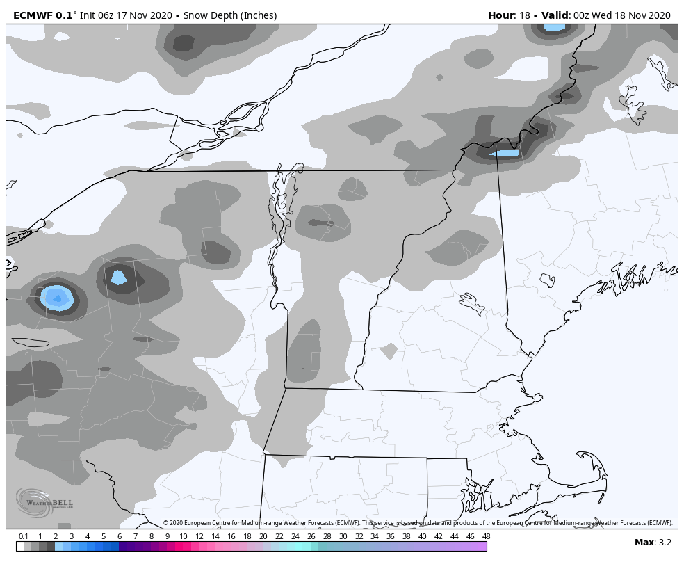
TONIGHT: Mostly cloudy. An occasional flurry. Light coatings down to valley floors making for slick travel. A low 20 to 25. Northwest winds 10 mph.
WEDNESDAY: Widely scattered morning flurries, giving way to partial late day clearing. Well below normal. A high upper 20s to near 30. Northwest winds 10 to 25 mph.
Looking further ahead…
WEDNESDAY NIGHT: Mostly clear with few high clouds overnight. Cold. A low upper teens to low 20s.
THURSDAY: More clouds than sun. A little milder. A high upper 30s to near 40.
FRIDAY: Mixed clouds and sun. A low around 32. Milder. A high 50 to 55.
SATURDAY: Mixed clouds and sun. A low around 32 degrees. A high in the mid-40s.
SUNDAY: Variable cloudiness. Slight chance for a rain shower mixed with wet snowflakes. A low 25 to 30. A high upper 30s to around 40.
Average low mid-20s to around 30, Average highs in the low to mid 40s
RH/11-17 category forecast][end]
