
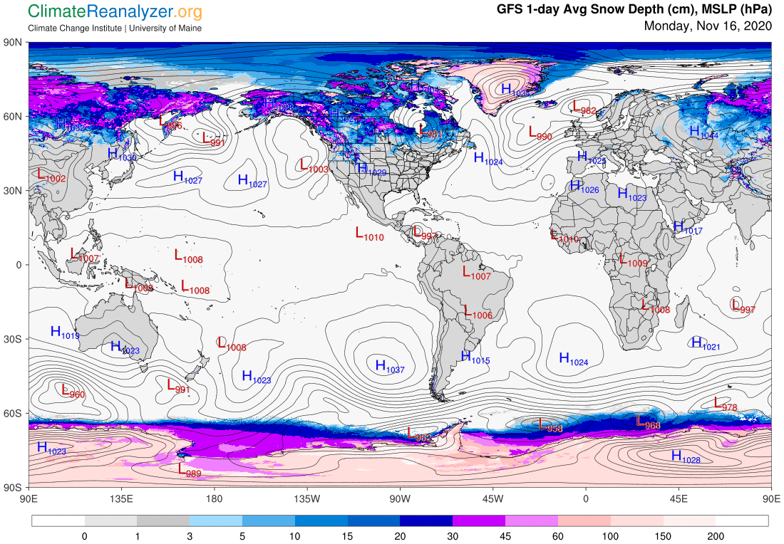
TONIGHT: Scattered rain & snow showers mainly northern areas. A dusting to an inch especially near the northern Greens with slippery spots. Otherwise mostly cloudy. A low 25 to 30. Southwest winds 10 mph.
TOMORROW: More clouds than sun. Scattered snow showers or flurries. Dusting to an inch, northern higher terrain & slick travel, mainly in the morning. A high in the middle-30s. Northwest winds 10 to 15 mph.
TUESDAY NIGHT: Mostly cloudy. An occasional flurry. Light coatings down to valley floors making for slick travel. A low 20 to 25. Northwest winds 10 mph.
WEDNESDAY: Lots of clouds with widely scattered morning flurries, giving way to partial late day clearing. Well below normal. A high in the mid to upper 20s. Northwest winds 10 to 25 mph.
Looking further ahead…
WEDNESDAY NIGHT: Mostly clear with few high clouds overnight. Cold. A low 15 to 20.
THURSDAY: Partly to mostly cloudy & cold. A high 35 to 40.
FRIDAY: Mostly cloudy. A low around 30. A high near 50.
SATURDAY: Mixed clouds and sun. A low around 32 degrees. A high in the 40s.
Average low mid-20s to around 30, Average highs in the low to mid 40s
RH/11-16 category forecast][end]
