Tuesday morning Forecast — February 1st, 2022

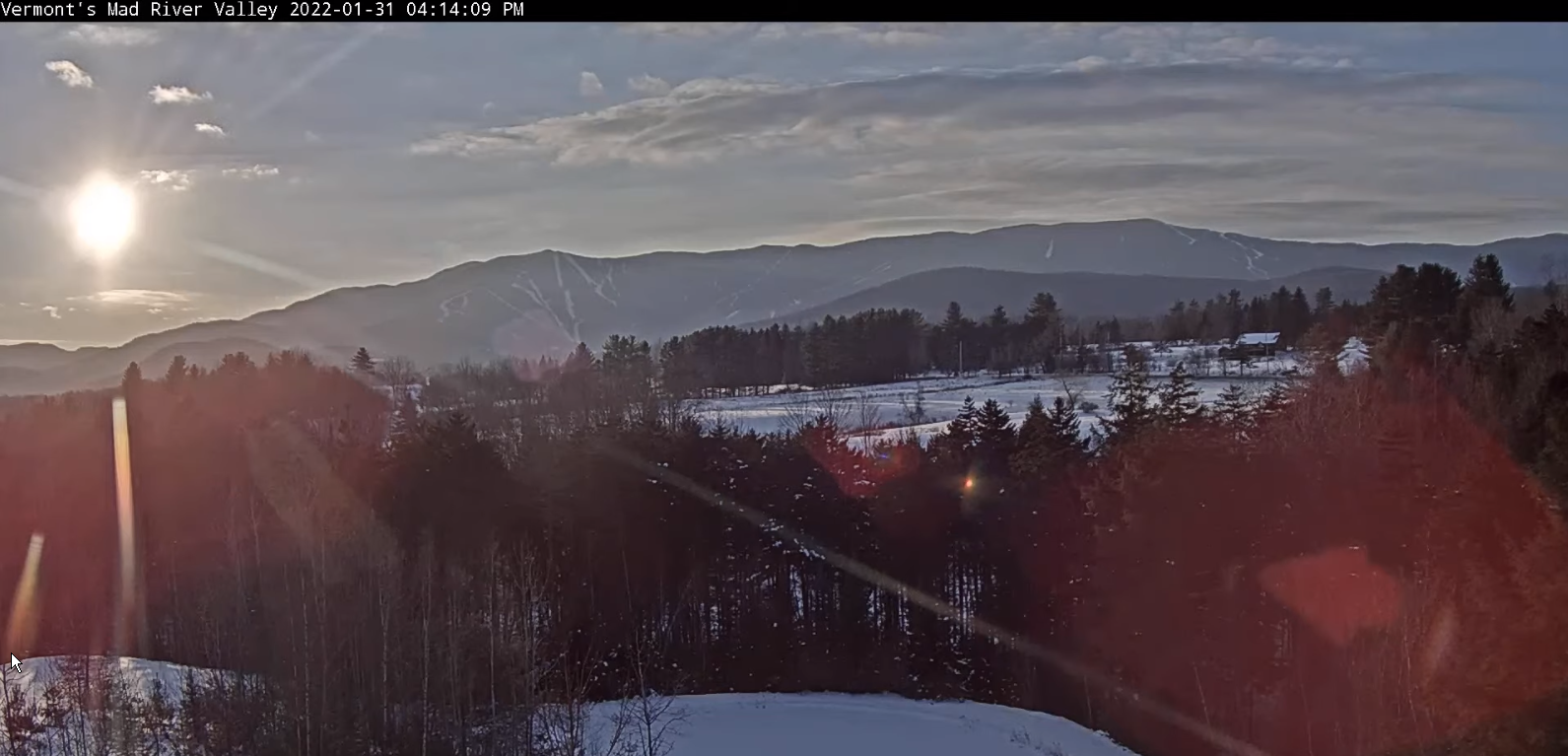
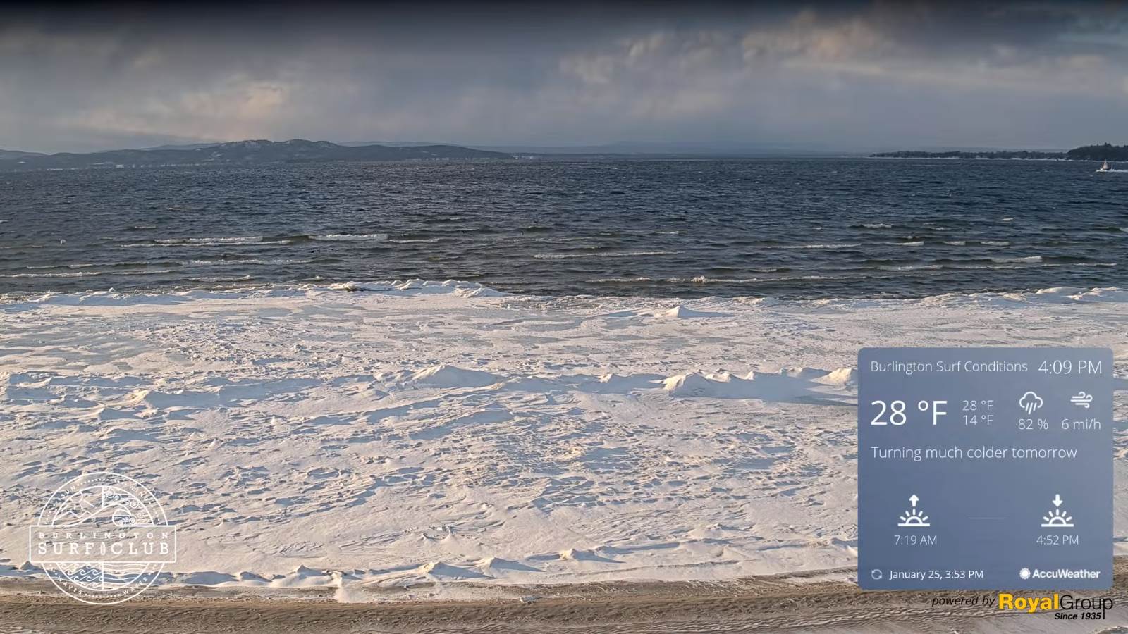
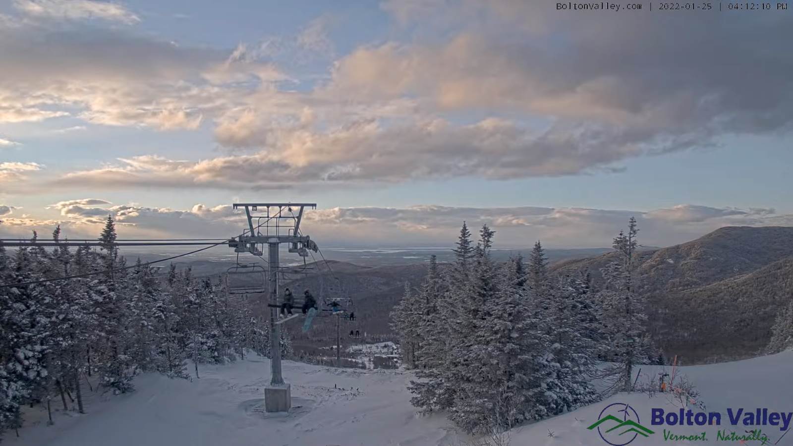
TODAY: Sunshine becoming filtered through high clouds. Clouding up across portions of eastern Vermont. A high in the upper 20s to near 30. Southeast winds 10 to 15 mph stronger near Lake Champlain and gusty.

TONIGHT: Considerable cloudiness. Blustery. A low about 25. South winds 10 to 15 mph stronger across Lake Champlain.

WEDNESDAY: Mainly gray with a hint of sunshine. A high near 40. South winds 10 to 15 mph stronger across Lake Champlain.

Looking further ahead…

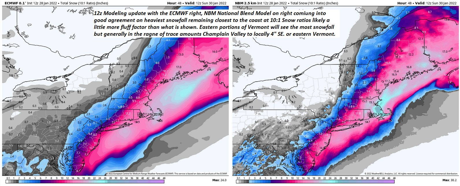
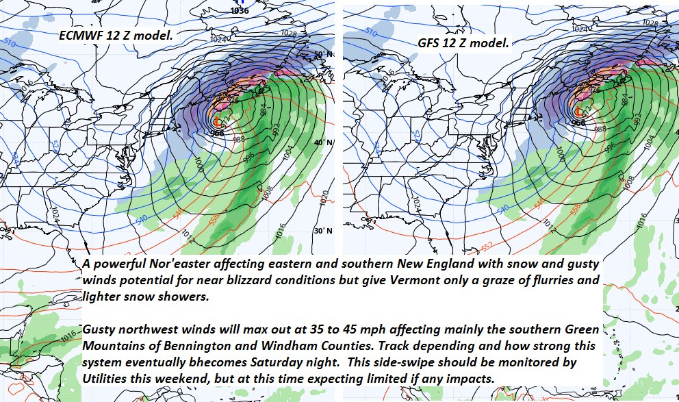
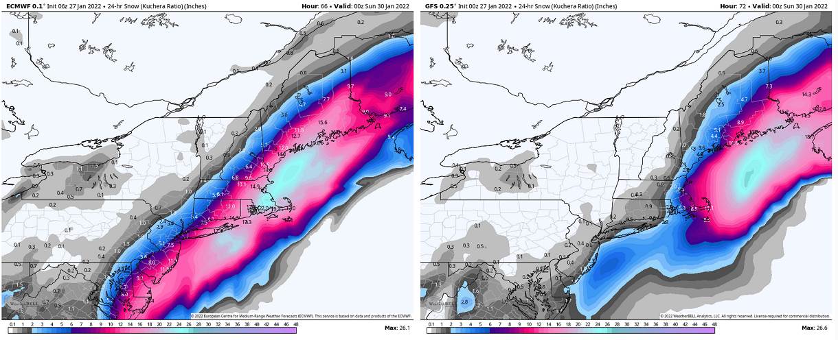
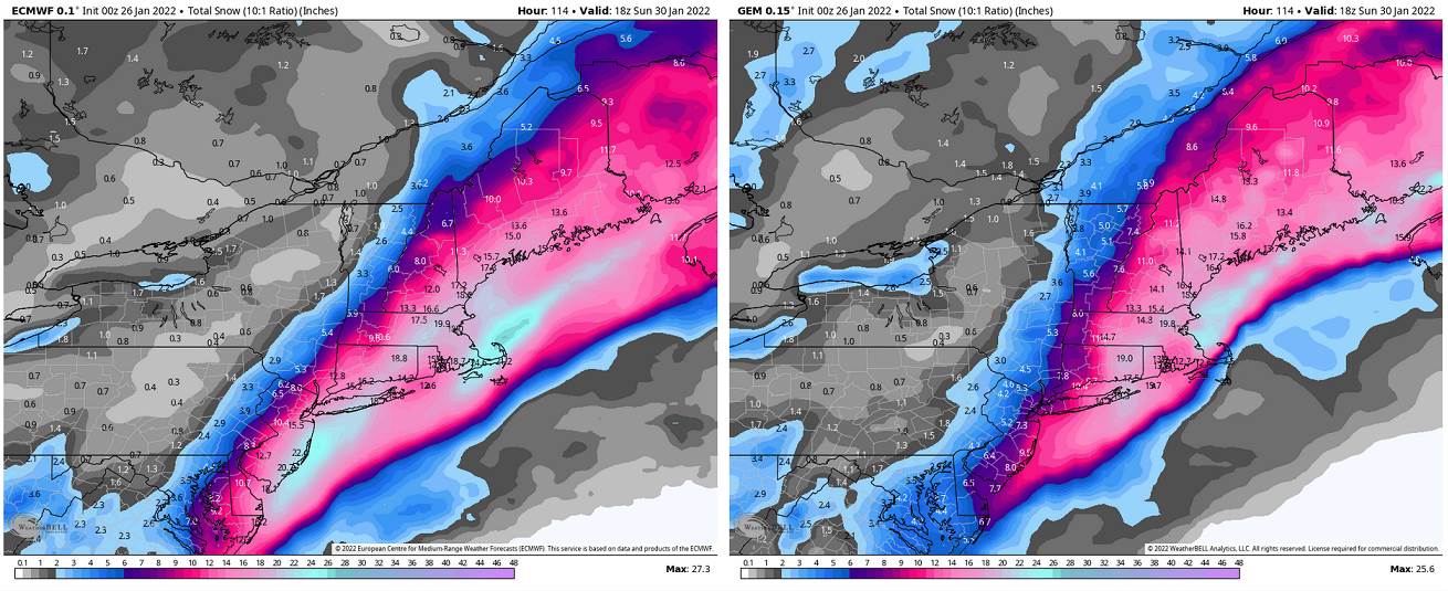
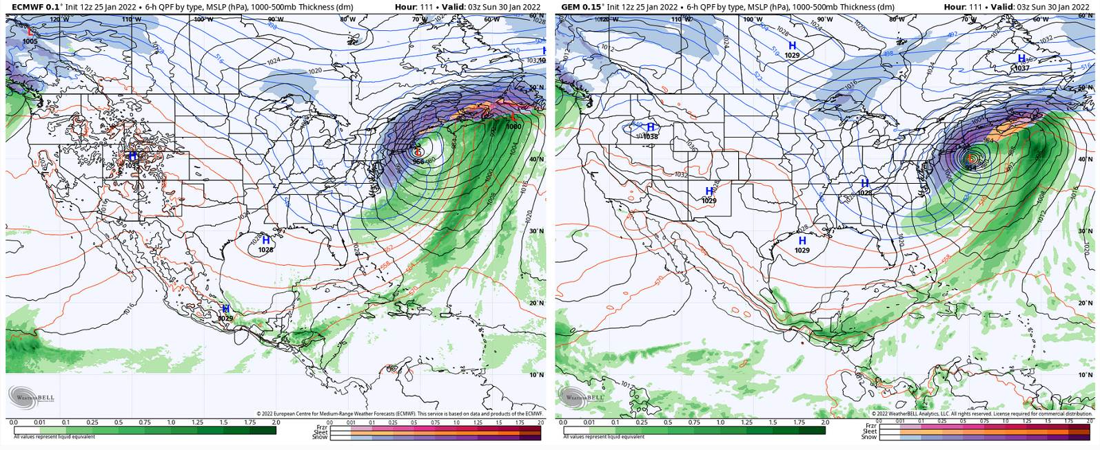
Winter Storm Watch late Wednesday night thru Friday afternoon

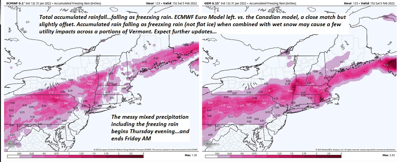
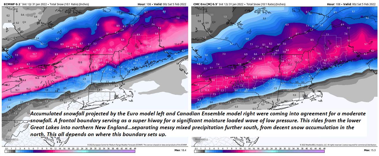
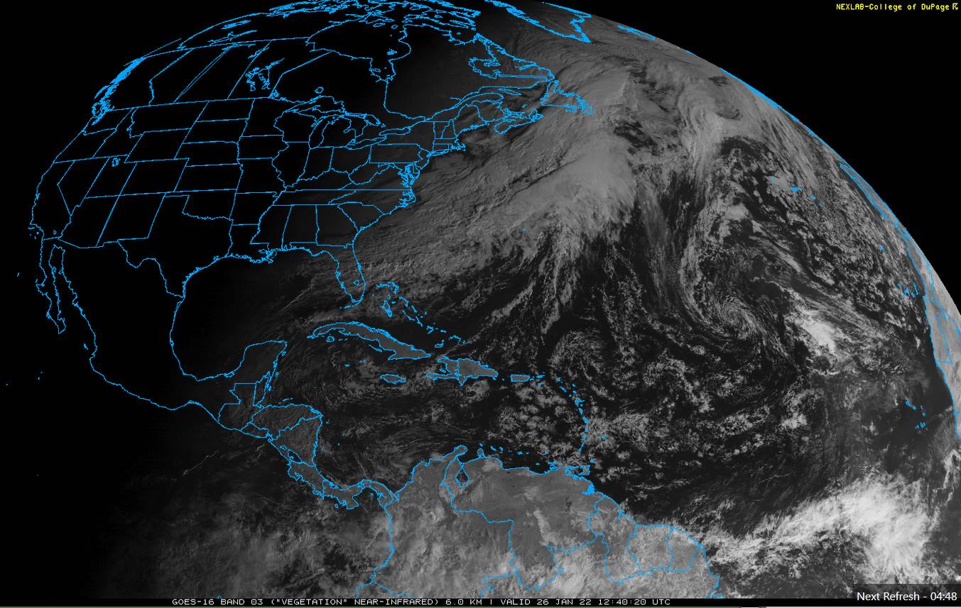
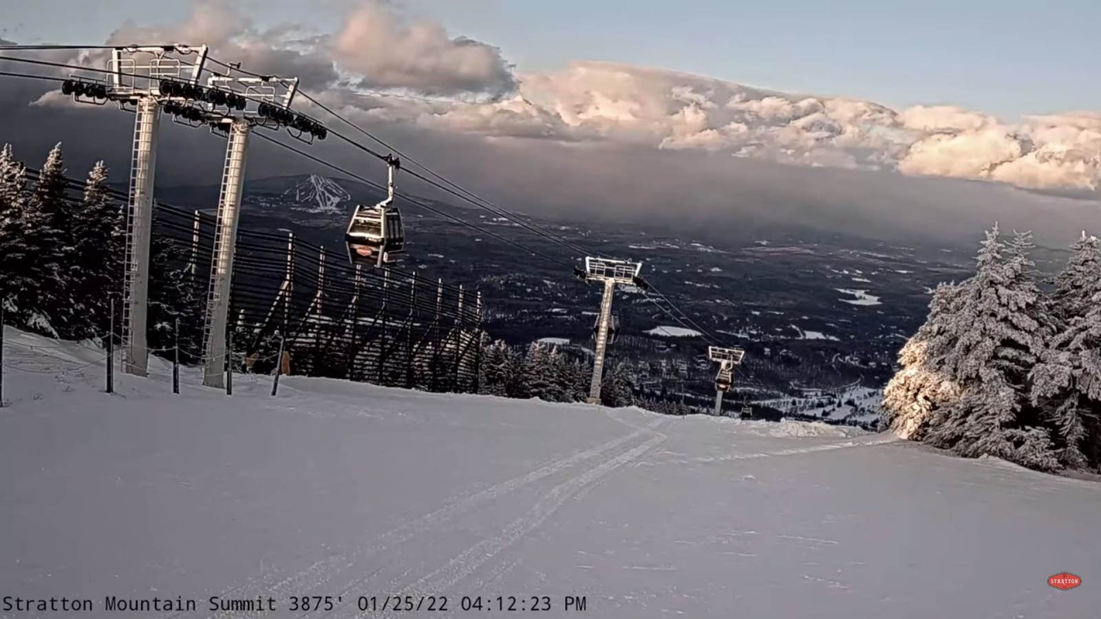
WEDNESDAY NIGHT: Cloudy. Periods of light rain…mixed with wet snow northern areas with a slushy inch higher terrain. A low 32 to 35.

THURSDAY: Gray. Chance for light rain mixing with or changing to wet snow from north to south. Accumulation of 1 to 3 inches, most northern areas. Temperatures holding about 32 to 35 degrees.

FRIDAY: Cloudy. Chance for snow central and northern areas…possibly moderate to heavy at times…with messy sleet and freezing rain/glazing…causing hazardous travel southern Vermont. Temperatures in the upper teens falling gradually thru the day.

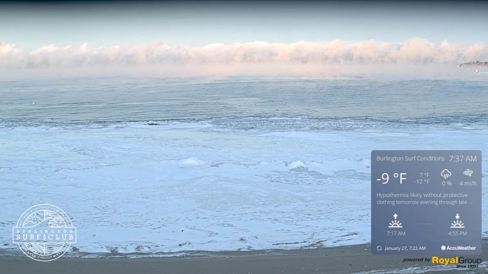
SATURDAY: A few clouds early, then increasing sunshine, but cold. A low around zero degrees. A high near 10 above.

SUNDAY: Bright sunshine and blue skies after few morning clouds. Frigid. A low 5 to 15 below. A high 15 to 20.

Average lows single digits to low teens. Average highs ranging mid-20s to low 30s.

End of Met. Winter March 9th

RH/2-1 forecast][end]

Updated Monday Evening Forecast — January 31st, 2022

TONIGHT: Cloudy periods this evening northern areas, otherwise mostly clear. A low minus 5 to around 5 above. Winds becoming light southeasterly.

TOMORROW: Partly to mostly sunny. A high in the upper 20s to near 30. Southeast winds 10 to 15 mph stronger near Lake Champlain and gusty.

TUESDAY NIGHT: Considerable cloudiness. Blustery. A low about 25. South winds 10 to 15 mph stronger across Lake Champlain.

WEDNESDAY: Mainly gray with a hint of sunshine. A high near 40. South winds 10 to 15 mph stronger across Lake Champlain.

Looking further ahead…

WEDNESDAY NIGHT: Cloudy. Good chance for rain or wet snow developing…generally light if any accumulation. A low 32 to 35.

THURSDAY: Gray. Chance for light accumulating “wet snow” mixed with rain south of the Barre-Montpelier area. Temperatures holding about 32 to 35 degrees.

FRIDAY: Cloudy. Chance for snow central and northern areas…possibly moderate to heavy at times…with messy sleet and freezing rain with glazing…causing hazardous travel southern Vermont. Temperatures in the upper teens falling gradually thru the day.

SATURDAY: A few clouds early then increasing sunshine. A low zero to 10 below. A high around 10 above.

Average lows single digits to low teens. Average highs ranging mid-20s to low 30s.

End of Met. Winter March 9th

RH/1-31 forecast][end]

Updated Monday Morning Forecast — January 31st, 2022

TODAY: Partly to mostly sunny with more clouds toward the Champlain Valley. Start of warming trend. A high 20 to 25. Light southwest winds.

TONIGHT: Mostly clear. A low minus 5 colder hollows to 10 above. Winds becoming light southeasterly.

TUESDAY: Partly to mostly sunny. A high in the upper 20s to near 30. Southeast winds 10 to 15 mph stronger near Lake Champlain and gusty.

Looking further ahead…

TUESDAY NIGHT: Considerable cloudiness. A low in the mid-20s.

WEDNESDAY: Mainly gray with a hint of sunshine. A high upper 30s to near 40.

THURSDAY: Gray. Chance for accumulating “wet snow” mixed with rain south of the Barre-Montpelier area. A low 32 to 35. Little temperature change. A high in the mid-30s.

FRIDAY: Cloudy. Chance for snow central and northern areas…possibly moderate to heavy at times…with messy sleet and freezing rain causing hazardous travel southern Vermont. Temperatures in the upper teens falling gradually thru the day.

Average lows single digits to low teens. Average highs ranging mid-20s to low 30s.

End of Met. Winter March 9th

RH/1-31 forecast][end]

Updated Friday Evening Forecast — January 28th, 2022

Wind chill Advisory 10 PM tonight into Saturday afternoon for northwestern Vermont…

TONIGHT: Partial clearing northern and western areas, otherwise cloudy. Scattered flurries mainly central and southern areas with a light coating. A low 5 above to 10 below. North winds picking up around 10 mph with dangerous wind chills.

TOMORROW: Gray. Periods of light snow or snow showers…dusting to 3”especially toward New Hampshire. Blustery to windy with lowering wind chills. Deep Freeze. A high 5 to 10 above. North winds 10 to 20 mph with stronger gusts producing some blowing and drifting.

SATURDAY NIGHT: Mainly cloudy. Lingering snow showers or flurries near the Connecticut River with little additional accumulation. otherwise considerable cloudiness. Frigid. A low zero to 10 below with dangerously cold wind chills. Northwest winds 10 to 25 mph.

SUNDAY: Partly to mostly sunny. Still rather cold. A high about 10 to 15. Northwest winds 10 to 15 mph producing cold wind chills.

Looking further ahead…

SUNDAY NIGHT: Scattered clouds. Frigid. A low 5 above to 10 below.

MONDAY: Bright sun and blue skies. Start of significant warming trend. A high 20 to 25.

TUESDAY: Intervals of morning sun, then cloudy. A low in the single digits. A late day high pushing to around 32.

WEDNESDAY: Mainly gray. Chance for wet snow showers mixed with sprinkles valley floors in the afternoon. A low 25 to 30. A high near 40.

Average lows single digits. Average highs ranging low to mid 20s.

End of Met. Winter March 9th

RH/1-28 forecast][end]

Updated Friday Morning Forecast — January 28th, 2022

TODAY: Scattered morning flurries with a dusting in spots, otherwise hints of sun through lots of clouds. A high in the 20s to near 30. Winds becoming northwest 10 mph.

Wind chill Advisory 10 PM tonight thru 1 PM Saturday..

TONIGHT: Considerable high and mid clouds. A low ranging zero to 15 below. Light north winds picking up around 10 mph lowering wind chills.

SATURDAY: Overcast. Occasional light snow or snow showers…dusting to locally 4”with the most far eastern and southern Vermont. Blustery to windy with lowering wind chills. A high 5 to 10 above. North winds 10 to occasionally 20 mph with minor blowing and drifting.

Looking further ahead…

SATURDAY NIGHT: Lingering snow showers or flurries less than an inch accumulation, otherwise considerable cloudiness. A low zero to 10 below with cold wind chills.

SUNDAY: Morning clouds then partly to mostly sunny. A high single digits near Quebec border to around 15…central and southern Vermont.

MONDAY: Bright sun and blue skies. A low 5 to 15 below. Start of significant warming trend. A high 20 to 25.

TUESDAY: Intervals of morning sun, then cloudy. A low in the single digits. A late day high pushing to around 32.

WEDNESDAY: Mainly gray. Chance for wet snow showers mixed with sprinkles valley floors in the afternoon. A low 25 to 30. A high near 40.

Average lows single digits. Average highs ranging low to mid 20s.

End of Met. Winter March 9th

RH/1-27 forecast][end]

Updated Thursday Evening Forecast — January 27th, 2022

TONIGHT: Mainly cloudy. Widely scattered flurries, mainly north of the Barre-Montpelier areas with a dusting developing this evening. A low 10 to 15. South to southwest winds 10 mph stronger near Lake Champlain.

TOMORROW: Scattered morning flurries with a dusting in spots, otherwise hints of sun through lots of clouds. A high mid-teens to mid-20s Barre-Montpelier areas south. Winds becoming northwest 10 mph.

FRIDAY NIGHT: Considerable high and mid clouds. A low ranging 5 above to 10 below. Light north winds.

SATURDAY: Overcast. Good chance for light snow showers or flurries eastern areas…toward New Hampshire with minor accumulation. Blustery to windy with lowering wind chills. A high 5 to 10 above. North winds 10 to 15 mph.

Looking further ahead…

SATURDAY NIGHT: Lingering flurries for a time eastern Vermont exiting, otherwise, fair and cold with considerable high cloudiness. A low zero to 10 below with cold wind chills.

SUNDAY: Morning clouds then partly to mostly sunny. A high single digits near Quebec border to around 15 above…central and southern Vermont.

MONDAY: Partly to mostly sunny. A low 5 to 15 below. Start of significant warming trend. A high 20 to 25.

TUESDAY: Intervals of morning sun, then cloudy. A low in the single digits. A late day high pushing to around 30

WEDNESDAY: Mainly gray. A low 25 to 30. A high around 35.

Average lows single digits. Average highs ranging low to mid 20s.

End of Met. Winter March 9th

RH/1-27 forecast][end]

Updated Thursday Morning Forecast — January 27th, 2022

TODAY: Bitterly cold start…with filtered sunshine thru high cloudiness…thickening up this afternoon. Not so cold with a high in the low 20s. South winds 10 to 15 mph, stronger over Lake Champlain.

TONIGHT: Mainly cloudy. Widely scattered flurries a dusting in spots. A low around 15. Southwest winds 10 mph stronger near Lake Champlain.

FRIDAY: Scattered morning flurries with a dusting in spots, otherwise hints of sun through lots of clouds. A high mid-teens to mid-20s Barre-Montpelier areas south. Winds becoming northwest 10 mph.

Looking further ahead…

FRIDAY NIGHT: Considerable high and mid clouds. A low ranging 5 above to 10 below.

SATURDAY: Overcast. Good chance for light snow showers or flurries eastern areas…toward New Hampshire with minor accumulation. A high 5 to 10 above.

SUNDAY: Morning clouds then partly to mostly sunny. A low 5 above to 5 below. A high single digits far north, to around 10 to 15 above…central and southern Vermont.

MONDAY: Partly to mostly sunny. A low 5 to 15 below. Start of significant warming trend. A high 20 to 25.

TUESDAY: Intervals of morning sun, then cloudy. A low in the single digits. A late day high pushing to around 30

WEDNESDAY: Mainly gray. A low 25 to 30. A high around 40.

Average lows single digits. Average highs ranging low to mid 20s.

End of Met. Winter March 9th

RH/1-27 forecast][end]

Updated Wednesday Night Weather — January, 26th, 2022

TONIGHT: Clear with clouds arriving toward daybreak. Frigid. A low ranging minus 5 to minus 25 coldest hollows. Little wind.

TOMORROW: Frigid start with filtered sunshine thru high clouds…thickening in the afternoon. Not so cold with a high in the low 20s. South winds 10 to 15 mph, stronger over Lake Champlain.

THURSDAY NIGHT: Mainly cloudy. Widely scattered flurries a dusting in spots. A low 10 to 15. Southwest winds 10 mph stronger near Lake Champlain.

FRIDAY: Scattered morning flurries with a dusting in spots, otherwise hints of sun through lots of clouds. A high 15 northern areas to 25 central and southern areas. Winds becoming northwest 10 mph.

Looking further ahead…

FRIDAY NIGHT: Considerable high and mid clouds. A low ranging zero to 10 above.

SATURDAY: Overcast. Chance for light snow or snow showers. Limited accumulation…mainly eastern areas. A high 5 to 15 above.

SUNDAY: Chance for early morning flurries exiting to partial sunshine. A low 5 above to 5 below. A high 10 to 15.

MONDAY: Partly to mostly sunny. A low zero to 10 below. A high near 20.

Average lows single digits. Average highs ranging low to mid 20s.

End of Met. Winter March 9th

RH/1-26 forecast][end]

Updated Wednesday Morning Forecast — January 26th, 2022

TODAY: Sunny, but bitterly cold. A high around zero northern tier, to around 10 above central areas. Light northwest winds lowering wind chills.

TONIGHT: Clear with clouds arriving toward daybreak. Frigid. A low ranging 5 to 25 below coldest northern hollows. Little wind.

THURSDAY: Frigid start with filtered sunshine thru high clouds…thickening in the afternoon. Not so cold with a high in the low 20s. South winds 10 to 15 mph, stronger over Lake Champlain.

Looking further ahead…

THURSDAY NIGHT: Mainly cloudy. Chance for a few flurries. A low 10 to 15.

FRIDAY: Gray skies. Scattered flurries with a dusting in spots. A high in the teen’s northern areas to near 25 central and southern.

SATURDAY: Overcast. A chance for accumulating snow, possibly moderate to significant amounts Saturday night. A low 5 below to 10 above. A high in the teens.

SUNDAY: Chance for leftover snow showers…giving way to periods of afternoon sun. A low 5 above to 5 below. A high 10 to 15.

MONDAY: Mixed sun and clouds. A low 5 below to 5 above. A high 20 to 25.

Average lows single digits. Average highs ranging low to mid 20s.

End of Met. Winter March 9th

RH/1-25 forecast][end]

Updated Tuesday Night Forecast — January 25th, 2022

Wind Chill Advisory Norther Tier and Lamoille Caledonia Counties Midnight thru 9 AM Wednesday morning…

TONIGHT: A few stray flurries, otherwise partly to mostly cloudy. Turning colder. A low 5 above to 10 below. Light northwest winds lowering wind chills.

TOMORROW: A few stray early morning flurries near Lake Champlain, Otherwise lots of mainly afternoon sunshine. Bitterly cold. A high near zero northern tier, to around 5 to 10 above. Light northwest winds lowering wind chills.

WEDNESDAY NIGHT: Clear with clouds arriving toward daybreak. Frigid. A low ranging 10 to 20 below with few minus 20s coldest hollows northern Vermont. Little wind.

THURSDAY: Frigid start with filtered sunshine thru high clouds…thickening in the afternoon. Not so cold with a high mid-teens to low 20s. South winds 10 to 15 mph, stronger over Lake Champlain.

Looking further ahead…

THURSDAY NIGHT: Mainly cloudy. Chance for a few flurries. A low 5 to 15

FRIDAY: Gray skies. Scattered flurries with a dusting in spots. A high around 25.

SATURDAY: Overcast. A chance for accumulating snow, possibly moderate to significant amounts Saturday night. A low zero to 10 above. A high in the teens.

SUNDAY: Chance for leftover snow showers…giving way to periods of afternoon sun. A low near zero. A high in the teens.

Average lows single digits. Average highs ranging low to mid 20s.

End of Met. Winter March 9th

RH/1-25 forecast][end]