
TODAY: Sunny, but bitterly cold. A high around zero northern tier, to around 10 above central areas. Light northwest winds lowering wind chills.
TONIGHT: Clear with clouds arriving toward daybreak. Frigid. A low ranging 5 to 25 below coldest northern hollows. Little wind.
THURSDAY: Frigid start with filtered sunshine thru high clouds…thickening in the afternoon. Not so cold with a high in the low 20s. South winds 10 to 15 mph, stronger over Lake Champlain.
Looking further ahead…
THURSDAY NIGHT: Mainly cloudy. Chance for a few flurries. A low 10 to 15.
FRIDAY: Gray skies. Scattered flurries with a dusting in spots. A high in the teen’s northern areas to near 25 central and southern.
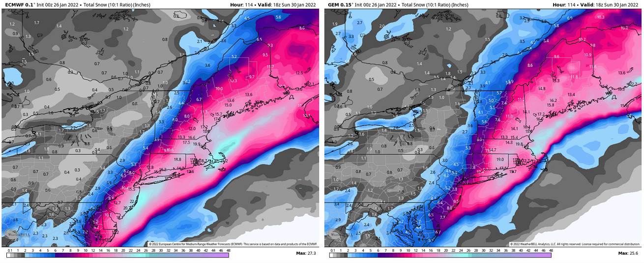
SATURDAY: Overcast. A chance for accumulating snow, possibly moderate to significant amounts Saturday night. A low 5 below to 10 above. A high in the teens.
SUNDAY: Chance for leftover snow showers…giving way to periods of afternoon sun. A low 5 above to 5 below. A high 10 to 15.
MONDAY: Mixed sun and clouds. A low 5 below to 5 above. A high 20 to 25.
Average lows single digits. Average highs ranging low to mid 20s.
End of Met. Winter March 9th
RH/1-25 forecast][end]
