Updated Friday Evening forecast — July 14th, 2023

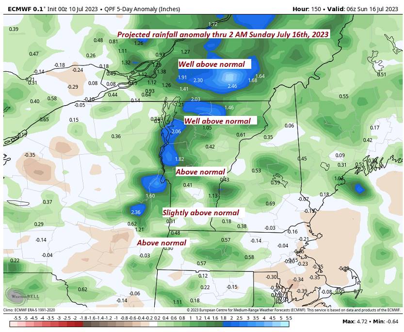
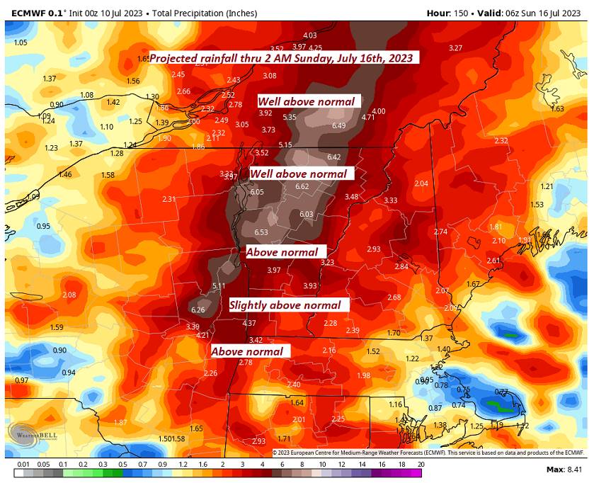
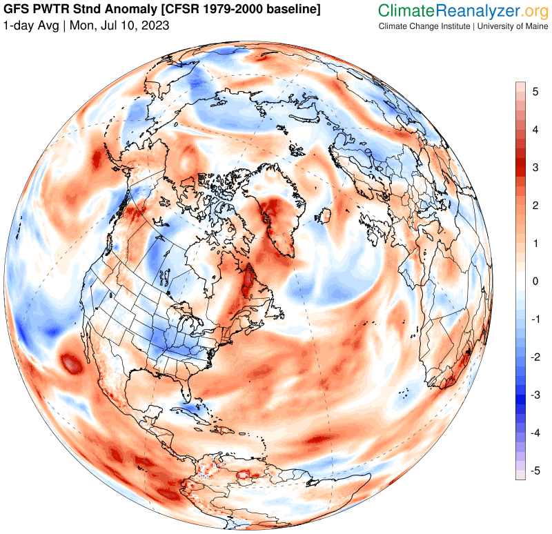
Latest (2023/07/13) 1-day area-weighted 2m temperature anomalies calculated from the NCEP Climate Forecast System (CFS) and CFS Reanalysis (CFSR). The anomaly values fluctuate day-to-day and week-to-week depending on prevailing weather patterns. For context, daily temperatures for the domains below are available via interactive charts for the entire CFS/CFSR 1979–present record. Anomalies are based on 1979–2000 climatology for the specific day of the year.

World Northern Hemisphere Arctic
+ 0.75 °C + 0.8 °C + 0.48 °C
Tropics Southern Hemisphere Antarctic
+ 0.89 °C + 0.69 °C + 1.25 °C

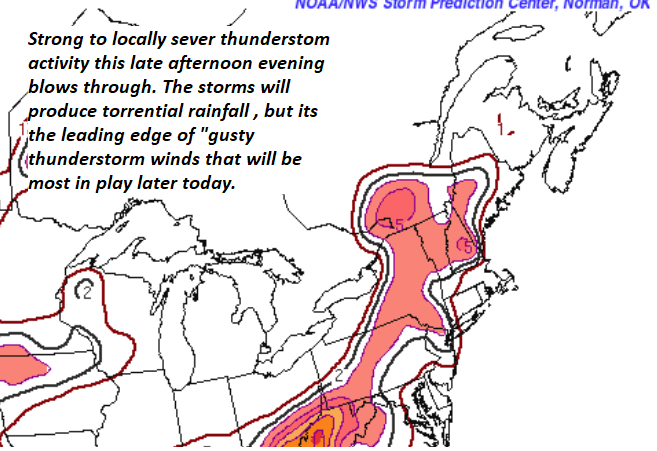
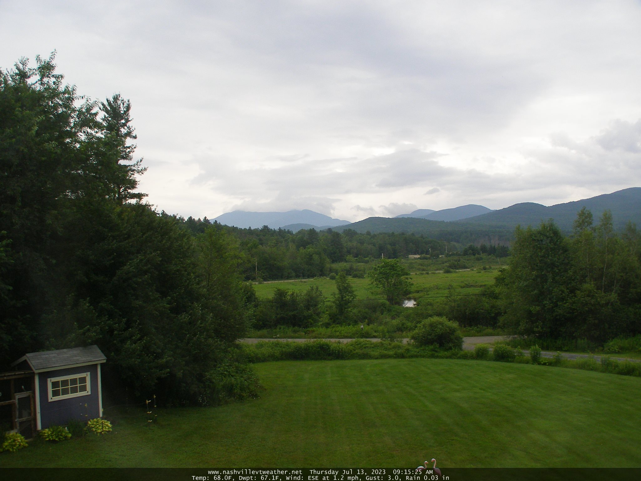
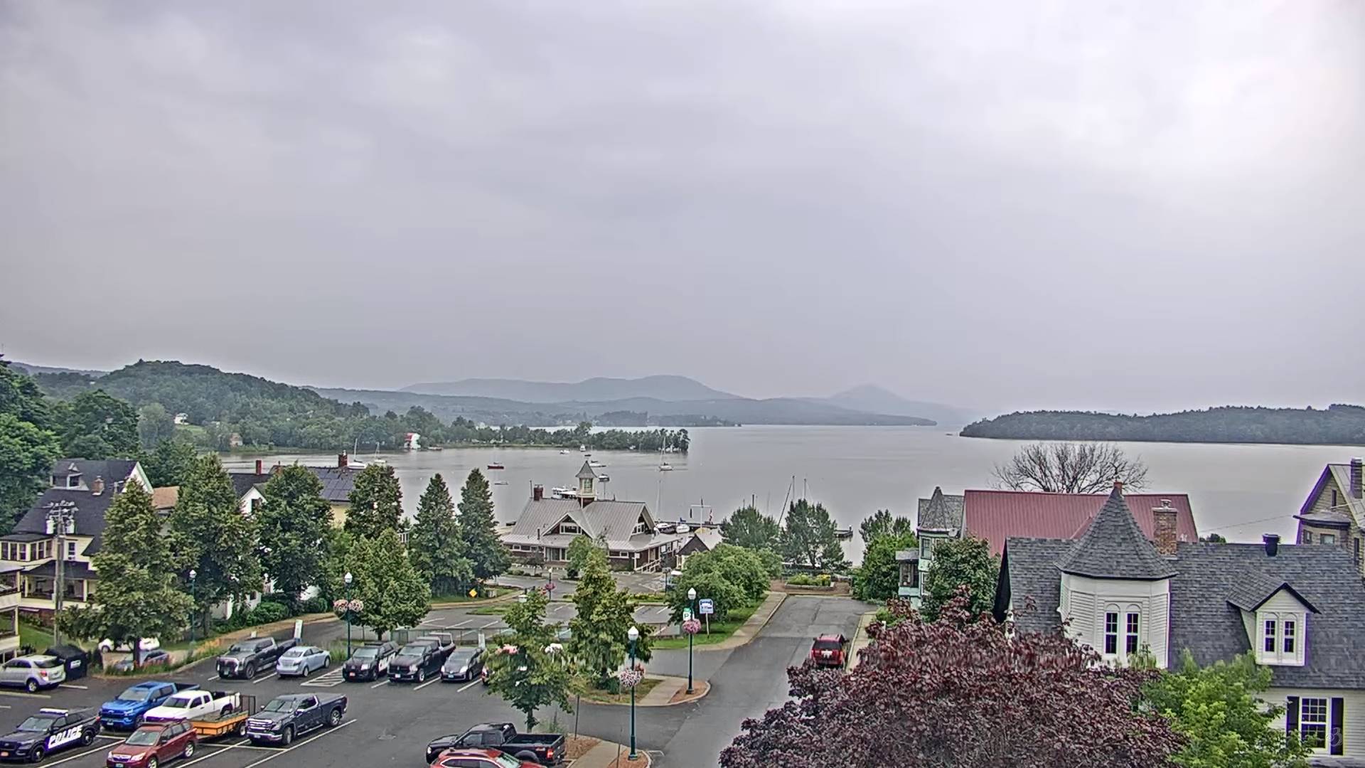
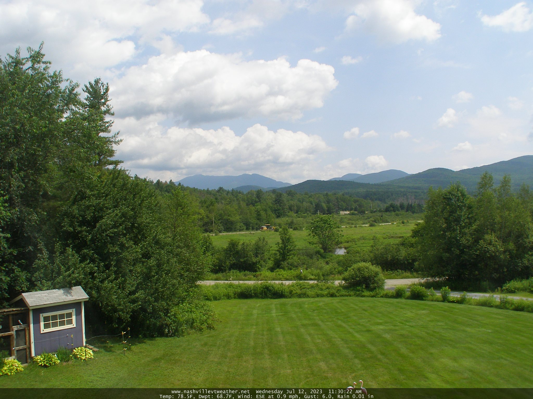
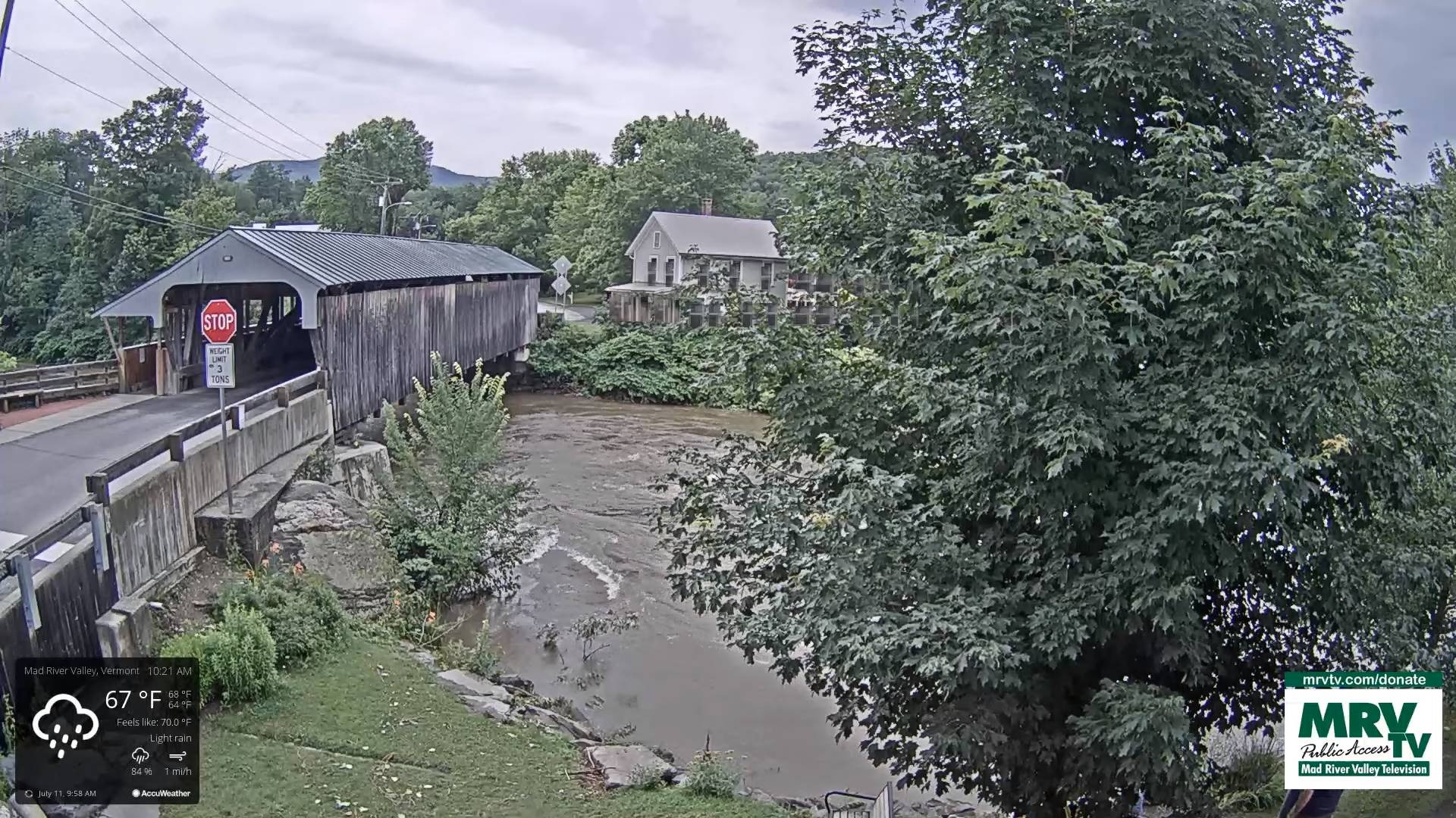
TONIGHT: Widely scattered showers and a possible thunderstorm, to wind down around mid-evening, partial clearing later on gives way to valley fog overnight. A low 60 to 65. Light southeast winds.

TOMORROW: Patchy valley fog, then then sunshine filtered by high clouds. A high lower 80s. Light southwest winds.

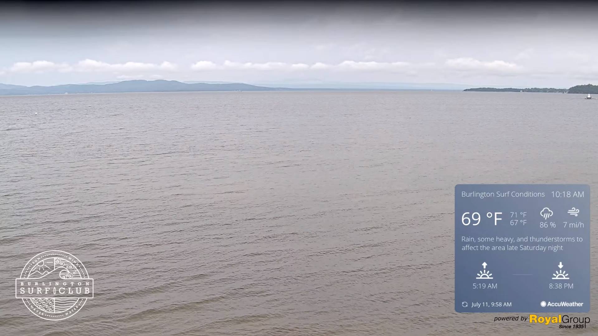
SATURDAY NIGHT: Mostly clear in the evening then clouding up. Muggy.A low mid to upper 60s. Considerable low clouds and areas of fog. Light southeast winds.

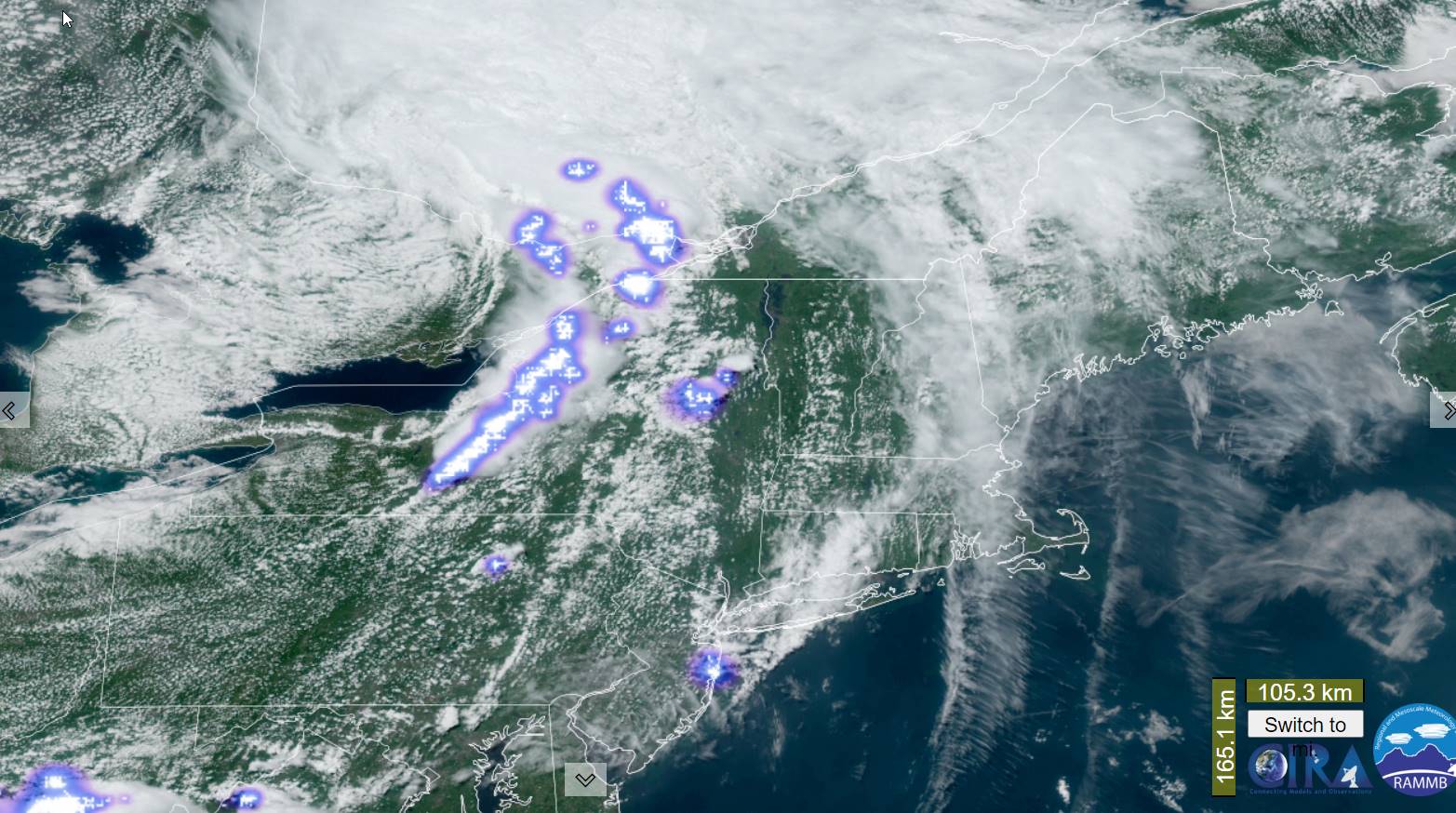
SUNDAY: Mainly cloudy. Showers likely, some moderate to heavy, with isolated rumbles of thunder. A high in the mid to upper 70s. Light southeast breeze.

Looking further ahead

SUNDAY NIGHT: Considerable low clouds and fog. Patchy drizzle. A low in the mid-60s.

MONDAY: Morning fog gradually gives way to mostly sunny skies and pleasant. Slightly less humid. A high in the low 80s.

TUESDAY: Patchy fog burns off to intervals of sunshine then more clouds. Chance for afternoon showers and thunderstorms…some locally heavy. A low upper 50s to near 60. A high mid-70s.

WEDNESDAY: Morning valley fog, burns off to partly to mostly sunny skies. Not so humid and pleasant. A low in the upper 50s to around 60. A high around 75.

Average lows 55 to 60. Average high upper 70s to low 80s.

Summer temps peak July 22nd

RH/7-13 forecast][end]

Updated Friday Morning Weather — July 14th, 2023

TODAY: Morning fog burns off to partial sun. More afternoon clouds with showers and scattered thunderstorms some locally heavy southern and eastern areas spreading north late. A high 75 to 80. Light south winds.

TONIGHT: Partial clearing in the evening, giving way to lots of low clouds and valley fog forming overnight. A low 60 to 65. Light southeast winds.

SATURDAY: Patchy valley fog, then then sunshine filtered by high clouds. A high lower 80s. Light southwest winds.

Looking further ahead

SATURDAY NIGHT: Mostly clear, before more clouds overnight. More muggy.A low mid to upper 60s

SUNDAY: Gray skies. Good chance for showers and afternoon thunderstorms, some locally heavy. A high in the mid to upper 70s.

MONDAY: Morning fog with light sprinkles or patchy drizzle gives way to lots of afternoon sunshine, and pleasant. A low in the mid-60s. A high 80 to 85.

TUESDAY: Patchy fog burns off to intervals of sunshine then more clouds. Chance for afternoon showers and thunderstorms…some locally heavy. A low in the low 60s. A high 75 to 80.

WEDNESDAY: Morning valley fog, burns off to partly to mostly sunny skies. A low in the upper 50s to around 60. A high around 75.

Average lows 55 to 60. Average high upper 70s to low 80s.

Summer temps peak July 22nd

RH/7-13 forecast][end]

Updated Thursday Night Forecast — July 13th, 2023

Flood Watch into tonight…Severe Thunderstorm Watch thru 8 PM.

TONIGHT: Showers and thunderstorms likely, some strong to severe with gusty winds, hail and briefly heavy rainfall this evening. Otherwise, gradual clearing giving way to low clouds and valley fog. A low 60 to 65. Light south to southwest breeze.

TOMORROW: Intervals of sunshine mixing with more afternoon clouds. Rising chance for showers and a few locally heavy thunderstorms. A high in the mid to upper 70s. Light south winds.

FRIDAY NIGHT: Partial clearing in the evening, giving way to lots of low clouds and valley fog forming overnight. A low mid-60s. Light southeast winds.

SATURDAY: Patchy valley fog, then then sunshine filtered by high clouds. A high lower 80s. Light southwest winds.

Looking further ahead

SATURDAY NIGHT: Mostly clear, before more clouds overnight. A low near 65.

SUNDAY: Gray skies. Chance for light rain or showers, maybe a rumble of thunder. A high in the mid to upper 70s.

MONDAY: Morning fog with light sprinkles or patchy drizzle gives way to lots of afternoon sunshine, and pleasant. A low in the mid-60s. A high 80 to 85.

TUESDAY: Patchy fog burns off to intervals of sunshine then more clouds. Chance for afternoon showers and thunderstorms…some possibly heavy. A low in the low 60s. A high in the low 80s.

Average lows 55 to 60. Average high upper 70s to low 80s.

Summer temps peak July 22nd

RH/7-13 forecast][end]

Updated Thursday Morning Forecast — July 13th, 2023

Flood Watch goes into effect 2 PM this afternoon into tonight…

TODAY: Cloudy periods with a few showers this morning, will mix with intervals of afternoon sun. Increasingly muggy. Showers and thunderstorms likely, some strong to severe with gusty winds, hail and locally heavy rainfall arriving late. A high in the upper 70s to near 80. South to southeast breeze 10 to 15 mph.

TONIGHT: Showers and thunderstorms likely, some strong to severe with gusty winds, hail and locally heavy rainfall this evening. Otherwise gradual clearing giving way to low clouds and valley fog. A low around 65. South breeze 10 mph.

FRIDAY: Intervals of sunshine mixing with more afternoon clouds. Rising chance for showers and strong to locally heavy thunderstorms. A high about 80. Light southwest winds.

Looking further ahead

FRIDAY NIGHT: atrial clearing in the evening, giving way to lots of low clouds and valley fog forming overnight. A low near 65.

SATURDAY: Patchy valley fog, then then sunshine filtered by high clouds. A high 80 to 85.

SUNDAY: Lots of clouds. Chance for light rain or showers and possible thunderstorms. A low near 65. A high upper 70s.

MONDAY: Morning fog with light sprinkles or patchy drizzle gives way to lots of afternoon sunshine, and pleasant. A low in the mid-60s. A high 80 to 85.

TUESDAY: Patchy fog burns off to intervals of sunshine then more clouds. Chance for afternoon showers and thunderstorms…some possibly heavy. A low in the low 60s. A high in the low 80s.

Average lows 55 to 60. Average high upper 70s to low 80s.

Summer temps peak July 22nd

RH/7-13 forecast][end]

Updated Wednesday night Forecast — July 11th, 2023

TONIGHT: Fair high cloudiness. Less humid and a touch cooler. Patchy valley fog. A 55 to 60. Little wind.

TOMORROW: Cloudy periods mixed with breaks of sun. Muggy. Showers and thunderstorms likely, some strong and locally heavy. A high in the upper 70s. South to southeast breeze 10 to 15 mph.

THURSDAY NIGHT: Scattered showers and thunderstorms, some locally heavy in the evening. Otherwise gradual clearing giving way to low clouds and valley fog. A low in the low 60s. South breeze 10 mph.

FRIDAY: Intervals of sun and clouds. Chance for lingering showers and afternoon thunderstorms, some heavy. A high about 80. Light southwest winds.

Looking further ahead

FRIDAY NIGHT: Mostly clear in the evening, Low clouds and fog forming overnight. A low near 65.

SATURDAY: Patchy valley fog, then then high cloudiness filtering the sun. Maybe a mountain sprinkle. A high 80 to 85.

SUNDAY: Lots of clouds. Chance for light rain or showers and possible thunderstorms. A low near 65. A high upper 70s.

MONDAY: Morning fog with light sprinkles or patchy drizzle gives way to lots of afternoon sunshine, and pleasant. A low in the mid-60s. A high 80 to 85.

Average lows 55 to 60. Average high upper 70s to low 80s.

Summer temps peak July 22nd

RH/7-11 forecast][end]

Updated Early Afternoon Forecast — July 12th, 2023

THIS AFTERNOON: Partly sunny. An isolated shower or thunderstorm toward southern areas. A high in the low 80s. West to southwest breeze 10 mph.

TONIGHT: Fair high cloudiness. Less humid and a touch cooler. Patchy valley fog. A little less humid. A 55 to 60. Little wind.

TOMORROW: Mixed sun and clouds early, then mostly cloudy & muggy again. Showers and thunderstorms likely, some strong and locally heavy. A high in the upper 70s. South to southeast breeze 10 mph.

Looking further ahead

THURSDAY NIGHT: Partly to mostly cloudy. Chance for scattered showers and thunderstorms lingering, some locally heavy. A low in the low 60s.

FRIDAY: Intervals of sun and clouds. Chance for lingering showers and afternoon thunderstorms, some heavy. A high about 80.

SATURDAY: Patchy valley fog, then mostly sunny and pleasant. A few more afternoon clouds and & isolated showers. A low 60 to 65. A high in the low 80s.

SUNDAY: Cloudy with periods of rain or showers. A low near 65. A high in the low 80s.

Average lows 55 to 60. Average high upper 70s to low 80s.

Summer temps peak July 22nd

RH/7-11 forecast][end]

Updated Tuesday morning Weather — July 11th, 2023

Flood Watch thru this evening. Flood Warnings for large parts of Vermont ongoing into this morning with river rises reaching catastrophic flooding on some rivers.

TODAY: Clouds & areas of fog, with leftover showers this morning…gives way to periods of afternoon sunshine. Isolated to widely scattered late afternoon showers and thunderstorms, one or two possibly strong & again locally heavy. A high upper 70s to about 80. West to southwest breeze 10 mph.

TONIGHT: Mostly clear setting up dense valley fog. Partly cloudy northern areas overnight. Slight chance for a shower/thunderstorm Champlain Valley. A low in the low 60s. Light southwest winds.

WEDNESDAY: Partly sunny. Isolated mainly afternoon showers with a rumble of thunder. A high in the low 80s. West breeze 10 mph.

Looking further ahead

WEDNESDAY NIGHT: Fair with variable high cloudiness. Patchy valley fog. A low in the low 60s.

THURSDAY: Mixed sun and clouds. Showers and thunderstorms likely, some strong and locally heavy. A high in the upper 70s

FRIDAY: Mostly cloudy. Chance for lingering showers and afternoon thunderstorms, some heavy. A low in the low 60s. A high about 80.

SATURDAY: Patchy valley fog, then mostly sunny and pleasant gives way to a few clouds & isolated showers. A low 60 to 65. A high about 80.

Average lows 55 to 60. Average high upper 70s to low 80s.

Summer temps peak July 22nd

RH/7-10 forecast][end]

Updated Monday Evening Forecast — July 10th, 2023

Flood Watch thru Tuesday evening. Flood Warnings for large parts of Vermont ongoing into Tuesday morning with river rises reaching catastrophic flooding in some areas.

TONIGHT: Mainly cloudy. Showers…moderate to heavy. Maybe a rumble of thunder this evening. A low about 60. West to northwest winds 10 mph.

TOMORROW: Clouds with leftover showers early…giving way to periods of afternoon sun. Chance for late afternoon showers and thunderstorms, one or two possibly strong & again locally heavy. A high upper 70s to about 80. West to southwest breeze 10 mph.

TUESDAY NIGHT: Mostly clear setting up dense valley fog. A low in the low 60s. Light southwest winds.

WEDNESDAY: Partly sunny. Isolated mainly afternoon showers with a rumble of thunder. A high in the low 80s. West breeze 10 mph.

Looking further ahead

WEDNESDAY NIGHT: Fair with variable high cloudiness. Patchy valley fog. A low in the low 60s.

THURSDAY: Mixed sun and clouds. Chance for late afternoon showers and thunderstorms. A high in the upper 70s

FRIDAY: Mostly cloudy. Chance for showers and a few afternoon thunderstorms. A low in the low 60s. A high about 80.

SATURDAY: Patchy valley fog, then mostly sunny and pleasant. A low 60 to 65. A high about 80.

Average lows 55 to 6

0. Average high upper 70s to low 80s.

Summer temps peak July 22nd

RH/7-10 forecast][end]

Monday Morning forecast — July 10th, 2023

Flood Watch thru Tuesday evening. Flood Warnings for large parts of Vermont ongoing into Tuesday morning with river rises reaching catastrophic flooding in some areas.

THIS AFTERNOON: Gray. Rain…moderate to occasionally heavy. Isolated embedded rumbles of thunder. A high in the upper 60s to near 70. Light and variable winds.

TONIGHT: Mainly cloudy. Periods of rain…moderate to heavy. Maybe a rumble of thunder this evening. A low about 60. Light west winds.

TOMORROW: Clouds with leftover showers, moderate to possibly heavy…giving way to periods of afternoon sun. Chance for late afternoon showers and thunderstorms, one or two possibly strong & again locally heavy. A high upper 70s to about 80. Southwest breeze 10 mph.

Looking further ahead

TUESDAY NIGHT: Mostly clear setting up dense valley fog. A low in the low 60s.

WEDNESDAY: Partly sunny. Widely scattered afternoon pop-up showers and thunderstorms. A high around 80.

THURSDAY: Mixed sun and clouds. Scattered afternoon showers and thunderstorms. A low in the low 60s. A high around 80.

FRIDAY: Mostly cloudy. Chance for afternoon showers and thunderstorms. A low in the mid-60s. A high in the upper 70s to low 80s.

Average lows 55 to 60. Average high upper 70s to low 80s.

Summer temps peak July 22nd

RH/7-10 forecast][end]

Updated Friday Evening Forecast — July 7th, 2023

TONIGHT: Widely scattered shower & isolated thunderstorms winding down this evening, otherwise partial clearing with low clouds and fog socking things in overnight. A low mid-to upper 60s. Light winds. (Thunder Dog a 3)

TOMORROW: Morning fog, then variable mainly high cloudiness. Isolated afternoon pop-up showers & thunderstorms near the mountains. A high in the lower 80s. Little wind.

SATURDAY NIGHT: Fair with high cloudiness in the evening, before more clouds arrive overnight. Isolated showers, mainly southern & eastern areas. A low 60 to 65. Light south to southeast winds.

SUNDAY: Mainly gray. Showers becoming likely in the afternoon…moderate to heavy at times with a few rumbles of thunder. A high around 75. South breeze 10 mph.

Looking further ahead

SUNDAY NIGHT: Overcast. Chance for periods of rain or showers, moderate to heavy at times, maybe a rumble. A low about 65.

MONDAY: Overcast. Chance for rain or showers…moderate to heavy at times in the morning, maybe a rumble.A high 70 to 75.

TUESDAY: Clouds with leftover showers…giving way to periods of afternoon sun. A low 60 to 65. A high 75 to 80.

WEDNESDAY: Partly sunny. A low in the low to mid-60s. A high in the lower 80s.

Average lows 55 to 60. Average high upper 70s around 80.

Summer temps peak July 22nd

RH/7-7 forecast][end]