Updated Tuesday Evening Forecast — June 19th, 2018

TONIGHT: Clear & starlit. A low upper 40s to around 50. Little wind.

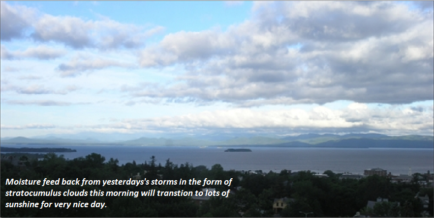
TOMORROW: Mostly sunny. A high in the mid 70s to near 80. Light west breeze.

WEDNESDAY NIGHT: Partly cloudy with isolated showers northern areas overnight. Elsewhere mostly clear. A low 50 to 55. Light north wind.

Summer solstice 6:07 EDT

THURSDAY: A few morning clouds then lots of sunshine & a bit cool. A high upper 60s to near 70. North to northwest breeze 10 to 15 mph.

Looking further ahead…

THURSDAY NIGHT: Clear & starlit. A low 40 to 45.

FRIDAY: Mostly sunny. A high pushing 80.

SATURDAY: Morning sun then increasing clouds leading to a rising chance for afternoon showers. A low in the 50s. A high in the mid 70s.

SUNDAY: Lots of clouds. Chance for showers possible thunderstorms. A low in the upper 50s to around 60. A high in the lower 80s.

Average lows 50 to 55, normal highs around 75.

RH/6-19[end]

Virus-free. www.avast.com

Updated Tuesday morning Forecast — June 19th, 2018

TODAY: A few morning clouds, then mostly sunny and pleasantly comfortable. A high around 70. Northwest winds pick up at 10 to 20 mph.

TONIGHT: Clear & starlit. A low upper 40s to around 50. Little wind.

WEDNESDAY: Mostly sunny. A high in the mid to upper 70s. Light west breeze.

Looking further ahead…

WEDNESDAY NIGHT: A few clouds. Slight chance for a shower across northern areas, otherwise mostly clear. A low 50 to 55.

Summer solstice 6:07 EDT

THURSDAY: Mostly sunny & a bit cool. A high upper 60s to near 70.

FRIDAY: Mostly sunny. A low 40 to 45. A high pushing 80.

SATURDAY: Morning sun then increasing clouds leading to a chance for an afternoon shower or thunderstorm. A low in the 50s. A high in the mid 70s.

SUNDAY: Mixed clouds and sun. Scattered showers and thunderstorms. A low in the upper 50s to around 60. A high in the lower 80s.

Average lows 50 to 55, normal highs around 75.

RH/6-19[end]

Virus-free. www.avast.com

Updated Monday Evening forecast — June 18th, 2018

Severe Thunderstorm Watch Chittenden-Washington-Caledonia Counties south through 10 PM this evening

TONIGHT: Showers and thunderstorms…some strong to severe and briefly heavy…through late evening…then partly cloudy overnight. Patchy valley fog.A low around 60. Northwest breeze 10 to 15 mph.

TOMORROW: A few morning clouds, then mostly sunny and pleasantly comfortable. A high around 70. Northwest winds 10 to 20 mph.

TUESDAY NIGHT: Clear & starlit. A low upper 40s to around 50. Little wind.

WEDNESDAY: Mostly sunny. A low around 55. A high in the mid to upper 70s. Light west breeze.

Looking further ahead…

WEDNESDAY NIGHT: Scattered clouds or mostly clear. A low near 55.

Summer solstice 6:07 EDT

THURSDAY: Mostly sunny. A high upper 60s to around 70.

FRIDAY: Mostly sunny. A low in the 40s. A high 75 to 80.

SATURDAY: Partly to mostly sunny. A low in the 50s. A high in the 70s.

Average lows 50 to 55, normal highs around 75.

RH/6-18[end]

Virus-free. www.avast.com

Updated Monday morning forecast — June 18th, 2018

Heat Advisory 11 AM through 6 PM Monday for lower valleys of eastern and western Vermont….

TODAY: Variably cloudy, hot and & sticky. Isolated showers and thunderstorms northern areas give way to partly cloudy skies. Showers and thunderstorms redeveloping this afternoon…some locally heavy with strong gusty winds and hail. A near record high upper 80s to around 90. Southwest winds 10 to 20 mph.

TONIGHT: Showers and thunderstorms…some strong to severe and locally heavy…winding down. A low upper 50s to around 60. Northwest breeze 10 to 15 mph.

TUESDAY: A few morning clouds, then mostly sunny and pleasantly comfortable. A high around 70. Northwest winds 10 to 20 mph.

Looking further ahead…

TUESDAY NIGHT: Clear & starlit. A low upper 40s to around 50.

WEDNESDAY: Mostly sunny. A low around 55. A high around 70.

Summer solstice 6:07 EDT

THURSDAY: Mostly sunny. A low near 55. A high 70 to 75.

FRIDAY: Mostly sunny. A low 45 to 50. A high pushing near 80.

Average lows 50 to 55, normal highs around 75.

RH/6-18[end]

Virus-free. www.avast.com

Updated Friday evening Forecast — June 15th, 2018

TONIGHT: Clear & starlit. Patchy valley fog. A low upper 40s to low 50s. Light southwest winds.

TOMORROW: Lots of sunshine. A high pushing to near 80. Northwest breeze 10 mph.

SATURDAY NIGHT: Clear & starlit. A low 50 to 55. Little wind

SUNDAY Fathers Day: Mostly sunny in the morning then partial afternoon sunshine. A rising chance for a late day thunderstorm across the northern tier. Much warmer and muggy in the afternoon, with a high around 85. Southwest breeze 10 to 15 mph.

Looking further ahead…

SUNDAY NIGHT: Cloudy periods. Scattered showers and thunderstorms northern areas. Sultry and warm. A low around 70.

MONDAY: Variably cloudy & sticky. Mainly late day and evening thunderstorms…some strong and locally heavy. A near record high around 90.

TUESDAY: A few morning clouds, then increasing sunshine and comfortable. A low around near 60. A high 70 to 75.

WEDNESDAY: Partly to mostly sunny. A low around 50. A high around 80.

THURSDAY: Sunshine with afternoon cloudiness. A low near 55. A high around 80.

Average lows 50 to 55, normal highs around 75.

RH/6-15[end]

Virus-free. www.avast.com

Updated Friday morning forecast — June 15th, 2018

TODAY: Rain showers exiting late this morning then partial afternoon sun. A high in the low 70s. Northwest winds 10 to 15 mph.

TONIGHT: Mostly clear. Patchy valley fog. A low upper 40s. Light winds.

SATURDAY: Lots of sunshine. A high pushing to near 80. Northwest breeze 10 mph.

Looking further ahead…

SATURDAY NIGHT: Mostly clear. Patchy valley fog. A low 50 to 55.

SUNDAY Fathers Day: Mostly sunny in the morning then partial afternoon sunshine. A rising chance for a late day thunderstorms across the northern tier areas of Vermont. Much warmer and muggy in the afternoon, with a high in the low to mid 80s.

MONDAY: Variably cloudy & sticky. Afternoon showers and thunderstorms some strong to locally severe. A low around 70. A record high in the low 90s!

TUESDAY: Variable cloudiness. Scattered showers and afternoon thunderstorms mostly central and southern areas. A low around near 60. A high around 70.

WEDNESDAY: Partly to mostly sunny. A low around 50. A high 75 to 80.

THURSDAY: Sunshine with afternoon cloudiness. A low 50 to 55. A high upper 70s to around 80.

Average lows 50 to 55, normal highs around 75.

Virus-free. www.avast.com

Updated Thursday night Forecast — June 14th, 2018

TONIGHT: Mainly cloudy. Scattered sprinkles near the mountains this evening. Rain showers likely overnight. A low 45 to 50. Light north to northwest winds.

TOMORROW: A cloudy start with rain showers exiting, then increasingly sunny and comfortable in the afternoon. A high in the low 70s. Northwest winds 10 to 15 mph.

FRIDAY NIGHT: Mostly clear. Patchy valley fog. A low upper 40s. Light winds.

SATURDAY: Lots of sunshine. A high pushing to near 80. Northwest breeze 10 mph.

Looking further ahead…

SATURDAY NIGHT: Mostly clear. A low in the 50s.

SUNDAY Fathers Day: Mostly sunny in the morning then partial afternoon sunshine. A rising chance for a late day shower or thunderstorm northern areas. Much warmer with a high in the mid 80s.

MONDAY: Variably cloudy & sticky. Chance for showers and thunderstorms. A low 65 to 70. A high pushing to near 90.

TUESDAY: Mostly sunny. A low around 55. A high in the low 70s.

WEDNESDAY: Bright sunshine. A low around 50. A high in the 70s.

Average lows 50 to 55, normal highs around 75.

RH/6-14[end]

Virus-free. www.avast.com

Updated Thursday morning Forecast — June 14th, 2018

TODAY: Occasional showers, otherwise clouds with a couple breaks of sun. Blustery at times, much cooler and less humid. A high near 65. West to northwest winds 10 to 25 mph with a few higher gusts.

TONIGHT: Occasional rain showers near the mountains. Otherwise becoming partly to mostly cloudy. A low 45 to 50. Light northwest winds.

FRIDAY: Morning clouds, then increasingly sunny and comfortable. A high in the low 70s. Northwest winds 10 to 15 mph.

Looking further ahead…

FRIDAY NIGHT: Scattered evening clouds or mostly clear. Patchy valley fog. A low upper 40s to low 50s.

SATURDAY: Lots of sunshine. A high pushing to near 80.

SUNDAY Fathers Day: Mostly sunny in the morning then partial afternoon sunshine. A rising chance for a late day shower or thunderstorm northern areas late. A low 50 to 55. Much warmer with a high in the mid 80s.

MONDAY: Variably cloudy & sticky. Chance for showers and thunderstorms. A low mid to upper 60s. A high 85 to 90.

TUESDAY: Partly to mostly sunny. A low in the 50s. A high in the in the low 70s.

WEDNESDAY: Partly to mostly sunny. A low around 50. A high in the upper 70s to around 80.

Average lows 50 to 55, normal highs around 75.

RH/6-14[end]

Virus-free. www.avast.com

Updated Wednesday Evening Forecast — June 13th, 2018

TONIGHT: Partly to mostly cloudy. Scattered evening showers and thunderstorms, some could be strong toward the Champlain Valley, otherwise mostly cloudy and eventually not as humid overnight. A low 55 to 60. Southwest winds 10 mph.

TOMORROW: Occasional showers, otherwise lots of clouds with a couple breaks of sun. Blustery much cooler and less humid. A high in the upper 50s to mid 60s. West to northwest winds 10 to 25 mph with a few higher gusts.

THURSDAY NIGHT: Widely scattered showers, especially near the mountains. Otherwise lots of clouds. A low in the 40s. Light northwest winds.

FRIDAY: Morning clouds, then increasingly sunny and comfortable. A high upper 60s to low 70s. Northwest winds 10 to 15 mph.

Looking further ahead…

FRIDAY NIGHT: Scattered evening clouds or mostly clear. Patchy valley fog. A low 45 to 50.

SATURDAY: Lots of sunshine. A high pushing to near 80.

SUNDAY Fathers Day: Partly to mostly sunny. A low 50 to 55. Much warmer with a high in the mid 80s.

MONDAY: Variably cloudy & sticky. Chance for showers and thunderstorms. A low mid to upper 60s. A high 80 to 85.

Average lows 50 to 55, normal highs around 75.

RH/6-13[end]

Virus-free. www.avast.com

Updated Wednesday Morning forecast — June 13th, 2018

TODAY: Some sun mixed with cloudy periods and increasingly muggy. Scattered showers developing with a late day thunderstorm or two. A high upper 70s to around 80. Southwest winds 10 to 15 mph.

TONIGHT: Partly to mostly cloudy. Scattered evening showers and thunderstorms, some could be strong toward portions of western Vermont, otherwise mostly cloudy and eventually not as humid overnight. A low 55 to 60. Southwest winds 10 mph.

THURSDAY: Mostly cloudy with lingering showers, especially near the mountains. Turning breezy, less humid and cooler. A high 65 to 70. West winds 10 to 25 mph.

Looking further ahead…

THURSDAY NIGHT: Widely scattered showers, especially near the mountains. Otherwise partly cloudy. A low in the 40s.

FRIDAY: Some morning clouds give way increasing sunshine and comfortable. A high in the lower 70s.

SATURDAY: Lots of sunshine. A low 45 to 50. A high 75 to 80.

SUNDAY Fathers Day: Partly to mostly sunny. A low around 50. Much warmer with a high in the mid 80s.

MONDAY: Mixed sun and clouds and sticky. Chance for showers and thunderstorms. A low mid to upper 60s. A high 80 to 85.

Average lows 50 to 55, normal highs around 75.

Virus-free. www.avast.com