
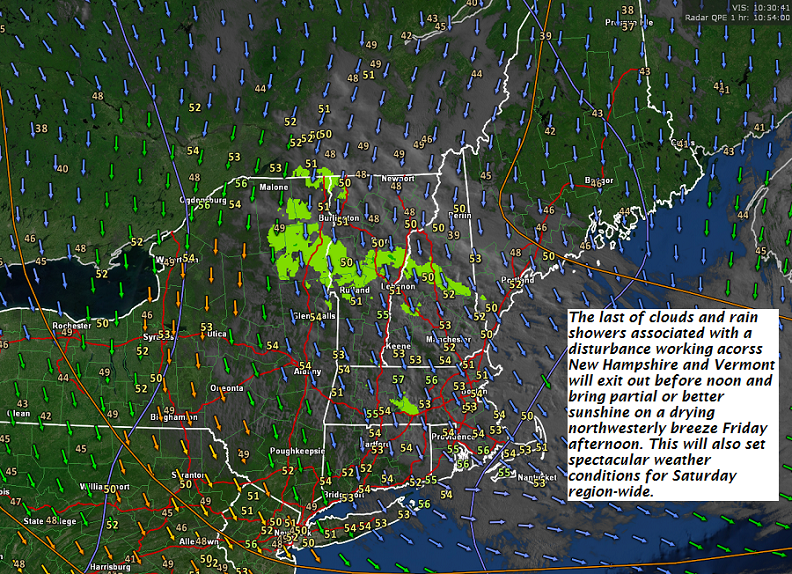
TODAY: Rain showers exiting late this morning then partial afternoon sun. A high in the low 70s. Northwest winds 10 to 15 mph.
TONIGHT: Mostly clear. Patchy valley fog. A low upper 40s. Light winds.
SATURDAY: Lots of sunshine. A high pushing to near 80. Northwest breeze 10 mph.
Looking further ahead…
SATURDAY NIGHT: Mostly clear. Patchy valley fog. A low 50 to 55.
SUNDAY Fathers Day: Mostly sunny in the morning then partial afternoon sunshine. A rising chance for a late day thunderstorms across the northern tier areas of Vermont. Much warmer and muggy in the afternoon, with a high in the low to mid 80s.
MONDAY: Variably cloudy & sticky. Afternoon showers and thunderstorms some strong to locally severe. A low around 70. A record high in the low 90s!
TUESDAY: Variable cloudiness. Scattered showers and afternoon thunderstorms mostly central and southern areas. A low around near 60. A high around 70.
WEDNESDAY: Partly to mostly sunny. A low around 50. A high 75 to 80.
THURSDAY: Sunshine with afternoon cloudiness. A low 50 to 55. A high upper 70s to around 80.
Average lows 50 to 55, normal highs around 75.
| Virus-free. www.avast.com |
