Updated Tuesday Evening Forecast — September 3rd, 2019

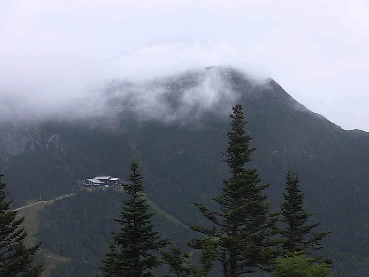
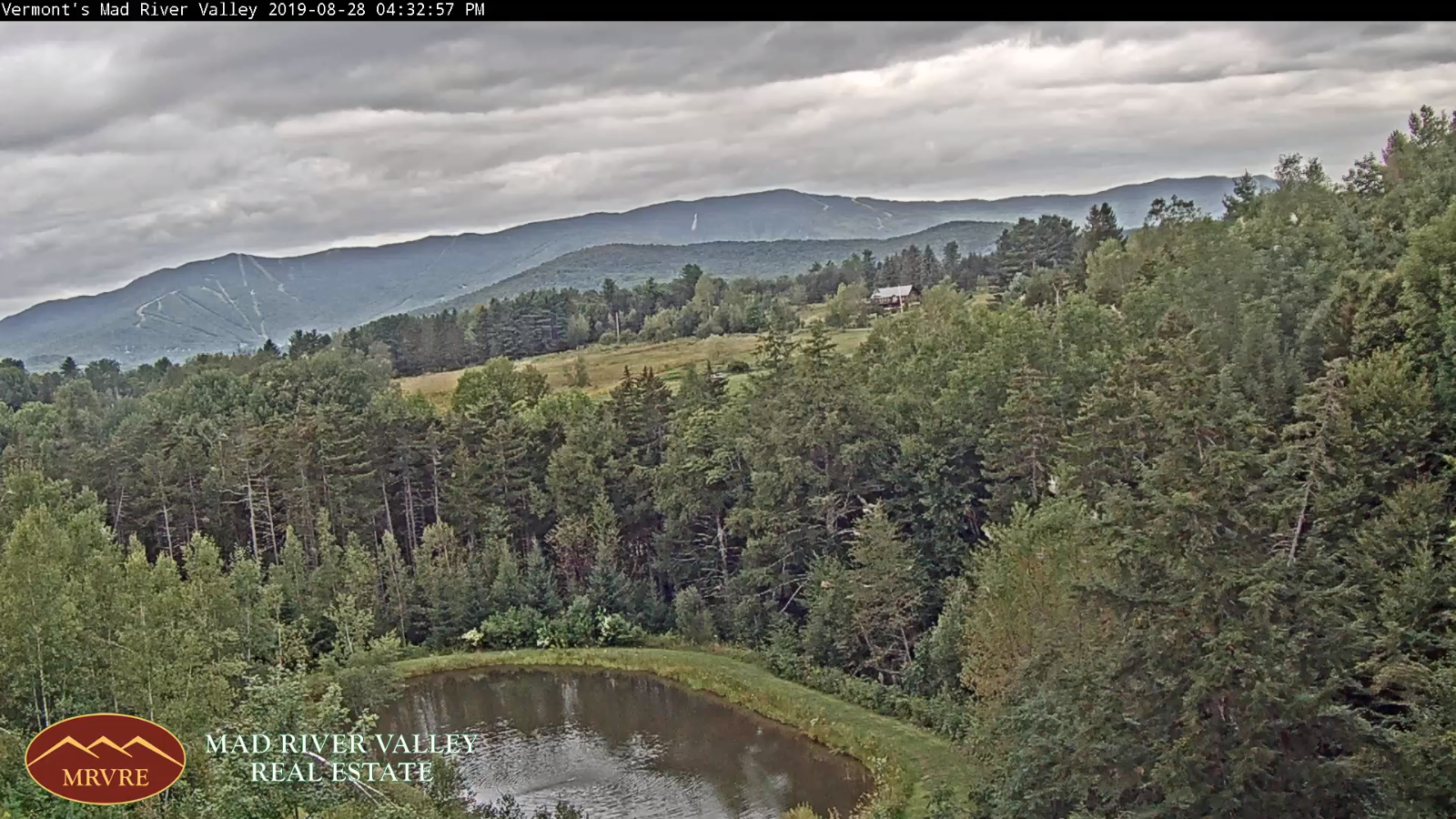
TONIGHT: A few clouds this evening with cloudy periods overnight. A rising chance for a shower toward daybreak. Patchy valley fog. A low 55 to 60. Southeast breeze 10 to 15 mph overnight.

TOMORROW: Clouds with intervals of sun at times. Breezy and a little muggy. Scattered showers with a chance for thunderstorms eastern and southern areas in the afternoon…some with gusty winds. A high pushing to near 75. South to southwest breeze 10 to 20 mph with higher gusts Champlain Valley.

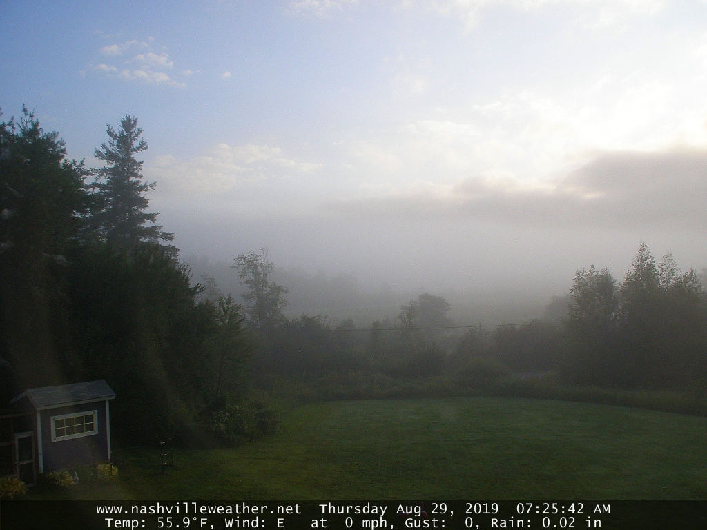
WEDNESDAY NIGHT: Clearing skies leading to areas of valley fog. A low in the low to mid 40s. Light northwest winds.

THURSDAY: Pick of the week. Bright sunshine and blue skies after morning fog. A high in the middle 60s. Northwest winds 10 mph.

Looking further ahead…

THURSDAY NIGHT: Mostly clear. Patchy valley fog. A low near 45.

FRIDAY: Morning fog, then mixed clouds and sun. Slight chance for a few sprinkles. A high in the mid 60s.

SATURDAY: Mixed clouds and sunny intervals. A low 45 to 50. A high in the upper 60s to around 70.

SUNDAY: Mostly cloudy and cooler. Chance for a few showers. A low around 50. A high in the 60s.

Average lows in the upper 40s to mid 50s. Average highs close to 75

RH/9-3-19[end]

Updated Tuesday Morning forecast — September 3rd, 2019

TODAY: Considerable clouds with breaks of sunshine developing away from the mountains. A high around 70. A light west winds.

TONIGHT: Scattered clouds with areas of valley fog… clouding up overnight. A low 55 to 60. Southeast breeze 10 to 15 mph overnight.

WEDNESDAY: Lots of clouds, breezy and even a little muggy. Good chance for showers with isolated thunderstorms. …exiting late. A high in the lower 70s. South to southwest winds 10 to 20 mph with higher gusts Champlain Valley.

Looking further ahead…

WEDNESDAY NIGHT: Clearing skies leading to areas of valley fog. A low in the low to mid 40s.

THURSDAY: Pick of the week. Mostly sunny but cool after morning fog. A high in the middle 60s.

FRIDAY: Sunshine after morning fog then mostly cloudy in the afternoon. A low near 45. A high in the mid 60s.

SATURDAY: Mixed clouds and sunshine. A low 45 to 50. A high in the mid to upper 60s.

SUNDAY: Mostly cloudy. A low in the 40s. A high in the 60s.

Average lows in the upper 40s to mid 50s. Average highs close to 75

RH/9-3-19[end]

Updated Labor Day Monday morning Forecast — September 2nd, 2019

TODAY Labor Day: Intermittent rain…tapering to showers this afternoon with possible rumble of thunder southern areas. Some late day breaks of sun. A high around 65. South winds 10 to 15 mph.

TONIGHT: Evening partial clearing, then mostly cloudy overnight, with a chance for a sprinkle. A low around 55 with areas of valley fog. Light southwest winds.

TUESDAY: Considerable clouds with breaks of afternoon sunshine. A high around 70. A light west to northwest wind.

Looking further ahead…

TUESDAY NIGHT: Mostly clear. Valley fog. A low 55 to 60.

WEDNESDAY: Lots of clouds, breezy and even a little muggy. Good chance for showers with a risk for afternoon thunderstorms…exiting late. A high 70 to 75.

THURSDAY: Sunny but cool after morning fog. A low in the mid 40s. A high near 65.

FRIDAY: Sunshine after morning fog then mostly cloudy in the afternoon. A low near 45. A high near 65.

Average lows in the upper 40s to mid 50s. Average highs close to 75

RH/9-2-19[end]

Updated Evening Forecast — August 30th, 2019

TONIGHT: Mostly clear this evening then some high cloudiness. Patchy valley fog. A low near 50. Light west winds.

TOMORROW: Valley fog burns off to Variable cloudiness. Cooler. A high 65 to 70. Northwest breeze 10 to 20 mph.

SATURDAY NIGHT: Mostly clear giving way to high cloudiness. Patchy valley fog. A low near 45. Little wind.

SUNDAY: Partly sunny with more clouds developing late. Isolated late day showers. A high in the low 70s. South breeze 10 mph.

Looking further ahead…

SUNDAY NIGHT: Cloudy. Good chance for showers. A low 55 to 60.

MONDAY Labor Day: Cloudy. Showers becoming likely…some possible moderate to heavy with a rumble of thunder toward southern areas. A high around 65.

TUESDAY: More clouds than sun. A low 50 to 55. A high near 75.

WEDNESDAY: Lots of clouds. Chance for showers & possible thunderstorms. A low 50 to 55. A high 75 to 80.

Average lows in the upper 40s to mid 50s. Average highs mid 70s.

RH/8-30-19[end]

Updated Friday Morning Forecast — August 30th, 2019

TODAY: Brief morning sun, then cloudy periods with scattered showers developing. Some late afternoon sunshine returns. A high near 75. Southwest winds 10 to 20 mph.

TONIGHT: Mostly clear. Patchy valley fog. A low 50 to 55. Light west winds.

SATURDAY: Morning fog burning off to a mix of clouds and intervals of sun away from the mountains. Cooler. A high 65 to 70. Northwest breeze 10 to 15 mph.

Looking further ahead…

SATURDAY NIGHT: Mostly clear giving way to high cloudiness. Patchy valley fog. A low 45 to 50.

SUNDAY: Partial morning sunshine then lots of clouds. Chance for a showers southern and central areas in the afternoon…overspreading the region late. A high upper 60s to around 70.

MONDAY Labor Day: Cloudy. Showers becoming likely…some possible moderate to heavy with a rumble of thunder toward southern areas. A low near 55. A high in the upper 60s to near 70.

TUESDAY: More clouds than sun. A low 50 to 55. A high 70 to 75.

WEDNESDAY: Lots of clouds. Chance for showers. A low 50 to 55. A high pushing into the 70s.

Average lows in the upper 40s to mid 50s. Average highs mid 70s.

RH/8-30-19[end]

Updated Thursday Night Forecast — August 29th, 2019

TONIGHT: Mostly clear. Patchy valley fog. A low 50 to 55. Light southwest winds.

TOMORROW: Brief morning sun, then cloudy periods with scattered showers. Some late afternoon sunshine returns. A high near 75. Southwest winds 10 to 20 mph.

FRIDAY NIGHT: Mostly clear. Patchy valley fog. A low 50 to 55. Light west winds.

SATURDAY: Morning fog burning off clouds and intervals of sun. A little cooler. A high 65 to 70. Northwest breeze 10 to 15 mph.

Looking further ahead…

SATURDAY NIGHT: Mostly clear giving way to high cloudiness. Patchy valley fog. A low around 50.

SUNDAY: Partial morning sunshine then lots of clouds. Chance for a showers toward Rutland and points south. A high 65 to 70.

MONDAY Labor Day: Cloudy. Chance for showers. A low near 55. A high in the mid 60s.

TUESDAY: More clouds than sun. A low 50 to 55. A high near 75.

WEDNESDAY: Lots of clouds. Chance for showers. A low 50 to 55. A high around 70.

Average lows in the upper 40s to mid 50s. Average highs mid 70s.

RH/8-29-19[end]

Updated Thursday Morning Forecast — August 29th, 2019

TODAY: Morning fog burns off to partial sunshine. Becoming less humid. A high near 75. West to northwest winds 10 mph.

TONIGHT: Mostly clear. Patchy valley fog. A low 50 to 55. Light west to southwest winds.

FRIDAY: Morning sunshine then mostly cloudy. Chance for a few light showers. A high near 75. Southwest winds 10 to 15 mph.

Looking further ahead…

FRIDAY NIGHT: Mostly clear. Patchy valley fog. A low in the lower 50s.

SATURDAY: Sunshine after morning fog, then afternoon cloudiness. A little cooler. A high 65 to 70.

SUNDAY: Partial morning sunshine then lots of clouds. Chance for a showers toward Rutland and points south. A low around 50. A high near 70.

MONDAY Labor Day: Cloudy. Chance for showers. A low mid 50s. A high in the mid to upper 60s.

TUESDAY: More clouds than sun. Chance for an afternoon shower. A low near 55. A high 70 to 75.

Average lows in the upper 40s to mid 50s. Average highs mid 70s.

RH/8-29-19[end]

Updated Wednesday Evening Forecast — August 28th, 2019

TONIGHT: Showers becoming likely later this evening…exiting before daybreak to partial clearing. Areas of valley fog. A low in the upper 50s. Light southwest winds.

TOMORROW: Morning fog burns of partial sunshine. Becoming less humid. A high near 75. West to northwest winds 10 mph.

THURSDAY NIGHT: Mostly clear. Patchy valley fog. A low 50 to 55. Light west to southwest winds.

FRIDAY: Morning sunshine then mostly cloudy. Chance for a few showers. A high near 75. Southwest winds 10 to 15 mph.

Looking further ahead…

FRIDAY NIGHT: Mostly clear. Patchy valley fog. A low in the lower 50s.

SATURDAY: Sunshine after morning fog, then afternoon cloudiness. A little cooler. A high 65 to 70.

SUNDAY: Partial morning sunshine then lots of clouds. Chance for a showers toward Rutland and points south. A low around 50. A high in the upper 60s to near 70.

MONDAY Labor Day: Mostly cloudy. Chance for leftover showers. A low mid 50s. A high in the upper 60s.

Average lows in the upper 40s to mid 50s. Average highs mid 70s.

RH/8-28-19[end]

Updated Wednesday Morning Forecast — August 28th, 2019

TODAY: Some intervals of morning sun, then lots of clouds. More humid. Showers arrive Champlain Valley this afternoon…overspreading the region late on. A high upper 70s to near 80. South breeze 10 to 15 mph.

TONIGHT: Showers likely, possibly moderate to heavy southeastern areas. Clearing skies overnight leading to considerable valley fog. A low to near 60. Light west winds.

THURSDAY: Patchy morning fog gives way to more sunshine than clouds. Becoming less humid. A high near 75. West to northwest winds 10 mph.

Looking further ahead…

THURSDAY NIGHT: Mostly clear. Patchy valley fog. A low 50 to 55.

FRIDAY: Morning sunshine then mostly cloudy. Chance for a few showers. A high in the mid 70s.

SATURDAY: Sunshine after morning fog, then afternoon cloudiness. A little cooler. A low 50 to 55. A high in the upper 60s.

SUNDAY: Partial morning sunshine then lots of clouds. Chance for a showers toward Rutland and points south. low around 50. A high near 70.

MONDAY Labor Day: Mostly cloudy. Chance for leftover showers. A low 50 to 55. A high around 70.

Average lows in the upper 40s to mid 50s. Average highs mid 70s.

RH/8-28-19[end]

Updated Tuesday Evening Forecast — August 27th, 2019

TONIGHT: Mostly fair with high clouds. Patchy valley fog. A low in the mid 50s. Light south winds.

TOMORROW: Brief morning sun, then lots of clouds and more humid. Showers likely arriving Champlain Valley early afternoon overspreading the region late in the afternoon. A high upper 70s to near 80. South breeze 10 to 15 mph.

WEDNESDAY NIGHT: Showers likely, briefly heavy with possible rumble of thunder southern areas. Clearing overnight leading to valley fog. A low upper 50s to near 60. Light west winds.

THURSDAY: Patchy morning fog gives way to more sun than clouds. Becoming less humid. A high 70 to 75. West to northwest winds 10 mph.

Looking further ahead…

THURSDAY NIGHT: Mostly clear. Patchy valley fog. A low 50 to 55.

FRIDAY: Mostly sunny with more afternoon clouds. Maybe a mountain sprinkle. A high in the mid 70s.

SATURDAY: Sunshine after morning fog, then afternoon cloudiness. A little cooler. A low 50 to 55. A high in the upper 60s.

SUNDAY: Mixed sun and clouds. A low around 50. A high near 70.

MONDAY Labor Day: Mostly cloudy. Chance for showers. A low in the mid 50s. A high around 70.

Average lows in the upper 40s to mid 50s. Average highs mid 70s.

RH/8-27-19[end]