
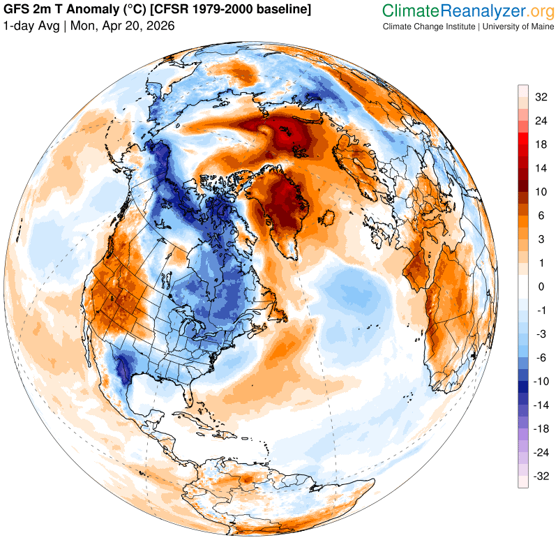
Roger Hill’s forecast 3:00 PM MONDAY 4-20-26
TONIGHT: Becoming clear & very chilly. Isolated patchy valley fog. A low 20 to 25. Little wind.
TOMORROW: Mixed sun and clouds. A high in the mid-40s with a consistent warming trend. Light southwest winds.
TUESDAY NIGHT: Partly to mostly cloudy. A low around 32. Light southeast winds.
WEDNESDAY: Mixed clouds and sun. Slight chance for wet snowflake or sprinkle. A high near 50. Light south to southeast winds.
Looking further ahead
WEDNESDAY NIGHT: Partly to mostly cloudy. Areas of fog overnight. Widely scattered light rain showers/sprinkles or mixed with wet snowflakes higher terrain. A low around 30.

THURSDAY: Maybe a wet snowflake or sprinkle Northeast VT exiting. Otherwise, mostly sunny. A high 50 to 55.
FRIDAY: Mostly sunny. Lows 30 to 35. Highs around 55.
SATURDAY: Clouding up after morning sun. Lows upper 20s to low 30s. Highs rebound mid and upper 50s.
Average low: low to mid-30s Average high mid-50s to low 60s.
Full Flower Moon May 1st 2026 at 1:23 PM
RH/4-20/forecast][end] Fox Trot Delta Tango
