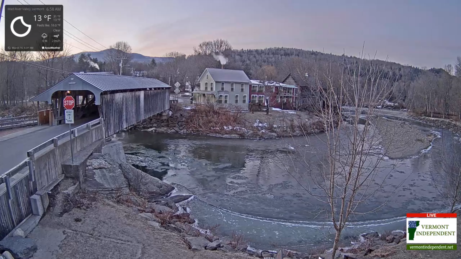
TONIGHT: A leftover rain or wet snow shower Northeast Kingdom into mid evening, then clearing. A low mid to upper 20s. West winds 10 mph.
TOMORROW: Sunshine gives way high cloudiness in the afternoon. A high low to mid 40s. Possible sap run. Light northwest winds.
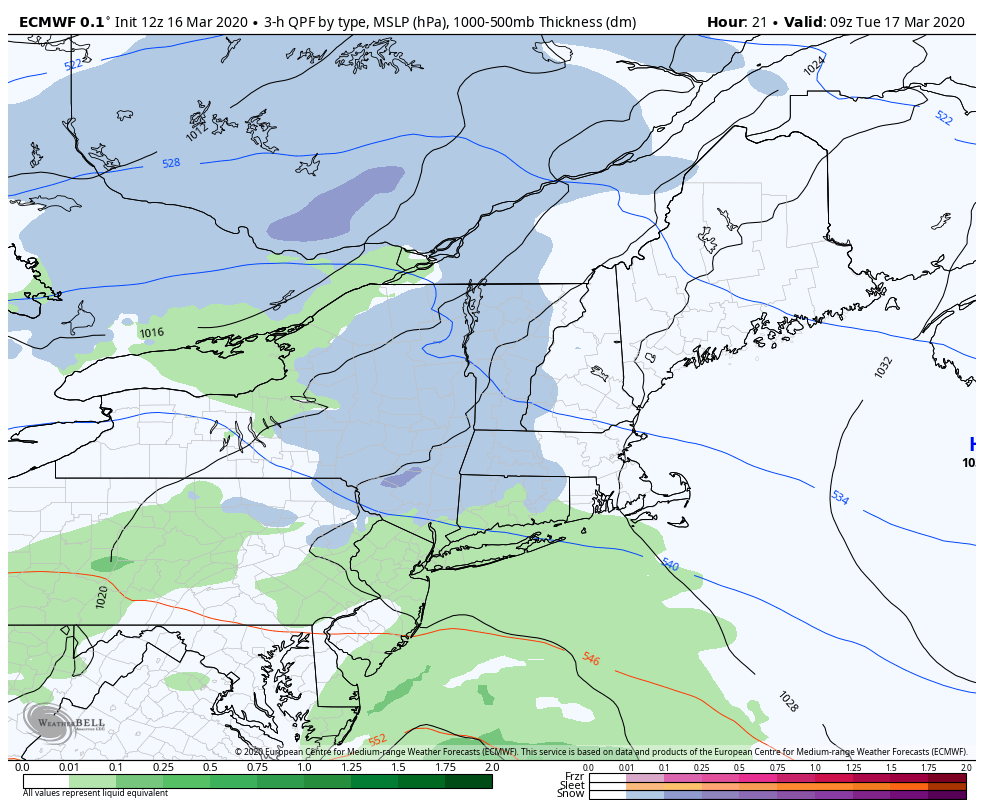
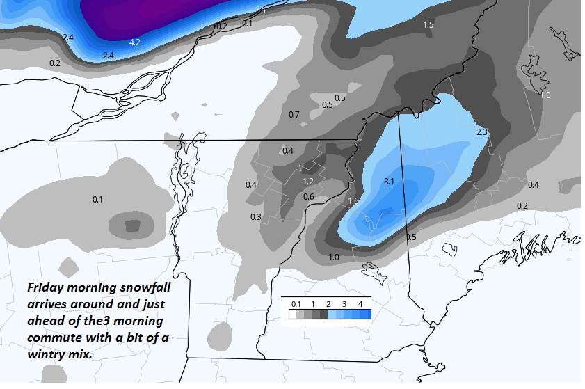
WEDNESDAY NIGHT: Considerable cloudiness. Light accumulating snow likely, especially central and southern areas with just flurries northern areas. Accumulation dusting to an inch north. A low 32 to 35. Light southeast winds.
THURSDAY: Mainly cloudy. Occasional snow showers or flurries…exiting late morning. Dusting to an inch north with 1 to locally 4” central and southern areas. An afternoon high 40 to 45. Southeast breeze 10 mph.
Looking further ahead…
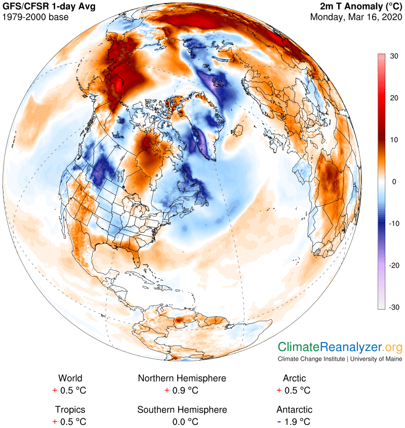
Vernal Equinox occurs 11:49 PM Thursday night…
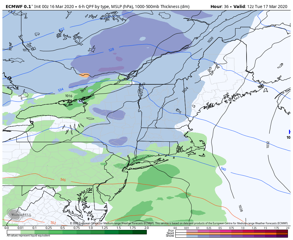
THURSDAY NIGHT: Cloudy. Occasional rain showers developing after midnight. A low in the mid to upper 30s.
FRIDAY: Mostly cloudy and spring-like. Occasional rain showers in the morning. A break, then a round rain showers moderate at times…maybe a rumble of thunder in the afternoon. Temperatures peaking in the 60s then sharply colder…blustery.
SATURDAY: A stray flurry early, then partly to mostly sunny. Blustery and colder. A low 25 to 30. A high around 32 degrees.
SUNDAY: Bright sun and blue skies. A morning low 5 to 15 above. A high 30 to 35.
Average lows mid-teens to low 20s, average highs upper 30s to mid-40s….
RH/3-17[end]