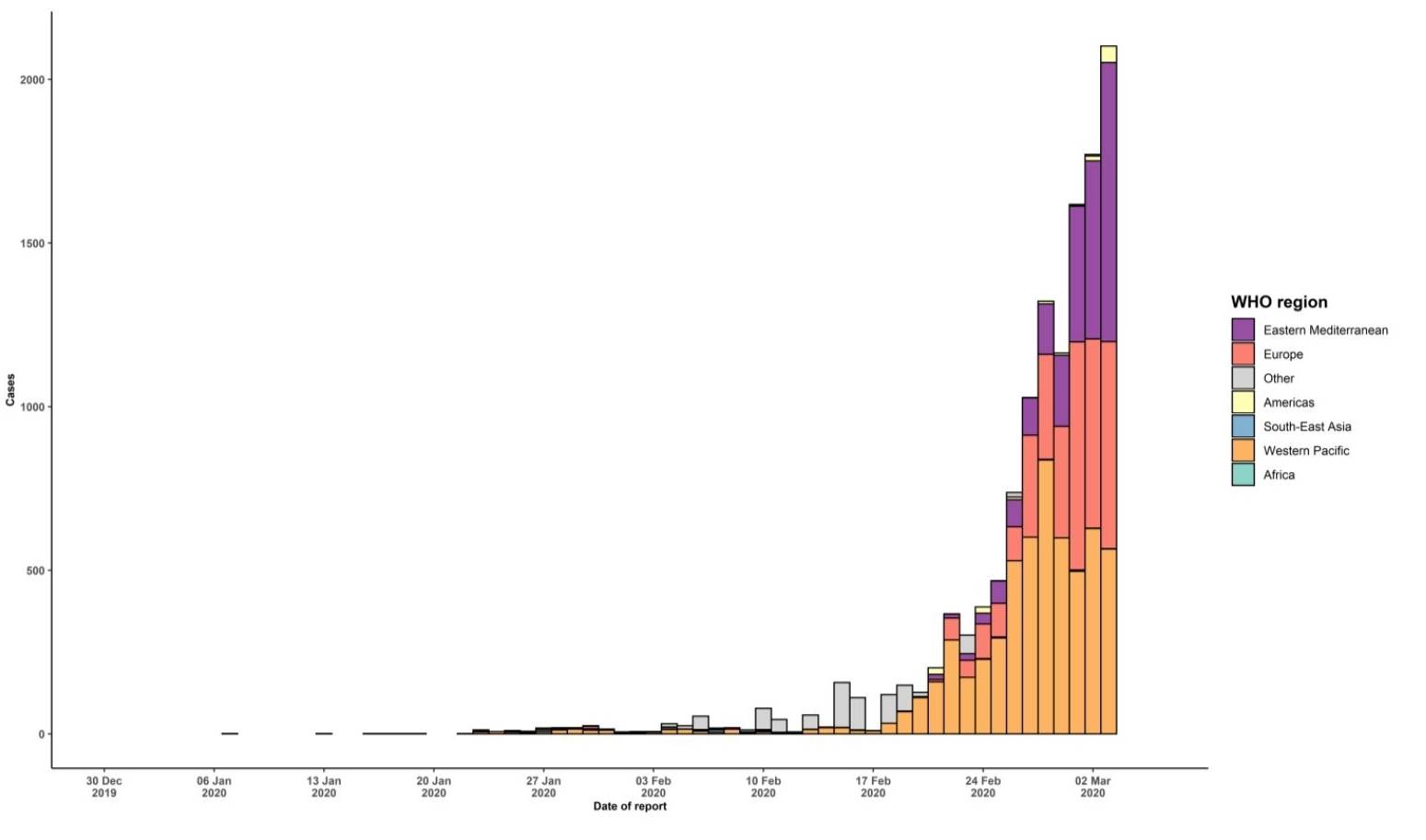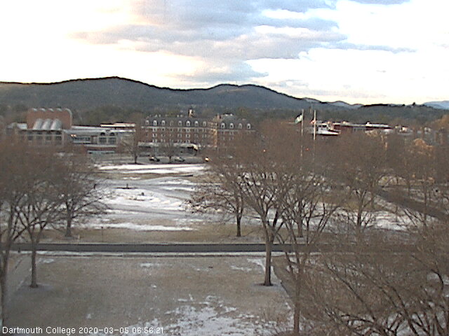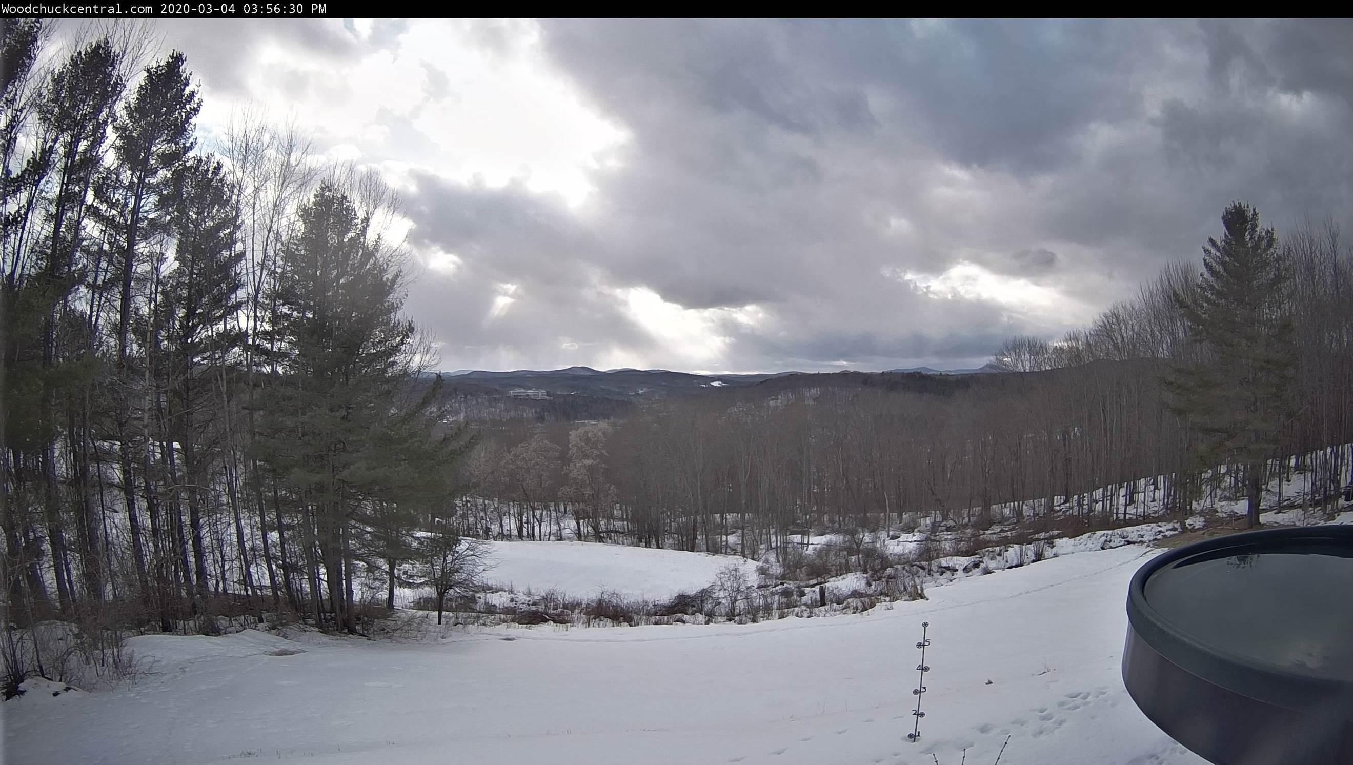
TONIGHT: Rain showers exiting late this evening as a few mountain flurries. Otherwise partial clearing and colder overnight. A low ranging through the 20s. Northwest winds pick up 10 to 20 mph.
TOMORROW: Brief morning sunshine then mostly cloudy. A high mid-30s to near 40. Northwest winds 10 mph.
WEDNESDAY NIGHT: Mostly clear. A low 15 to 25. Light north winds.
THURSDAY: Partly sunny. A high 45 to 50 with a sap run likely. South winds 10 mph.
Looking further ahead…
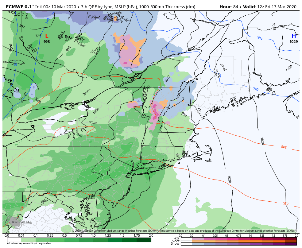
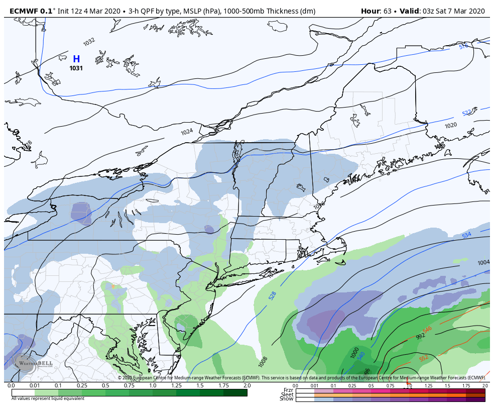
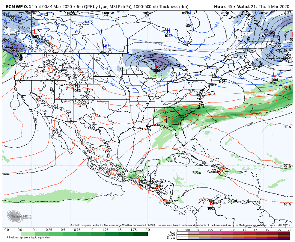
THURSDAY NIGHT: Fair early then clouding up. Chance for rain or mixed precipitation arriving toward daybreak. A low 32 to 40.
FRIDAY: Gray. Chance for rain or a brief wintry mix early on departing in the afternoon with clearing. Blustery to windy at times. A high 45 to 50.
SATURDAY: Partly to mostly cloudy, blustery and colder. Isolated flurries northern mountains. A low upper 20s to low 30s. A high low to mid 30s.
SUNDAY: Bright sunshine. A low in the upper single digits to mid-teens. A high in the 20s.
MONDAY: Sunshine filtered by high cloudiness. A low in the single digits to low teens. A high 30 to 35.
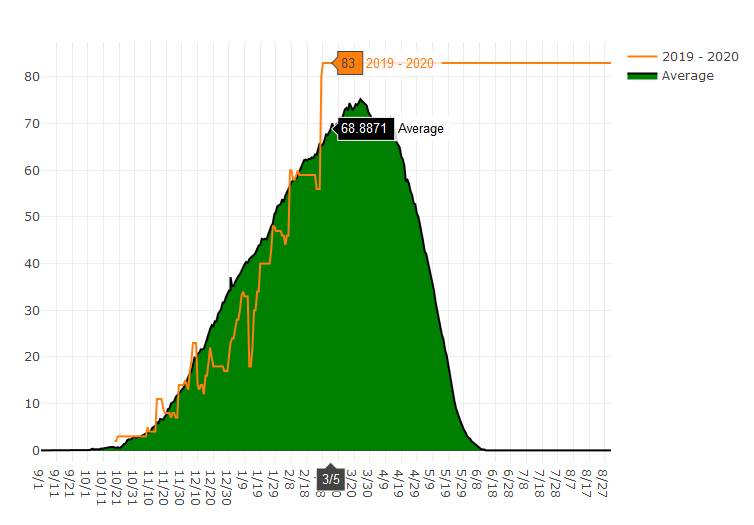
Average lows mid-teens to low 20s, average highs upper 30s to mid-40s….
RH/3-10[end]