Updated Thursday Morning Forecast — February 25th, 2021

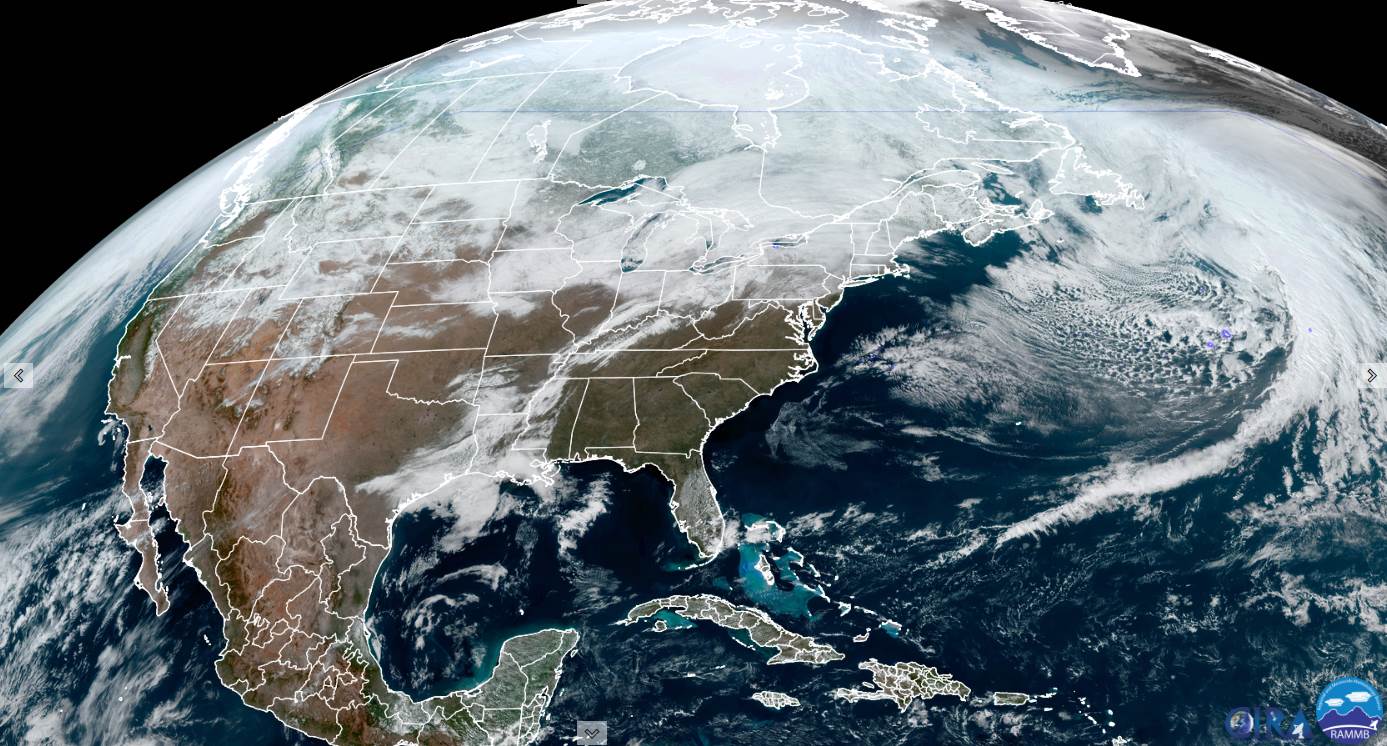
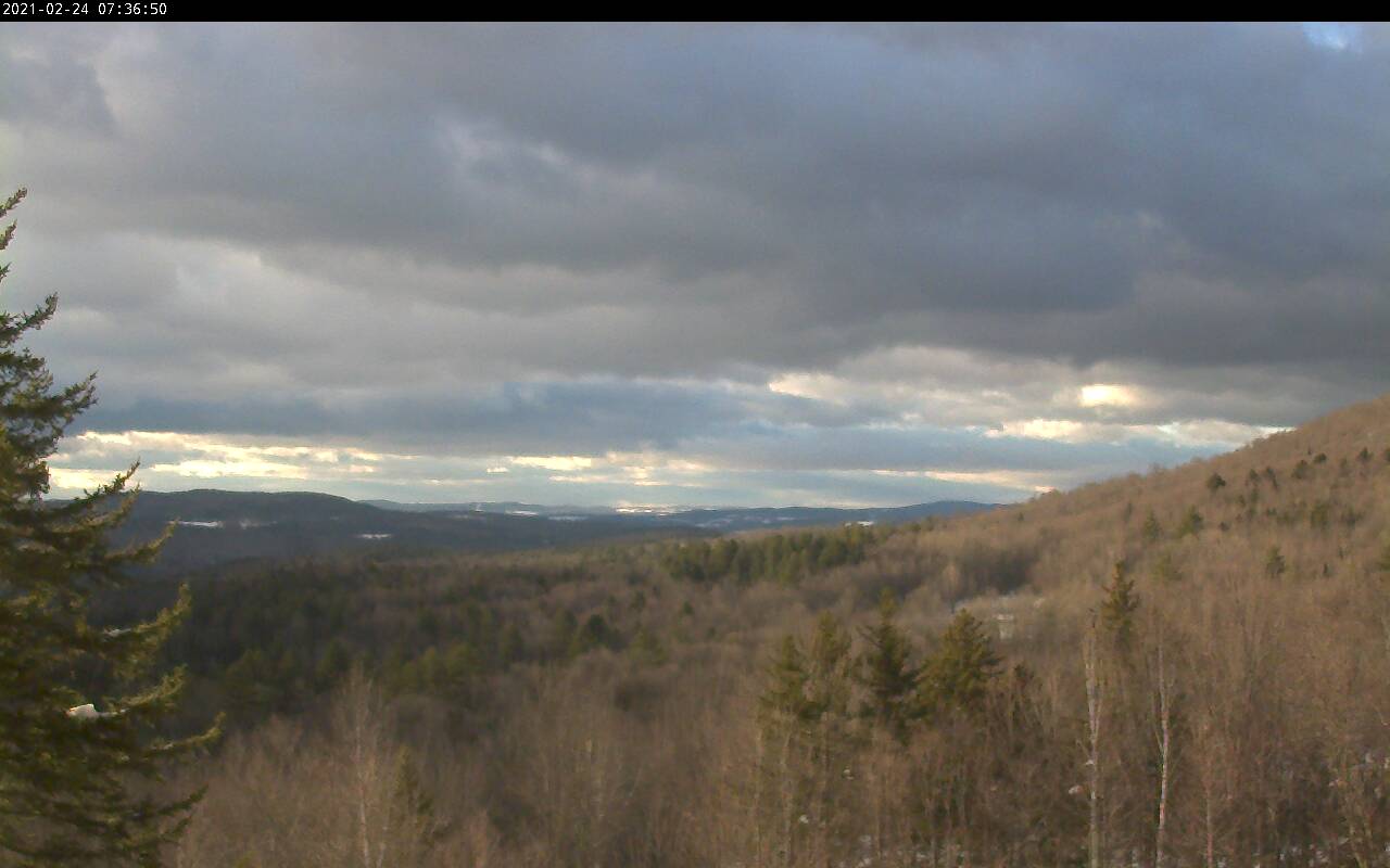
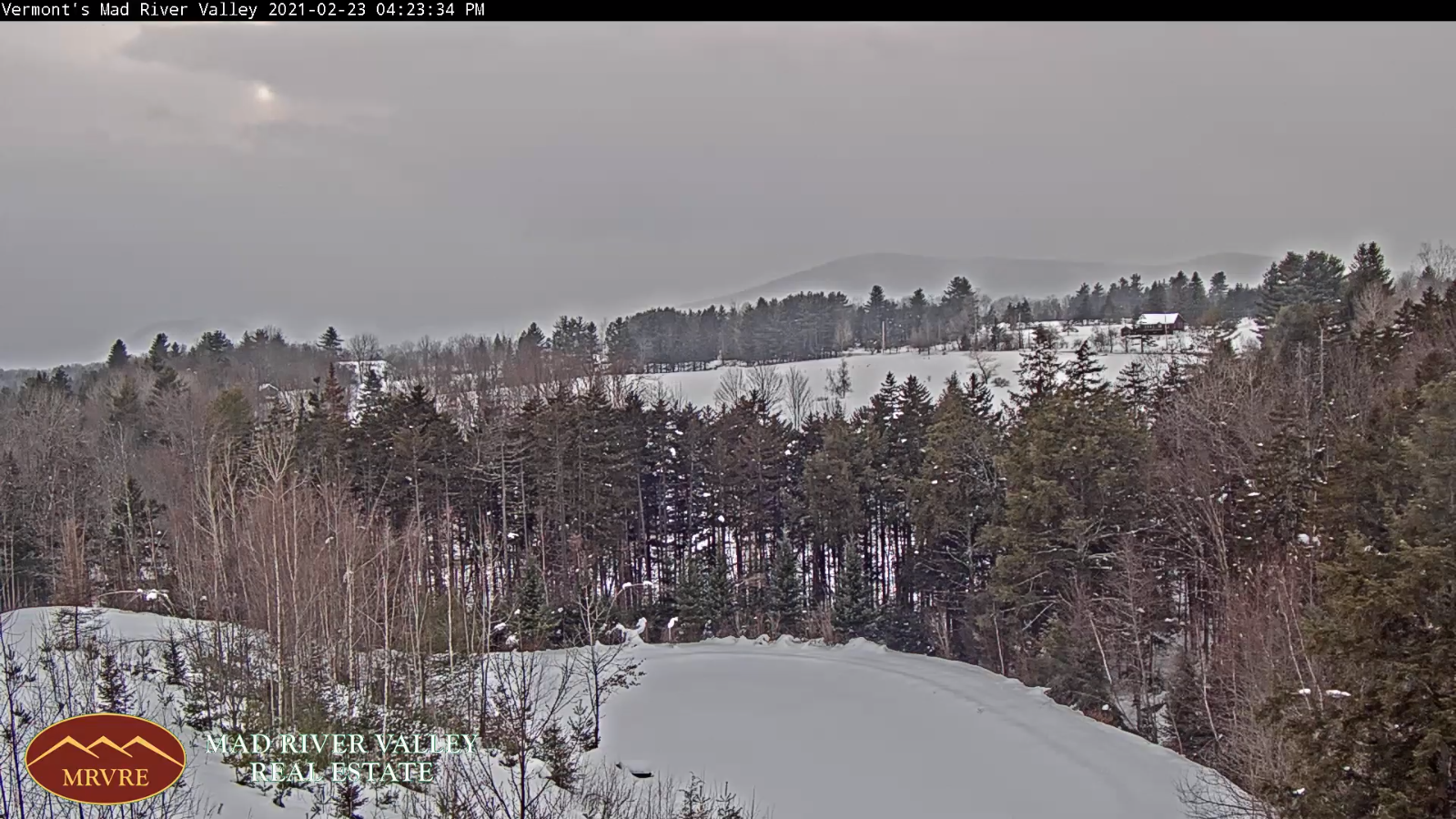
TODAY: Scattered flurries winding down mainly northern Green Mountains. Otherwise more clouds then sun. Blustery & colder. Temperatures in the mid to upper 20s. Northwest winds 10 to 20 mph.

TONIGHT: A few evening clouds…then clear and fully moonlit. Frigid. A low zero to 5 above. Light northwest winds.

FRIDAY: Pick of the week. A beauty after a frigid start. Bright sunshine & blue skies. A high upper 20s to near 30. Light west winds.

Looking further ahead…

FRIDAY NIGHT: Mostly clear and fully moonlit. A low in the low to mid-teens.

‘Full Worm Moon” Saturday 1:48 PM

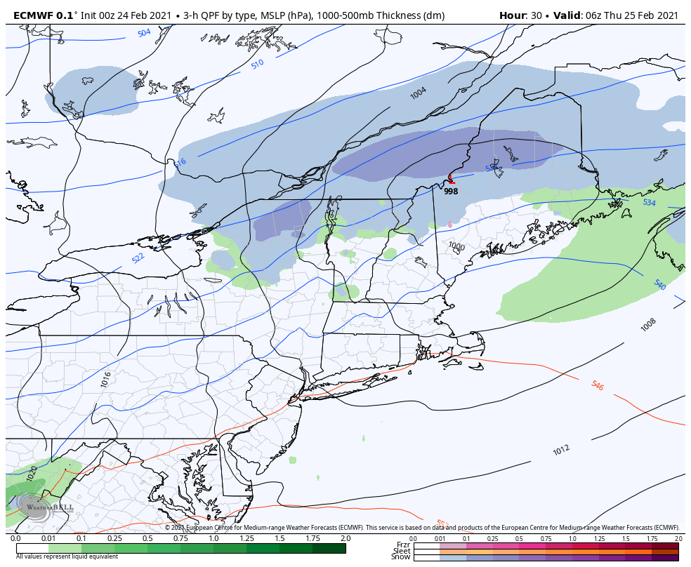
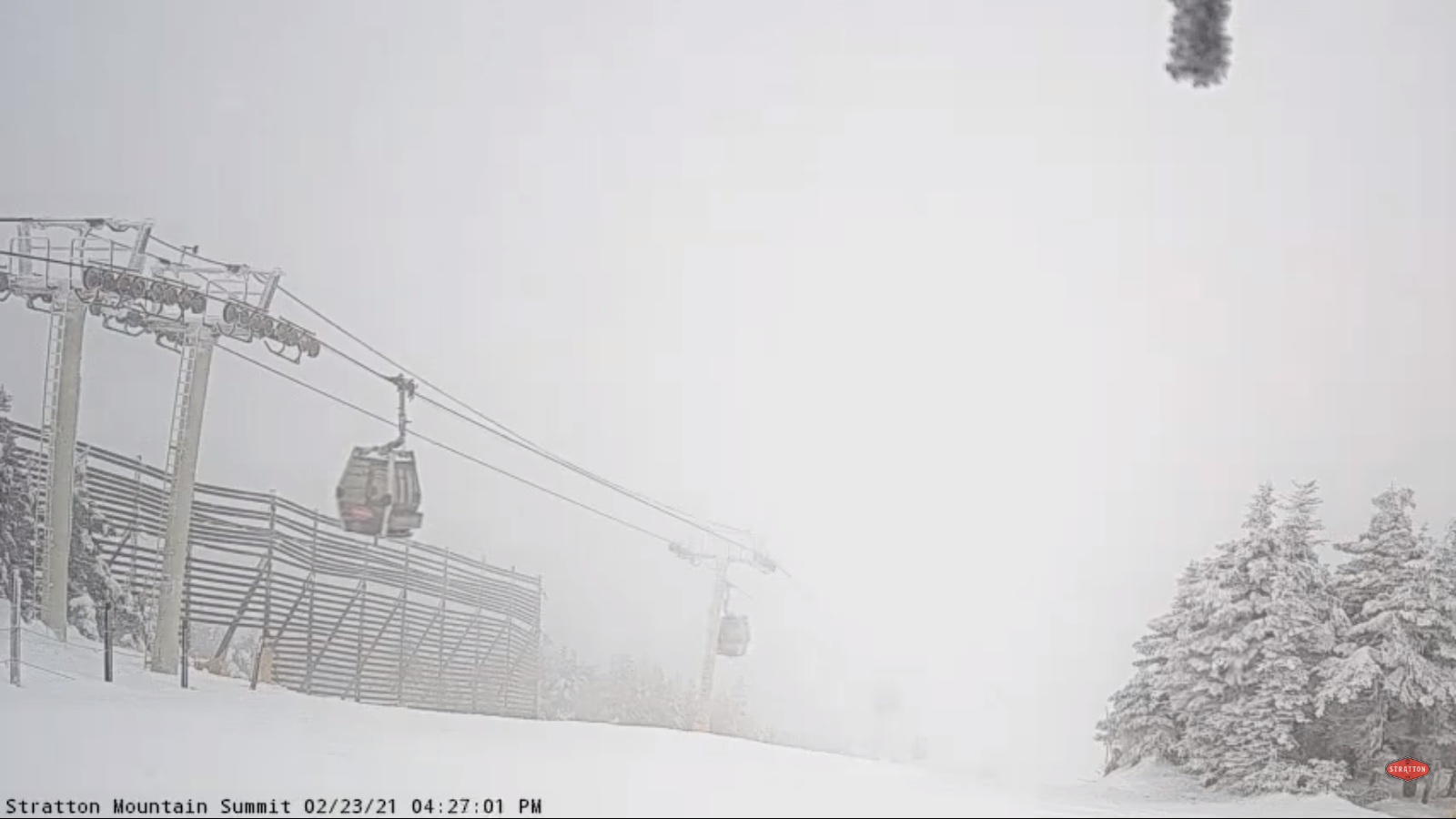
SATURDAY: Clouding up & turning breezy to windy. A good chance for wet accumulating snow showers…mixing rain in the afternoon. Accumulation dusting to an inch…elevated terrain before exiting late. A late day high pushing toward 40.

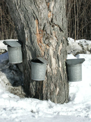
SUNDAY: Considerable high cloudiness with some sunny breaks. A low around 30. Milder in the afternoon with a possible sap run. A high 40 to 45.

MONDAY: Scattered snow showers or flurries early, with some minor accumulation.Partly to mostly cloudy. A low in the low 30s. A high near 40.

TUESDAY: Morning clouds then increasing sunshine. Blustery & sharply colder. A morning low 5 to 10 above. A high upper teens to low 20s.

Average low ranging 5 to 15 above, Average highs ranging low to mid 30s

End of Meteorological Winter March 9th… based off local climatology.

RH/2-24category forecast][end]

Updated Wednesday Evening Forecast — February 24th, 2021

TONIGHT: Mostly cloudy, blustery unsettled. Scattered rain/wet snow showers develops later this evening and more prevent overnight. Accumulation a dusting to 1 inch mainly Green Mountain Resorts. Mild this evening…turning colder overnight with a low 25 to 30. Southwest breeze shifts to northwesterly and picks up to 10 to 25 mph.

TOMORROW: Frequent mountain snow showers and valley flurries northern areas early. Minor additional accumulation. Otherwise clouds give to partial late day sun. Blustery & colder. Temperatures in the mid to upper 20s. Northwest winds 10 to 20 mph.

THURSDAY NIGHT: A few evening clouds…then clear and fully moonlit. Frigid. A low Zero to 5 above. Light northwest winds.

FRIDAY: Pick of the week. A beauty after a frigid start. Bright sunshine & blue skies. A high upper 20s to near 30. Light west winds.

Looking further ahead…

FRIDAY NIGHT: Mostly clear and fully moonlit. A low in the low to mid-teens.

‘Full Worm Moon” Saturday 1:48 PM

SATURDAY: Gray skies, leading to a chance for wet accumulating snow showers changing or mixing rain in the afternoon before exiting late. An early evening high 40 to 45.

SUNDAY: Morning clouds, give way to filtered sun through high clouds. A low around 30. Milder in the afternoon with a possible sap run. A late day high mid to upper 40s.

MONDAY: Partly to mostly cloudy. A low around 35. A high upper 30s to low 40s.

Average low ranging 5 to 15 above, Average highs ranging low to mid 30s

End of Meteorological Winter March 9th… based off local climatology.

RH/2-24category forecast][end]

Updated Wednesday Morning Forecast — February 24th, 2021

TODAY: Clouds with a few breaks of sun this morning. Milder. A high 40 to 45. Scattered mixed rain & wet snow showers developing this afternoon especially northern areas. (Chance of a sap run lower elevations) South to southwest breeze 10 mph.

TONIGHT: Mostly cloudy & blustery unsettled. Scattered mixed rain & wet snow showers. Minor accumulations across the elevated terrain. A low in the upper 20s to around 30. Southwest breeze 10 to 20 mph becoming northwesterly overnight with higher gusts.

THURSDAY: A few northern mountain flurries dry up. Otherwise clouds mixing with intervals of afternoon sun. Blustery & colder. Temperatures in the mid to upper 20s. Northwest winds 10 to 20 mph.

Looking further ahead…

THURSDAY NIGHT: Becoming clear & fully moonlit, frigid. A low 5 below to 5 above.

FRIDAY: Pick of the week. A beauty after a frigid start. Bright sunshine & blue skies. A high upper 20s to near 30.

‘Full Worm Moon” Saturday 1:48 PM

SATURDAY: Gray skies, leading to a chance for wet accumulating snow showers changing or mixing rain in the afternoon before exiting late. A low around 15. An early evening high 40 to 45.

SUNDAY: Morning clouds, give way to filtered sun through high clouds. A low around 30. Milder in the afternoon with a possible sap run. A late day high pushing toward 45 degrees.

MONDAY: Partly to mostly cloudy. A low near 32. A high 40 to 45.

Average low ranging 5 to 15 above, Average highs ranging low to mid 30s

End of Meteorological Winter March 9th… based off local climatology.

RH/2-24category forecast][end]

Updated Tuesday Evening Forecast — February 23rd, 2021

TONIGHT: Lots of clouds. Scattered wet snow showers mixed with raindrops valleys floors for a time early. A slushy ½ inch to an inch accumulation especially high terrain. A low in the upper 20s. West to southwest winds developing 10 to 15 mph.

TOMORROW: Mainly cloudy. Late day rain or snow showers developing. A high near 40. (Slight chance of a sap run lower elevations) Southwest breeze 10 mph.

WEDNESDAY NIGHT: Mostly cloudy & blustery and colder. Scattered rain or snow showers changing to snow showers with a risk of a snow squall. A dusting to an inch valley’s, and one to two northern mountains. A low in the low 20s. West winds shifting to northwesterly 10 to 25 mph overnight

THURSDAY: Lingering northern mountain flurries with minor accumulation. Blustery & little colder. A high mid to upper 20s. Northwest winds 10 to 20 mph.

Looking further ahead…

THURSDAY NIGHT: Becoming clear moonlit, frigid. A low 5 below to 5 above.

FRIDAY: A beauty after a frigid start. A few clouds but otherwise bright sunshine. A high mid to upper 20s.

‘Full Worm Moon” Saturday 1:48 PM

SATURDAY: Gray, leading to a chance for wet accumulating snow showers. A low around 15. An early evening high near 40.

SUNDAY: Morning clouds, give way to intervals of afternoon sun. A low 25 to 30. Milder in the afternoon with a possible sap run. A late day high pushing toward 45 degrees.

Average low ranging 5 to 15 above, Average highs ranging low to mid 30s

End of Meteorological Winter March 9th… based off local climatology.

RH/2-23category forecast][end]

Updated Tuesday Morning Forecast — February 23rd, 2021

TODAY: A stray mountain flurry early far northern areas….otherwise considerable cloudiness. Flurries or light rain showers redeveloping late. A high in the mid to upper 30s. Southwest winds 10 mph.

TONIGHT: Lots of clouds. Scattered snow showers or flurries mixed with rain valleys floors early. A dusting to an inch accumulation. A low 25 to 30. West winds 10 mph.

WEDNESDAY: Mainly cloudy. Chance for a late day rain or snow shower. A high near 40. (Slight chance of a sap run lower elevations) Light southwest winds.

Looking further ahead…

WEDNESDAY NIGHT: Mostly cloudy & blustery. Scattered rain or snow showers changing to snow showers with a risk of a snow squall. A dusting to 2”mainly high terrain. A low 20 to 25.

THURSDAY: Clouds with scattered light snow showers or flurries, minor accumulation. Blustery & little colder. A high in the upper 20s.

FRIDAY: A beauty after a frigid start. A few clouds but otherwise bright sunshine. A low 5 below to 5 above. A high around 25.

SATURDAY: Gray, leading to a chance for wet accumulating snow showers. A low in the mid-teens. An early evening high 35 to 40.

SUNDAY: Morning clouds, give way to intervals of afternoon sun. A low near 30. Milder in the afternoon with a possible sap run. A late day high in the low 40s.

Average low ranging 5 to 15 above, Average highs ranging low to mid 30s

End of Meteorological Winter March 9th… based off local climatology.

RH/2-22category forecast][end]

Updated Monday Evening Forecast — February 22nd, 2021

TONIGHT: Overcast. Snow showers for time this evening…tapering to a few flurries. About an inch additional accumulation…more toward Rutland. A low near 25. Light southwest winds.

TOMORROW: Cloudy. A rising likelihood of flurries or light rain showers late. A high in the mid-30s. Southwest winds 10 mph.

TUESDAY NIGHT: Lots of clouds. Scattered light snow showers or flurries. A dusting to an inch accumulation. A low in the upper 20s. west winds 10 mph.

WEDNESDAY: Clouds with a few breaks of sun. Chance for a late day rain or snow shower. A high upper 30s to around 40. (Possible sap run lower elevations) Light southwest winds.

Looking further ahead…

WEDNESDAY NIGHT: Mostly cloudy & blustery. Scattered rain or snow showers changing to snow showers with a risk of a snow squall. A dusting to an inch mainly high terrain. A low 20 to 25.

THURSDAY: Morning clouds with a few leftover mountain flurry. Blustery & colder. A high in the upper 20s.

FRIDAY: A beauty after a cold start. Blue skies and bright sunshine. A low zero to 10 above. A high in the mid-20s.

SATURDAY: Thickening clouds, leading to a chance for wet accumulating snow showers. A low near 10 above. A high 30 to 35.

Average low ranging 5 to 15 above, Average highs ranging low to mid 30s

End of Meteorological Winter March 9th… based off local climatology.

RH/2-22category forecast][end]

Updated Monday Morning Forecast — February 22nd, 2021

TODAY: Gray skies & becoming blustery. A few flurries develop this morning, a rising chance for accumulation light snow or snow showers mid-afternoon. Accumulation 1 to locally 3” with most across more southerly areas. Slightly milder with a high in the low 30s. South to southeast winds developing 10 to 15 mph.

TONIGHT: Snow showers tapering to a few flurries. Minor additional accumulation mainly this evening. A low near 25. Light southwest winds.

TUESDAY: Cloudy. A rising chance for occasional flurries or light snow showers late. A high in the mid-30s. Southwest winds 10 mph.

Looking further ahead…

TUESDAY NIGHT: Lots of clouds. Scattered light snow showers or flurries. A dusting to an inch accumulation. A low in the upper 20s.

WEDNESDAY: Mainly gray. Chance for a late day rain or snow shower. A high upper 30s to around 40. (Possible sap run lower elevations)

THURSDAY: Mostly cloudy. Scattered snow showers, maybe a snow squall early colder and blustery at times. A low around 25.

A high around 30.

FRIDAY: A beauty after a cold start. Blue skies and bright sunshine. A low zero to 10 above. A high 20 to 25.

SATURDAY: Thickening clouds, leading to a chance for wet accumulating snow showers. A low 5 to 10 above. A high in the low to mid 30s.

Average low ranging 5 to 15 above, Average highs ranging low to mid 30s

End of Meteorological Winter March 9th… based off local climatology.

RH/2-22category forecast][end]

Updated Friday Evening Forecast — February 19th, 2021

TONIGHT: Cloudy. Scattered snow showers or flurries. Around an inch accumulation. A low around 15. Light south winds becoming northwesterly 10 mph overnight.

TOMORROW: Scattered mountain snow showers and valley flurries. Dusting to an inch. Breaks of sun possible in the afternoon. A high near 25. Northwest winds 10 mph.

SATURDAY NIGHT: Clouds, with a few stray flurries…drying up with clearing developing toward midnight. Colder. A low 5 below to 5 above. Light northwest winds.

SUNDAY: Bright sun & blue skies after a cold start. A high in the lower 20s. Light northwest winds.

Looking further ahead…

SUNDAY NIGHT: Clear and cold with increasing high clouds after midnight. A low in the single digits.

MONDAY: Gray skies & becoming blustery. A rising chance for accumulating snow late. Milder in the afternoon with a high

pushing toward 30.

TUESDAY: Lots of clouds. Scattered flurries drying up. A low near 25. A high around 35.

WEDNESDAY: Chance for morning flurries…and again later in the day. Otherwise mainly gray. A low in the upper 20s.

A high mid-30s.

Average low ranging mid-single digits to mid-teens, Average highs 30 to 35.

End of Meteorological Winter March 9th… based off local climatology.

RH/2-19category forecast][end]

Updated Friday Morning Forecast — February 19th, 2021

TODAY: Mainly gray. Flurries northern areas with occasional light snow showers. Dustings northern areas with an inch toward Rutland-White River Jct. A high in the upper 20s. Southeast winds 10 mph.

TONIGHT: Cloudy. Scattered snow showers or flurries. Around an inch accumulation. A low around 15. Light south winds becoming northwesterly overnight.

SATURDAY: Scattered mountain snow showers and valley flurries. Dusting to 2 inches mainly in the mountains. Breaks of sun develops in the afternoon. A high near 25. Northwest winds 10 mph.

Looking further ahead…

SATURDAY NIGHT: A few flurries drying up toward midnight. Gradual clearing. Colder. A low 5 to 10 above.

SUNDAY: Mostly sunny and beautiful winter day. A high in the lower 20s.

MONDAY: Clouding up & becoming breezy at times. Scattered flurries mid-day on with a chance for light accumulating snow later into Monday night. A low in the single digits. Milder in the afternoon with a high pushing toward 30.

TUESDAY: Mostly cloudy. Scattered flurries early drying up. A low near 25. A high around 35.

WEDNESDAY: Scattered snow showers or flurries with light coatings. Otherwise mostly cloudy. A low in the upper 20s. A high mid-30s.

Average low ranging mid-single digits to mid-teens, Average highs 30 to 35.

End of Meteorological Winter March 9th… based off local climatology.

Updated Thursday Evening Forecast — February 18th, 2021

TONIGHT: Cloudy. Light snow showers or flurries southern Vermont gradually overspreading the region. Little accumulation northern areas with around an inch elsewhere. A low mid to upper teens. Light northeast winds.

TOMORROW: Mainly gray. Flurries or light snow showers. Dusting to an inch…mainly central and southern areas. A high in the upper 20s. Southeast winds 10 mph.

FRIDAY NIGHT: Cloudy. Scattered snow showers or flurries. Around an inch accumulation. A low around 15. Wind becoming northwest 10 mph.

SATURDAY: Lots of clouds. Scattered mountain snow showers and valley flurries. Minor coatings. A high near 25. Northwest winds 10 mph.

Looking further ahead…

SATURDAY NIGHT: Scattered evening flurries drying up overnight with gradual clearing. Colder. A low around 5 above.

SUNDAY: Mostly sunny and beautiful winter day. A high 20 to 25.

MONDAY: Clouding up & becoming breezy at times. Chance for flurries in the afternoon. A low in the single digits. Milder in the afternoon with a high near30.

TUESDAY: Mostly cloudy. Scattered flurries early drying up. A low near 25. A high mid to upper 30s.

Average low ranging mid-single digits to mid-teens, Average highs 30 to 35.

End of Meteorological Winter March 9th… based off local climatology.

RH/2-18category forecast][end]