Updated Friday Morning Forecast — April 2nd, 2021

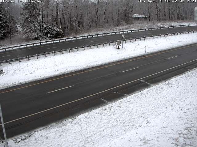
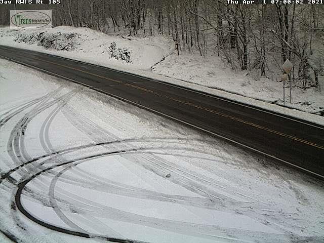
TODAY: A few mountain flurries otherwise clouds with a break of sun now and then this afternoon. A high around 30 degrees. Northwest winds 10 mph.

TONIGHT: Evening cloudiness gives way to partially moonlit skies. A low around 20. Light northwest winds.

SATURDAY: Lots of sunshine with a few high clouds late. A high in the mid-40s. Northwest winds 10 mph.

Looking further ahead…

SATURDAY NIGHT: Mostly clear & partially moonlit. A low 20 to 25.

SUNDAY: Clouds mixing with periods of afternoon sunshine. A high near 50.

MONDAY: Sunshine with some late day cloudiness. A low 25 to 30. A high mid to upper 40s.

TUESDAY: Partly sunny. A low 25 to 30. A high 50 to 55.

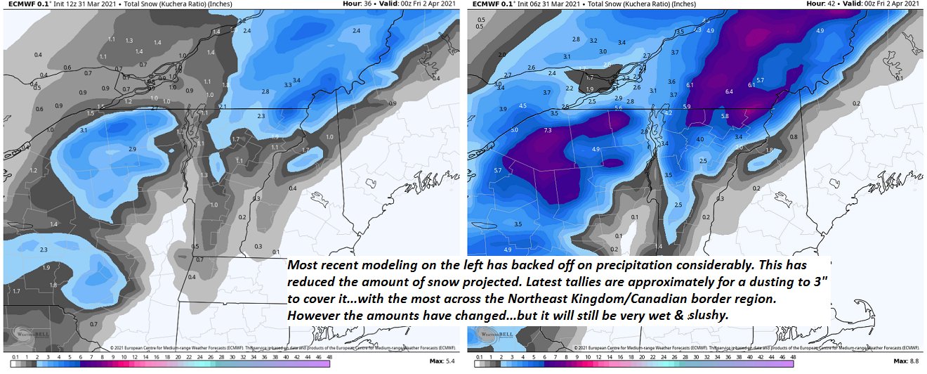
WEDNESDAY: Mostly cloudy. Maybe a rain shower. A low around 32. A high around 55.

Average low ranging thru the 20s Average highs mid-40s to low 50s

Start of Meteorological Summer June 6th… Summer peaks approx.. July 22nd based off local climatology.

RH/4-2 category forecast][end]

Updated Thursday Evening Forecast — April 1st, 2021

TONIGHT: A few stray flurries drying up this evening and becoming partly cloudy. A low upper teens to around 20. Light northwest winds.

TOMORROW: Sunshine mixed with clouds. A high around 32 degrees. Northwest winds 10 mph.

FRIDAY NIGHT: Clear & partially moonlit. A low upper teens to around 20. Light northwest winds.

SATURDAY: Lots of sunshine with more clouds late. A high in the mid-40s. Northwest winds 10 mph.

Looking further ahead…

SATURDAY NIGHT: Scattered clouds or mostly clear. A low 20 to 25.

SUNDAY: Partial morning sun then clouding up. A high near 50.

MONDAY: Sunshine with some late day cloudiness. A low 25 to 30. A high mid to upper 40s.

TUESDAY: Partly sunny. A low upper 20s to near 30. A high 50 to 55.

WEDNESDAY: Mostly cloudy Chance for a rain shower. A low 30 to 35. A high mid-50s to near 60.

Average low ranging thru the 20s Average highs mid-40s to low 50s

Start of Meteorological Summer June 6th… Summer peaks approx.. July 22nd based off local climatology.

RH/4-1 category forecast][end]

Updated Thursday morning forecast — April 1st, 2021

Winter Weather Advisory elevated portions of the Green Mountains thru late today…

TODAY: Cloudy. Periods of wet snow. Accumulation ranging from a dusting to 2” perhaps more Green Mountain summits. Temperatures gradually falling to around 30 late this afternoon. Northwest winds pick up 10 to 15 mph.

TONIGHT: Any leftover flurries exiting to partial clearing. A low in the mid-teens to near 20. Light northwest winds.

FRIDAY: Periods of morning sunshine mixing with more clouds in the afternoon. A high around 32 degrees. Northwest winds 10 mph.

Looking further ahead…

FRIDAY NIGHT: Clear & partially moonlit. A low upper teens to around 20.

SATURDAY: Mostly sunny with a few more clouds later on. A high in the low 40s.

SUNDAY: Partial morning sun then clouding up. A low around 25. A high around 50.

MONDAY: Partly to mostly cloudy. Chance for a snow shower, or rain shower northern & eastern areas. A low upper 20s to near 30. A high 35 to 40.

Average low ranging thru the 20s Average highs mid-40s to low 50s

Start of Meteorological Summer June 6th… Summer peaks approx.. July 22nd based off local climatology.

RH/4-1 category forecast][end]

Updated Wednesday Evening Forecast — March 31st, 2021

Winter Weather Advisory Central and northern Green Mountains/northern Champlain Valley…2 AM Thursday thru 2 AM Friday

TONIGHT: Rain showers…transition to a period of accumulating wet snow after midnight. A dusting to 2” north and west of Barre-Montpelier area. A low 32 to 35. Winds shift to northwest this evening about 10 mph.

TOMORROW: Cloudy. Periods of wet snow. Accumulation dusting to 3” with the most northern Green Mountains and elevated areas of the Northeast Kingdom. Temperatures gradually falling to around 30. Northwest winds pick up 10 to occasionally 20 mph.

THURSDAY NIGHT: Flurries in the evening exiting. Otherwise partial clearing. A low in the mid-teens to near 20. Northwest winds 10 mph.

FRIDAY: Periods of morning sunshine mixing with more clouds in the afternoon. A high around 32 degrees. Northwest winds 10 mph.

Looking further ahead…

FRIDAY NIGHT: Clear & partially moonlit. A low upper teens to around 20.

SATURDAY: Mostly sunny with a few more clouds later on. A high in the low 40s.

SUNDAY: Partial morning sun then clouding up. A low around 25. A high around 50.

MONDAY: Partly to mostly cloudy. Chance for a snow shower, or rain shower northern & eastern areas. A low upper 20s to near 30. A high 35 to 40.

Average low ranging thru the 20s Average highs mid-40s to low 50s

Start of Meteorological Summer June 6th… Summer peaks approx.. July 22nd based off local climatology.

RH/3-31 category forecast][end]

Updated Wednesday Morning Forecast — March 31st, 2021

TODAY: Gray skies. Rain showers arrive the last half of this afternoon toward the Champlain valley. A high upper 50s to 60. South winds 10 to 15 mph breezier toward Lake Champlain.

Winter Weather Advisory C. & N. Green Mountains/northern half of the Champlain Valley…overnight into Thursday night…

TONIGHT: Rain showers…transition to a period of accumulating wet snow after midnight. A dusting to 2” north and west of Barre-Montpelier area. A low 32 to 35. Winds shift to northwest winds 10 mph.

THURSDAY: Cloudy. Wet snow…moderate at times in the morning. Accumulation dusting to 3” east of the Greens, 2 to locally 5” with the most central and northern Green Mountains. Temperatures gradually falling into the upper 20s. Northwest winds pick up 10 to occasionally 20 mph.

Looking further ahead…

THURSDAY NIGHT: Snow showers…tapering to a few isolated flurries. Minor additional accumulation. A low in the upper teens.

FRIDAY: Lots of clouds. Maybe a stray mountain flurry early. A high around 30.

SATURDAY: Mostly sunny with a few more clouds later on. A low 15 to 20. A high near 40.

SUNDAY: Partial morning sun then clouding up. A low upper teens to low 20s. A high near 50.

MONDAY: Partly to mostly cloudy. Chance for a snow shower, or rain shower in the afternoon eastern areas. A low upper 20s to low 30s. A high 40 to 45.

Average low ranging thru the 20s Average highs mid-40s to low 50s

Start of Meteorological Summer June 6th… Summer peaks approx.. July 22nd based off local climatology.

RH/3-30 category forecast][end]

Updated Tuesday Evening Forecast — March 30th, 2021

TONIGHT: Gorgeous evening with high clouds thickening up overnight. Moonlit. A low 35 to 40. South winds 10 mph but brisk near Lake Champlain.

TOMORROW: Gray. A rising chance for rain showers developing late in the afternoon. A high around 60. South winds 10 to 15 mph breezier toward Lake Champlain.

Winter Storm Watch for central and northern Greens Mountains Champlain Valley late Wednesday night into late Thursday night…

WEDNESDAY NIGHT: Overcast.Occasional rain showers mixing with wet snow toward daybreak. A minor coating Champlain Valley and Green Mountains. A low 32 to 35. Northwest winds 10 mph.

THURSDAY: Cloudy. A “wintry mix” transitioning to all snow moderate at times. Accumulation 1 to 3” east of the Greens and 3 to locally 6” wet snow Champlain Valley central and northern Green Mountains. Temperatures gradually falling to near 30 in the afternoon. Northwest winds 10 to 15 mph.

Looking further ahead…

THURSDAY NIGHT: Snow showers…tapering to a few isolated flurries. Minor additional accumulation. A low around 20.

FRIDAY: Lots of clouds. Maybe a stray mountain flurry in the morning. A high in the low 30s.

SATURDAY: Mostly sunny then partly cloudy in the afternoon. A low upper teens to low 20s. A high around 45.

SUNDAY: Partial morning sun then clouding up. Chance for a flurry or sprinkle. A low ranging thru the 20s. A high in the low 50s.

Average low ranging thru the 20s Average highs mid-40s to low 50s

Start of Meteorological Summer June 6th… Summer peaks approx.. July 22nd based off local climatology.

RH/3-30 category forecast][end]

Updated Tuesday Morning Forecast — March 30th, 2021

TODAY: Sunshine a few high clouds this afternoon northern areas. Much warmer turning breezy. A high in the upper 50s to around 60. South breeze 10 to 20 mph and stronger toward Lake Champlain.

TONIGHT: High cloudiness and Moonlit. A low 35 to 40. South winds 10 mph but brisk near Lake Champlain.

WEDNESDAY: Gray. Thickening clouds. A rising chance for rain showers toward the Champlain Valley late. A high around 60. South winds 10 to 15 mph breezier toward Lake Champlain.

Looking further ahead…

WEDNESDAY NIGHT: Overcast.Chance for rain or rain showers mixed with wet snow late, with a minor coating Champlain Valley. A low 32 to 35.

THURSDAY: Cloudy. Chance for a “wintry mix” transitioning to all snow. Accumulation 1 to 3” east of the Greens and 3 to locally 6” wet snow Champlain Valley. Temperatures gradually falling to near 30 in the afternoon.

FRIDAY: Lots of clouds. Maybe a stray mountain flurry. A low around 20. A high in the low 30s.

SATURDAY: Mostly sunny then partly cloudy in the afternoon. A low upper teens to low 20s. A high around 45.

SUNDAY: Mixed clouds & sunshine. A low ranging thru the 20s. A high in the low 50s.

Average low ranging thru the 20s Average highs mid-40s to low 50s

Start of Meteorological Summer June 6th… Summer peaks approx.. July 22nd based off local climatology.

RH/3-30 category forecast][end]

Updated Monday Evening Forecast — March 29th, 2021

TONIGHT: Clear and moonlit skies. A low mid-20s. Light west winds.

TOMORROW: Mostly sunny with a few more high clouds afternoon northern areas. Much warmer turning breezy. A high in the upper 50s to around 60. South breeze 10 to 20 mph and little stronger toward Lake Champlain.

TUESDAY NIGHT: High cloudiness and Moonlit. A low 35 to 40. South winds 10 mph but brisk near Lake Champlain.

WEDNESDAY: Gray. Thickening clouds. A rising chance for rain showers toward the Champlain Valley late. A high in the low 60s. South winds 10 to 15 mph more breezy toward Lake Champlain.

Looking further ahead…

WEDNESDAY NIGHT: Overcast.Chance for rain or rain showers mixed with wet snow late. A low around near 32.

THURSDAY: Cloudy. Chance for a “wintry mix” transitioning to all snow with several inches of accumulation toward the Champlain Valley Temperatures falling through the 30s.

FRIDAY: Lots of clouds. Maybe a stray mountain flurry. A low around 20. A high around 30.

SATURDAY: Mostly sunny then partly cloudy in the afternoon. A low around 20. A high in the upper 40s.

Average low ranging thru the 20s Average highs mid-40s to low 50s

Start of Meteorological Summer June 6th… Summer peaks approx.. July 22nd based off local climatology.

RH/3-29 category forecast][end]

Updated Monday Morning Forecast — March 29th, 2021

Wind Advisory in effect thru 5 PM

TODAY: Clouds with occasional snow showers and a risk of a snow squall a dusting to 2” with the most in elevated northern terrain. Watch for slick spots elevated terrain. Increasing sunshine developing late this morning into the afternoon. Blustery to windy and colder. Temperatures dip this morning below freezing eventually rising into the mid-30s to near 40 this afternoon. West to northwest winds 15 to 35 mph with higher gusts over 50 mph especially southern Greens.

TONIGHT: A few high clouds, otherwise mostly clear and moonlit. A low mid to upper 20s. Light west winds.

TUESDAY: Mostly sunny with a few more high clouds late. A high in the upper 50s to around 60. South breeze 10 to 15 mph.

Looking further ahead…

TUESDAY NIGHT: Partly cloudy with mainly high clouds. A low 35 to 40.

WEDNESDAY: Gray skies with thickening clouds. A rising chance for rain showers in the afternoon. A high around 60.

THURSDAY: Chance for rain…with a transition to accumulating wet snow in the afternoon. A couple of inches possible. A low around near 32. A high mid to upper 30s.

FRIDAY: Mostly cloudy. Maybe a few stray mountain flurries. A low in the low to mid 20s. A high only near 32.

Average low ranging thru the 20s Average highs mid-40s to low 50s

Start of Meteorological Summer June 6th… Summer peaks approx.. July 22nd based off local climatology.

RH/3-29 category forecast][end]

Updated Friday Evening Forecast — March 26th, 2021

Flood Watch in effect thru Saturday Evening…

TONIGHT: Cloudy. Showers mixing with wet snowflakes higher northern terrain before exiting overnight. A low 32 to 35. West winds shifting to northwest 10 to 25 mph with higher gusts in the mountains this evening…decreasing overnight.

TOMORROW: Morning clouds give way to partly sunny skies. A bit colder. A high 45 to 50. Light northwest winds.

SATURDAY NIGHT: Partly cloudy in the evening, then clouding up. A few rain showers late. A low 32 to 35. Light southeast winds picking up 10 to 15 mph overnight.

SUNDAY: Overcast. Periods of light rain…becoming moderate at times in the afternoon. Breezy to windy at times. A high ranging in the 40s. Southeast winds 10 to 20 mph with higher gusts northern Greens.

Looking further ahead…

SUNDAY NIGHT: Rain tapering off as scattered showers before changing to snow showers with a dusting to an inch accumulation. A low around 25.

MONDAY: Clouds and a few leftover snow showers give way to breaks of afternoon sunshine, blustery to windy and colder. A high 35 to 40.

TUESDAY: Clouds mixing with lots of sunshine. An evening low in the mid-20s. A high around 55.

WEDNESDAY: Fair early, then clouding up with rain changing to wet snow. A low 32 to 35. A high reaching into the mid-60s.

Average low mid-teens to upper-20s Average highs low to mid 40s.

Start of Meteorological Summer June 6th… Summer peaks approx.. July 22nd based off local climatology.

RH/3-26-21 category forecast][end]