Updated Friday Morning Forecast — April 9th, 2021

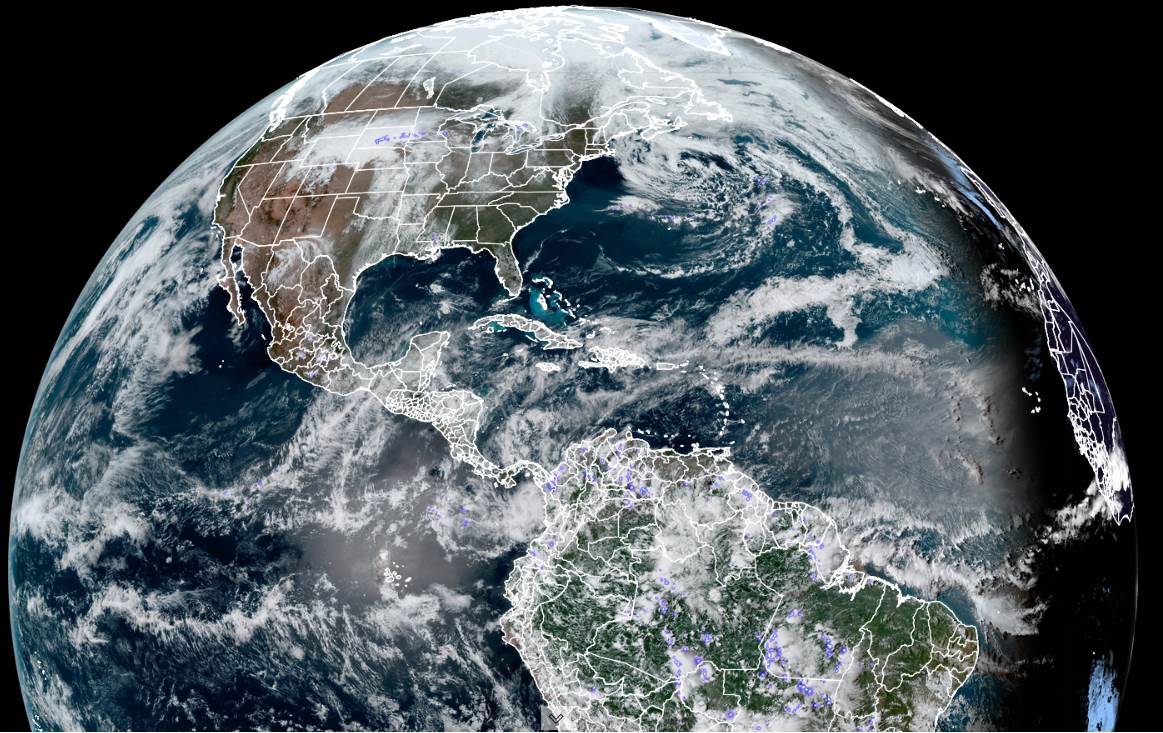
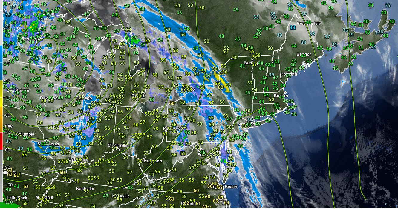
TODAY: A beauty. Sunshine, with high cloudiness arriving later this afternoon. A high in the low 70s. A light south breeze.

TONIGHT: Fair, but with considerable cloudiness. Isolated patches of fog. A low ranging thru the 40s. Light south winds.

SATURDAY: Clouds mixed with periods of sunshine. A high around 70. Light southeast winds.

Looking further ahead…

SATURDAY NIGHT: Partly to mostly cloudy. Patchy valley fog east of the Greens. A low 40 to 45.

SUNDAY: Periods of morning sun, then thickening cloudiness. Isolated late day showers or sprinkles southern and western areas. Cooler. A high in the low 60s.

MONDAY: Some morning sunshine then clouding up. A low around 40. Cooler. A high 55 to 60.

TUESDAY: Mainly cloudy. Maybe…a late day rain shower western areas. A low around 35. A high around 55.

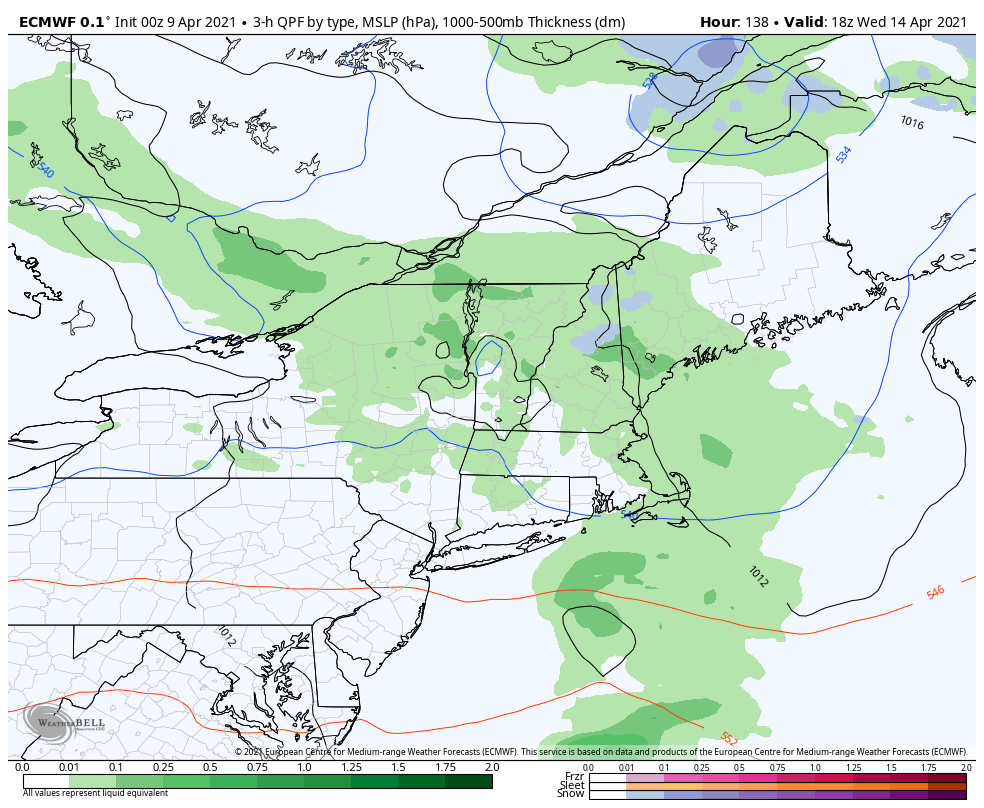
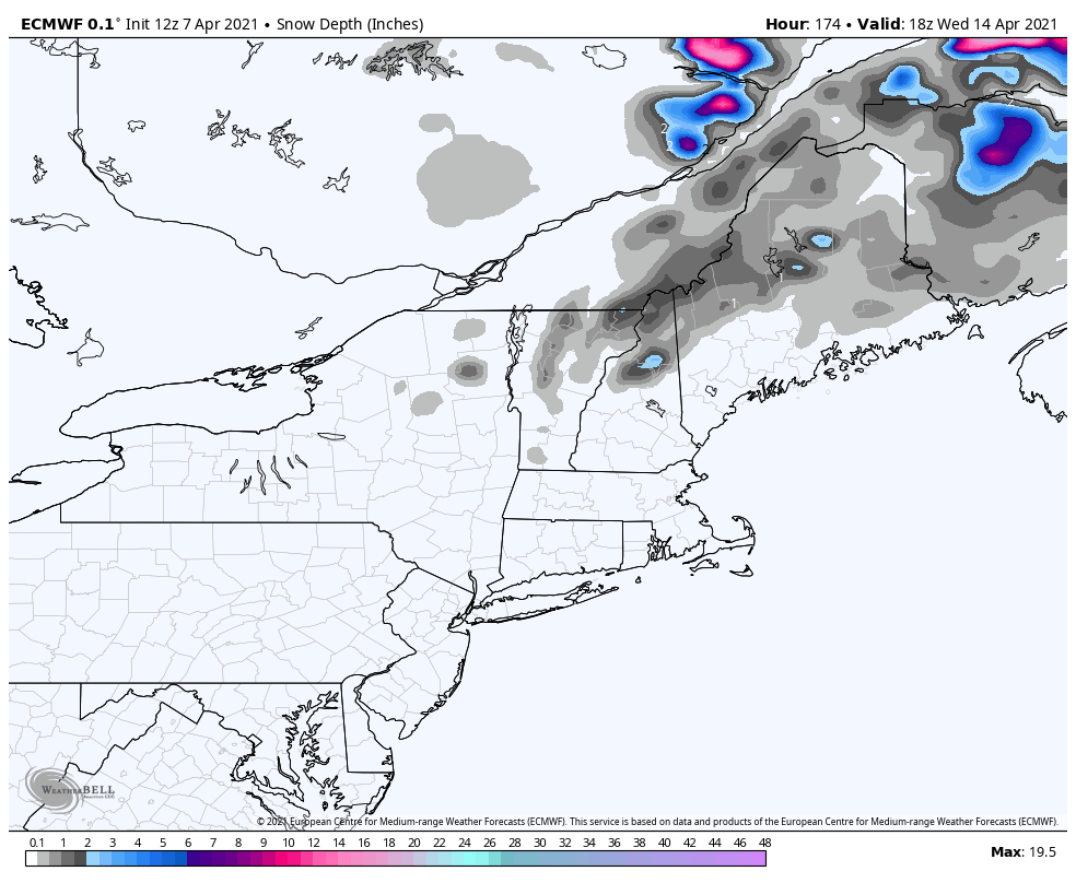
WEDNESDAY: Cloudy. Scattered rain showers possibly wet snowflakes mountain summits. A low 35 to 40.

A high 50 to 55.

Average low in the 30s. Average highs upper-40s to low 50s.

Start of Meteorological Summer June 6th… Summer peaks approx.. July 22nd based off local climatology.

RH/4-9category forecast][end]

Updated Thursday Evening Forecast — April 8th, 2021

TONIGHT: Mostly clear with a few high clouds. Isolated valley fog. A low 40 to 45. Southeast winds 10 mph

TOMORROW: Mostly sunny with high cloudiness arriving in the afternoon. A high around 70. A light south breeze.

FRIDAY NIGHT: Fair with patchy high clouds. Patchy valley fog. A low in the low to mid 40s. Light south winds.

SATURDAY: Periods of sun with increasing clouds later on. A high in the low 70s. Light southeast winds.

Looking further ahead…

SATURDAY NIGHT: Partly cloudy. A low 40 to 45.

SUNDAY: Periods of morning sun, then thickening cloudiness. A rising chance for rain showers later in the afternoon, mainly western areas. A high in the low 60s.

MONDAY: Lots of clouds. Chance for light rain showers especially western areas. A low around 40. Cooler. A high 55 to 60.

TUESDAY: Mainly cloudy. Chance for light rain showers. A low around 35. A high around 55.

WEDNESDAY: Considerable cloudiness. Scattered rain showers possibly wet snowflakes mountain summits. A low 35 to 40. A high 50 to 55.

Average low in the 30s. Average highs upper-40s to low 50s

Start of Meteorological Summer June 6th… Summer peaks approx.. July 22nd based off local climatology.

RH/4-8category forecast][end]

Updated Thursday Morning Forecast — April 8th, 2021

TODAY: A few clouds northern areas otherwise mostly sunny. A high 65 to 70. Light northeast winds.

TONIGHT: Mostly clear with a few high clouds. Isolated valley fog. A low around 40. Southeast winds 10 mph

FRIDAY: Mostly sunny with high cloudiness arriving in the afternoon. A high in the upper 60s to around 70. A light south breeze.

Looking further ahead…

FRIDAY NIGHT: Fair with patchy high clouds. Patchy valley fog. A low around 45.

SATURDAY: Periods of sun with increasing clouds later on. A high around 70.

SUNDAY: Periods of morning sun, then thickening cloudiness. A rising chance for rain showers later in the afternoon, mainly western areas. A low 40 to 45. A high around 60.

MONDAY: Gray. Chance for light rain showers. Areas of fog. A low around 40. Cooler. A high around 55.

TUESDAY: Overcast. Chance for light rain showers. A low around 35. A high around 50.

WEDNESDAY: Mostly cloudy. Scattered rain showers possibly mixed with wet snow in the higher terrain. A low in the mid-30s. A high 45 to 50.

Average low in the 30s. Average highs upper-40s to low 50s

Start of Meteorological Summer June 6th… Summer peaks approx.. July 22nd based off local climatology.

RH/4-8category forecast][end]

Updated Wednesday Evening Forecast — April 7th, 2021

TONIGHT: Mostly clear this evening then partly cloudy overnight. Patchy valley fog. A low upper 30s to mid-40s. Light east winds.

TOMORROW: More sunshine than clouds. A high 65 to 70. Light northeast winds.

THURSDAY NIGHT: Mostly clear. Isolated valley fog. A low 40 to 45. Southeast winds 10 mph

FRIDAY: Partly to mostly sunny. A high in the upper 60s to around 70. A light south breeze.

Looking further ahead…

FRIDAY NIGHT: Patchy valley fog. A low in the 40s

SATURDAY: Periods of morning sun with increasing clouds later on. A high around 70.

SUNDAY: Thickening cloudiness. A rising chance for rain showers in the afternoon, southern and western areas, dry toward the Northeast Kingdom. A low 40 to 45. A high upper 50s to near 60.

MONDAY: Clouds with intervals of sun northern areas. Chance for rain showers mainly southern and western areas. A low 40 to 45. A little cooler. A high in upper 50s to around 60.

Average low in the upper 20s to low 30s. Average highs upper-40s to low 50s

Start of Meteorological Summer June 6th… Summer peaks approx.. July 22nd based off local climatology.

RH/4-7 category forecast][end]

Updated Wednesday Morning Forecast — April 7th, 2021

TODAY: Morning cloudiness mixing with intervals of sunshine this afternoon. A high in the low 60s. Light north winds.

TONIGHT: Scattered clouds. A low upper 30s to mid-40s. Light northeast winds.

THURSDAY: Morning sun…then cloudy periods. A high 65 to 70. Light east winds.

Looking further ahead…

THURSDAY NIGHT: Mostly clear. A low 40 to 45.

FRIDAY: Morning sun, then partly sunny in the afternoon. A high in the upper 60s to around 70.

SATURDAY: Periods of morning sun with increasing clouds later on. A low in the 40s. A high around 70.

SUNDAY: Thickening cloudiness. A rising chance for rain showers in the afternoon, southern and western areas, dry toward the Northeast Kingdom. A low 40 to 45. A high upper 50s to near 60.

MONDAY: Clouds with intervals of sun northern areas. Chance for rain showers mainly southern and western areas. A low 40 to 45. A little cooler. A high in upper 50s to around 60.

Average low in the upper 20s to low 30s. Average highs upper-40s to low 50s

Start of Meteorological Summer June 6th… Summer peaks approx.. July 22nd based off local climatology.

RH/4-7 category forecast][end]

Updated Tuesday Evening forecast — April 6th, 2021

TONIGHT: Mostly clear except cloudiness toward the Northeast Kingdom. A low around 35 degrees. Light north to northeast winds.

TOMORROW: High cloudiness, then mostly sunny. A high near 60. Light north winds.

WEDNESDAY NIGHT: Scattered clouds or mostly clear. Patchy valley fog. A low mid to upper 30s. Light northeast winds.

THURSDAY: Morning sun…then few more afternoon clouds. A high around 65. Light east winds.

Looking further ahead…

THURSDAY NIGHT: Mostly clear. A low 35 to 40.

FRIDAY: Morning sun, then more afternoon clouds. A high in the mid-60s.

SATURDAY: Partly to mostly sunny. A low in the low to mid 40s. A high mid to upper 60s.

SUNDAY: Thickening cloudiness. A rising chance for rain showers in the afternoon. A low 40 to 45. A high upper 50s to near 60.

MONDAY: Mainly cloudy. Chance for rain showers. A low 40 to 45. A high upper 40s to near 50.

Average low in the upper 20s to low 30s. Average highs upper-40s to low 50s

Start of Meteorological Summer June 6th… Summer peaks approx.. July 22nd based off local climatology.

RH/4-6 category forecast][end]

Updated Tuesday Morning Forecast — April 6th, 2021

TODAY: Partly sunny, except considerable cloudiness Northeast Kingdom with a sprinkle or two northeast of Island Pond. A high near 55. Northwest winds 10 to 15 mph.

TONIGHT: Partly cloudy. A low around 35 degrees. Light north to northeast winds.

WEDNESDAY: Considerable high cloudiness mixed with intervals of sun. A high upper 50s to near 60. Light north winds.

Looking further ahead…

WEDNESDAY NIGHT: Scattered clouds or mostly clear. Patchy valley fog. A low around 35.

THURSDAY: Morning sun…then variable cloudiness. A high near 65.

FRIDAY: Partly sunny. A low in the upper 30s. A high in the mid-60s.

SATURDAY: Mostly sunny in the morning then partly cloudy. A low in the low to mid 40s. A high in the pushing toward 70.

SUNDAY: Considerable cloudiness. A rising chance for rain showers. A low around 45. A high 60 to 65.

Average low in the upper 20s to low 30s. Average highs upper-40s to low 50s

Start of Meteorological Summer June 6th… Summer peaks approx.. July 22nd based off local climatology.

RH/4-6 category forecast][end]

Updated Monday Evening Forecast — April 5th, 2021

Red Flag Warning Champlain and Connecticut River Valleys into most of southern Vermont thru 7 PM.

TONIGHT: Partly cloudy. A low in the upper 20s to low 30s. North winds becoming light.

TOMORROW: More clouds than sun northeast Vermont with a few snowflakes, partly sunny skies elsewhere. A high near 55. Northwest winds 10 to 15 mph.

TUESDAY NIGHT: Partly cloudy but mostly clear southern areas. A low around 35 degrees. Light north to northeast winds.

WEDNESDAY: Partly sunny. A high upper 50s to near 60. Light north winds.

Looking further ahead…

WEDNESDAY NIGHT: Scattered clouds or mostly clear. A low around 35.

THURSDAY: Morning sun…with a few more afternoon clouds. A high in the mid-60s.

FRIDAY: Mostly sunny. A low in the upper 30s. A high in the mid-60s.

SATURDAY: Mostly sunny. A low around 40. A high in the mid-60s.

Average low in the upper 20s to low 30s. Average highs upper-40s to low 50s

Start of Meteorological Summer June 6th… Summer peaks approx.. July 22nd based off local climatology.

RH/4-5 category forecast][end]

Updated Monday Morning Forecast — April 5th, 2021

Red Flag Warning Champlain and Connecticut River Valleys into most of southern Vermont

TODAY: Lots of clouds toward the Northeast Kingdom with a possible late afternoon shower mixed with wet snow flakes, otherwise mixed clouds and sun elsewhere. A high mid-40s to near 50. Northwest winds 10 to occasionally 25 mph…prompting high fire danger… with higher gusts toward Champlain valley.

TONIGHT: Partly cloudy. A low ranging thru the 30s. Light northwest winds.

TUESDAY: More clouds than sun Northeast with partly sunny skies elsewhere. A high 50 to 55. Northwest winds 10 to 15 mph.

Looking further ahead…

TUESDAY NIGHT: Partly cloudy but mostly clear southern areas. A low around 32 degrees.

WEDNESDAY: Partly sunny. A high near 60.

THURSDAY: Morning sun…gives way to more clouds. A low around 35. A high in the mid-60s.

FRIDAY: Partly sunny. A low around 40. A high in the mid-60s.

SATURDAY: Mostly sunny. A low 40 to 45. A high in the mid-60s.

Average low in the upper 20s to low 30s. Average highs upper-40s to low 50s

Start of Meteorological Summer June 6th… Summer peaks approx.. July 22nd based off local climatology.

RH/4-5 category forecast][end]

Updated Friday Evening Forecast — April 2nd, 2021

TONIGHT: Evening cloudiness then clearing to partially moonlit skies. A low 15 to 20. Light northwest winds.

TOMORROW: Lots of sunshine with a few high clouds late. A high in the mid-40s. Northwest winds 10 mph.

SATURDAY NIGHT: Mostly clear & partially moonlit. A low 20 to 25. Little wind.

SUNDAY: Clouds mixing with periods of sunshine. A high near 50. Northwest breeze 10 to 15 mph.

Looking further ahead…

SUNDAY NIGHT: Partly cloudy. A low 25 to 30.

MONDAY: Considerable cloudiness. A high mid to upper 40s.

TUESDAY: Partly sunny. A low 25 to 30. A high 50 to 55.

WEDNESDAY: Mixed clouds and sun. A low around 32. A high mid-50s.

Average low ranging thru the 20s Average highs mid-40s to low 50s

Start of Meteorological Summer June 6th… Summer peaks approx.. July 22nd based off local climatology.

RH/4-2 category forecast][end]