
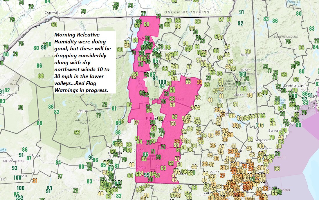
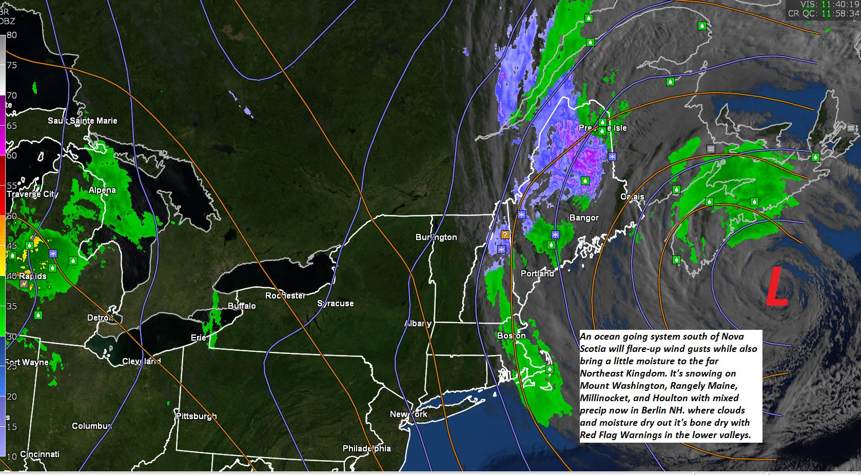
Red Flag Warning Champlain and Connecticut River Valleys into most of southern Vermont
TODAY: Lots of clouds toward the Northeast Kingdom with a possible late afternoon shower mixed with wet snow flakes, otherwise mixed clouds and sun elsewhere. A high mid-40s to near 50. Northwest winds 10 to occasionally 25 mph…prompting high fire danger… with higher gusts toward Champlain valley.
TONIGHT: Partly cloudy. A low ranging thru the 30s. Light northwest winds.
TUESDAY: More clouds than sun Northeast with partly sunny skies elsewhere. A high 50 to 55. Northwest winds 10 to 15 mph.
Looking further ahead…
TUESDAY NIGHT: Partly cloudy but mostly clear southern areas. A low around 32 degrees.
WEDNESDAY: Partly sunny. A high near 60.
THURSDAY: Morning sun…gives way to more clouds. A low around 35. A high in the mid-60s.
FRIDAY: Partly sunny. A low around 40. A high in the mid-60s.
SATURDAY: Mostly sunny. A low 40 to 45. A high in the mid-60s.
Average low in the upper 20s to low 30s. Average highs upper-40s to low 50s
Start of Meteorological Summer June 6th… Summer peaks approx.. July 22nd based off local climatology.
RH/4-5 category forecast][end]
