Updated Tuesday Morning Forecast — July 20th, 2021

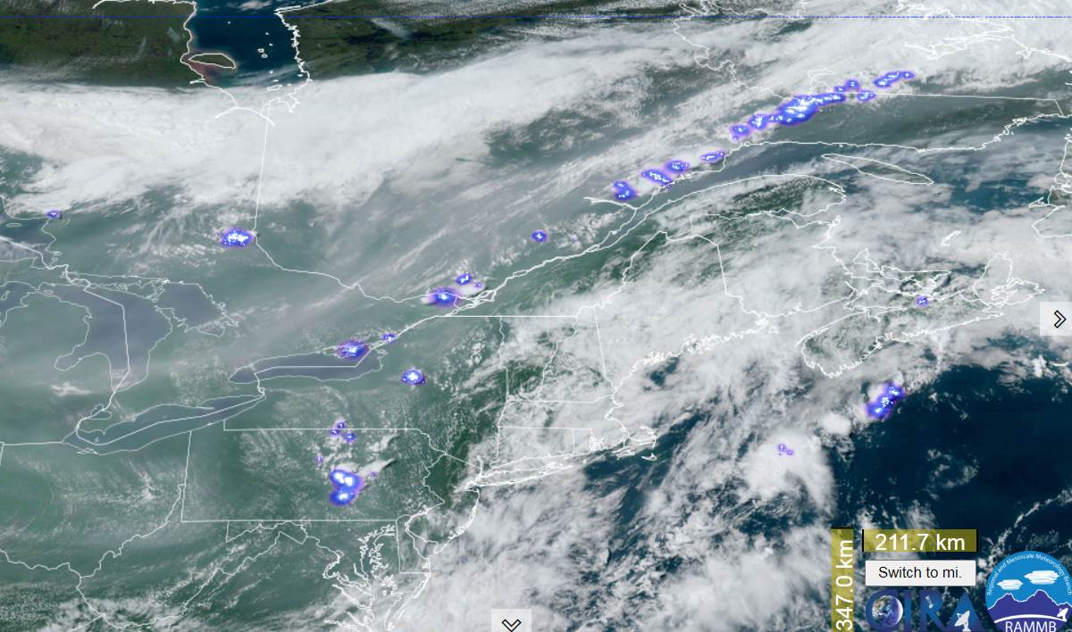
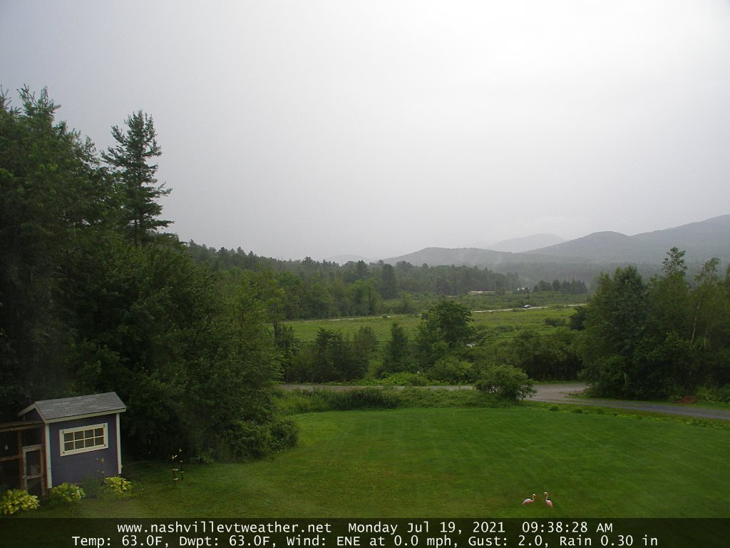
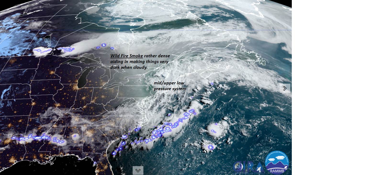
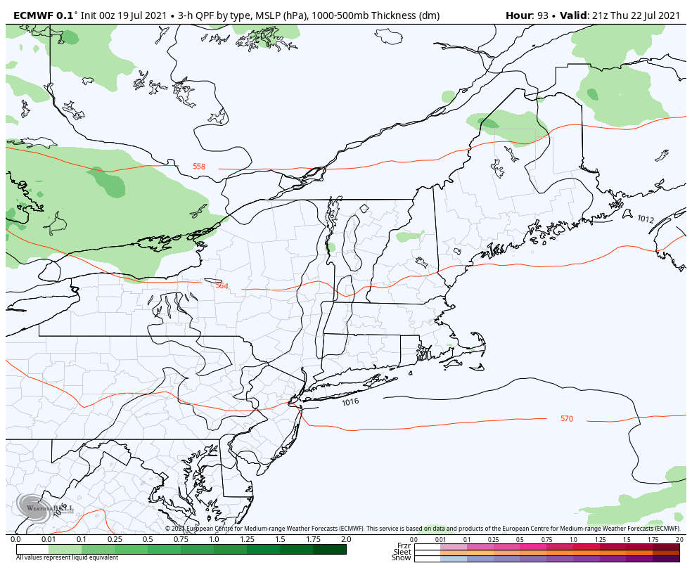
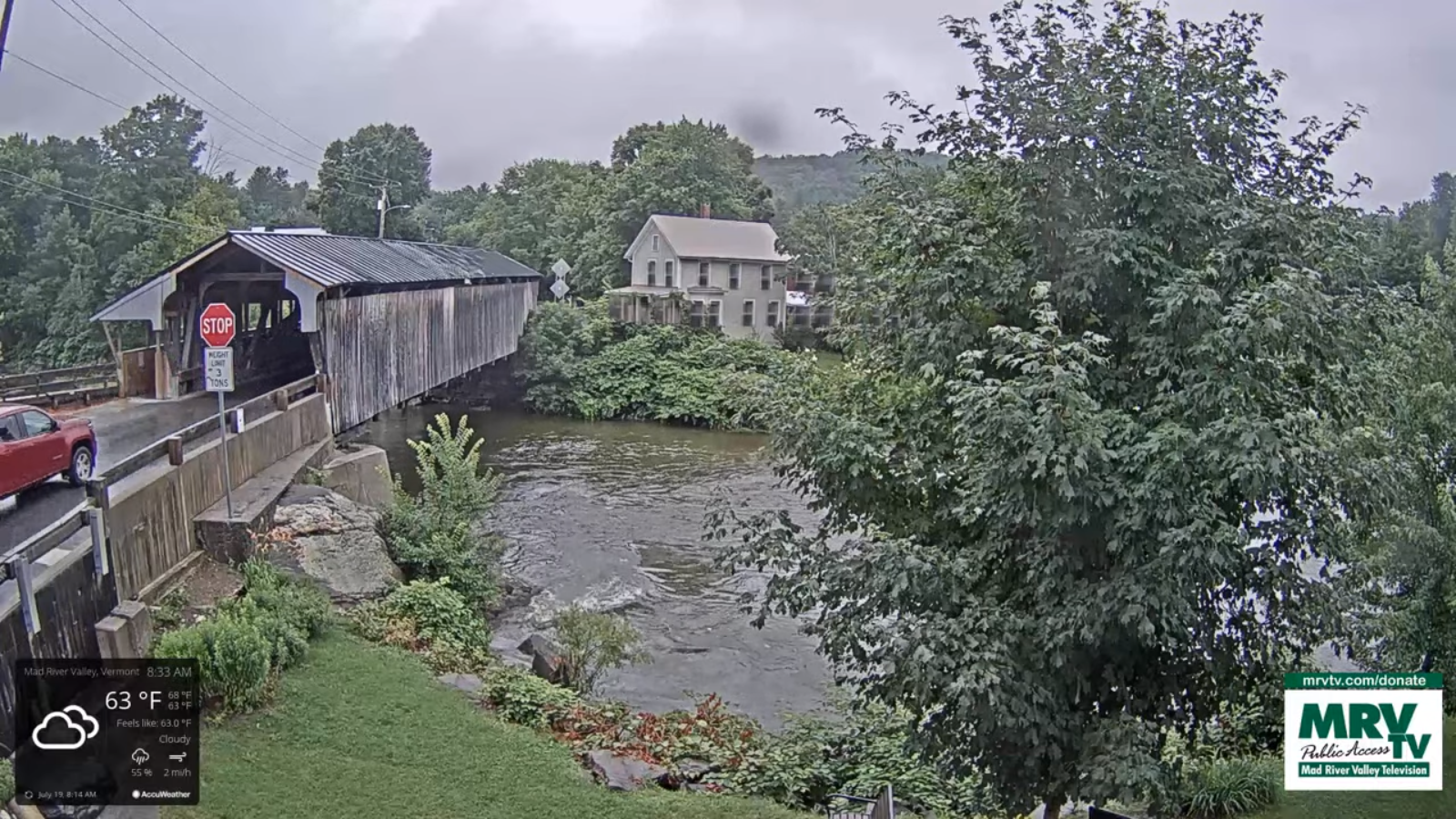
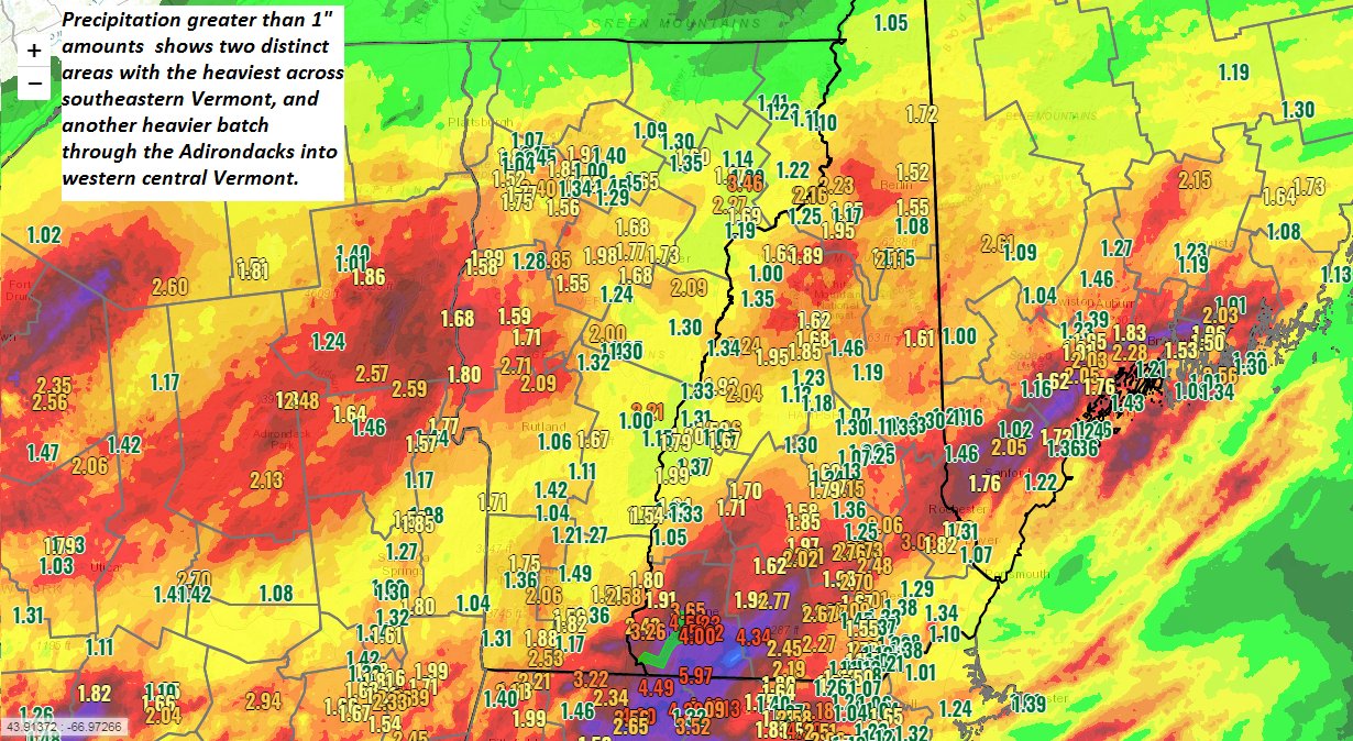
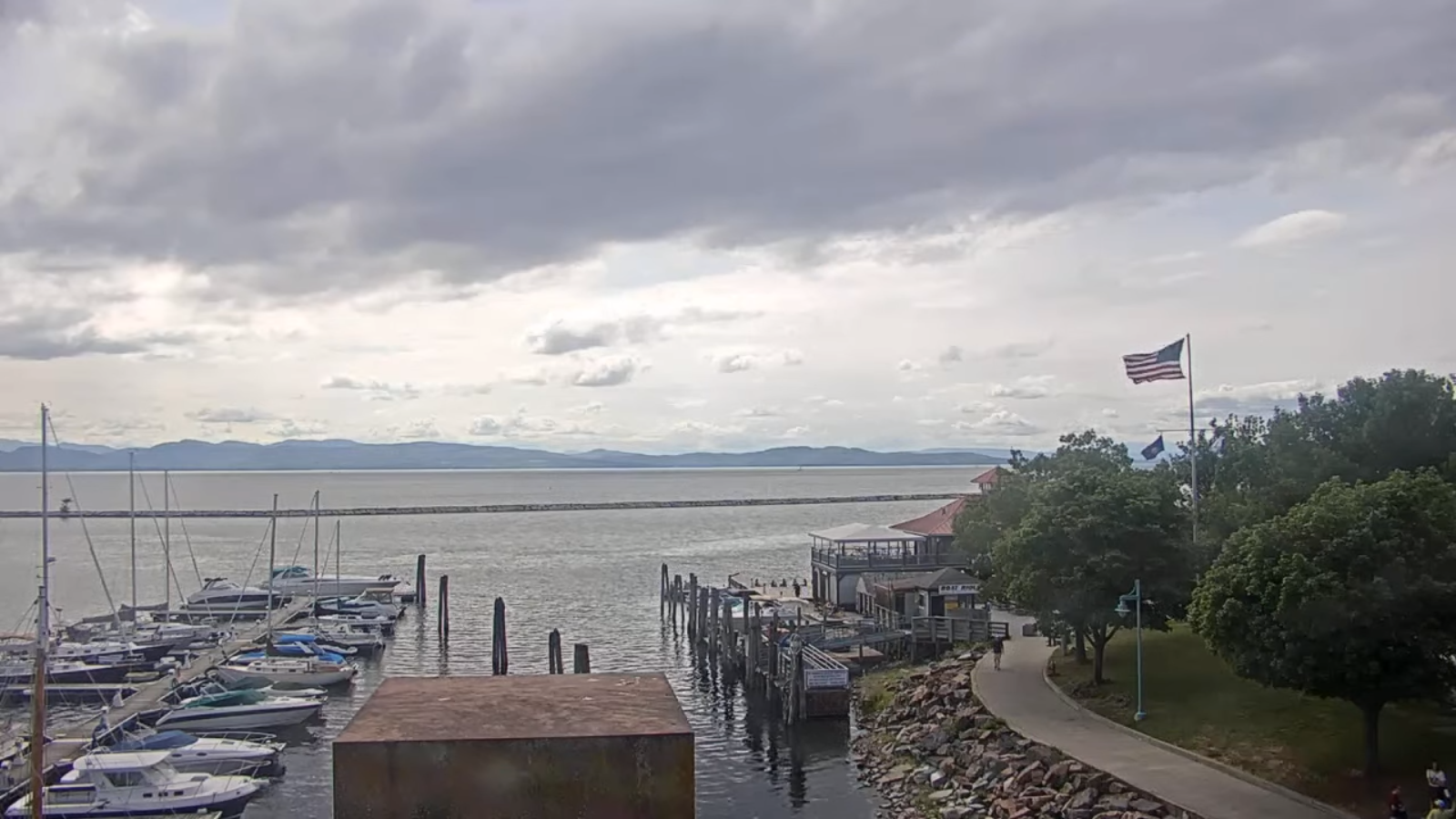
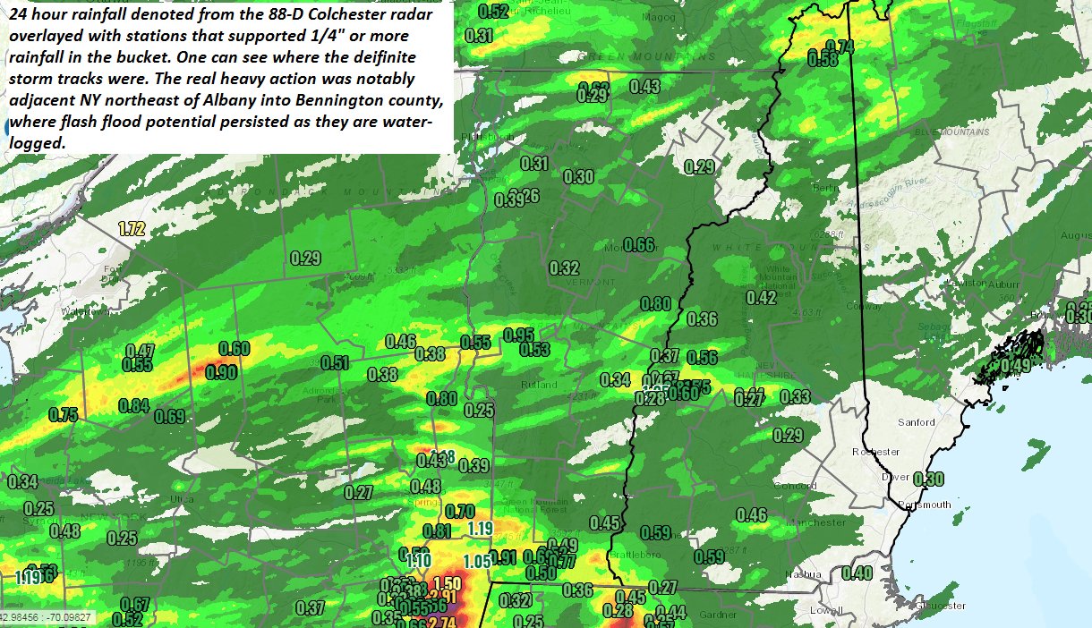
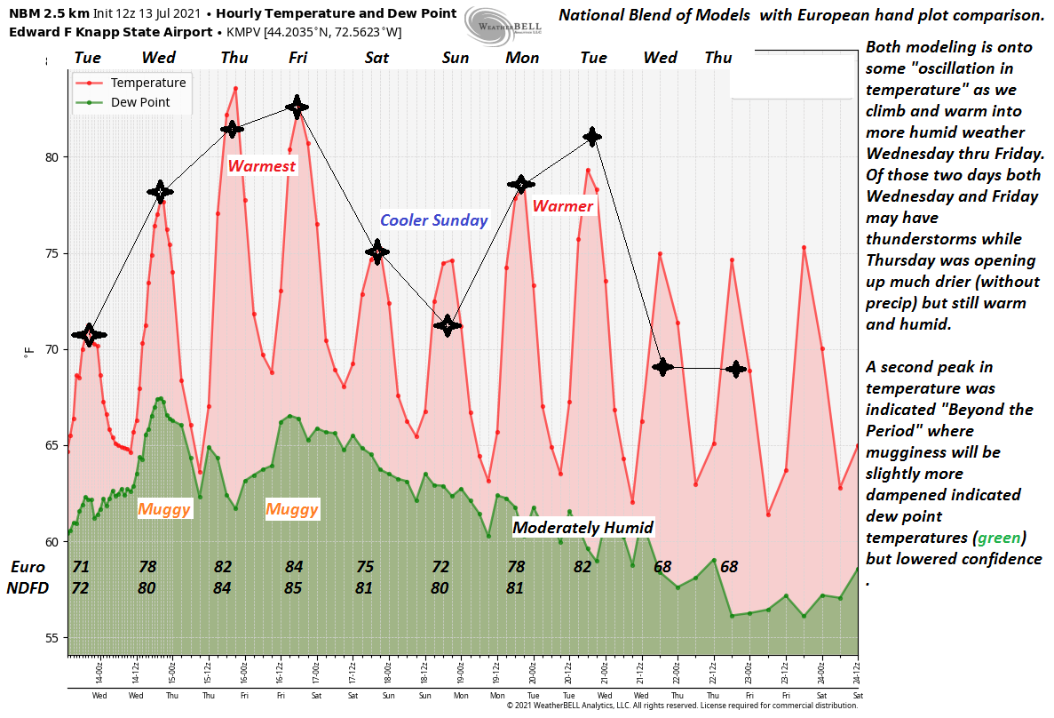
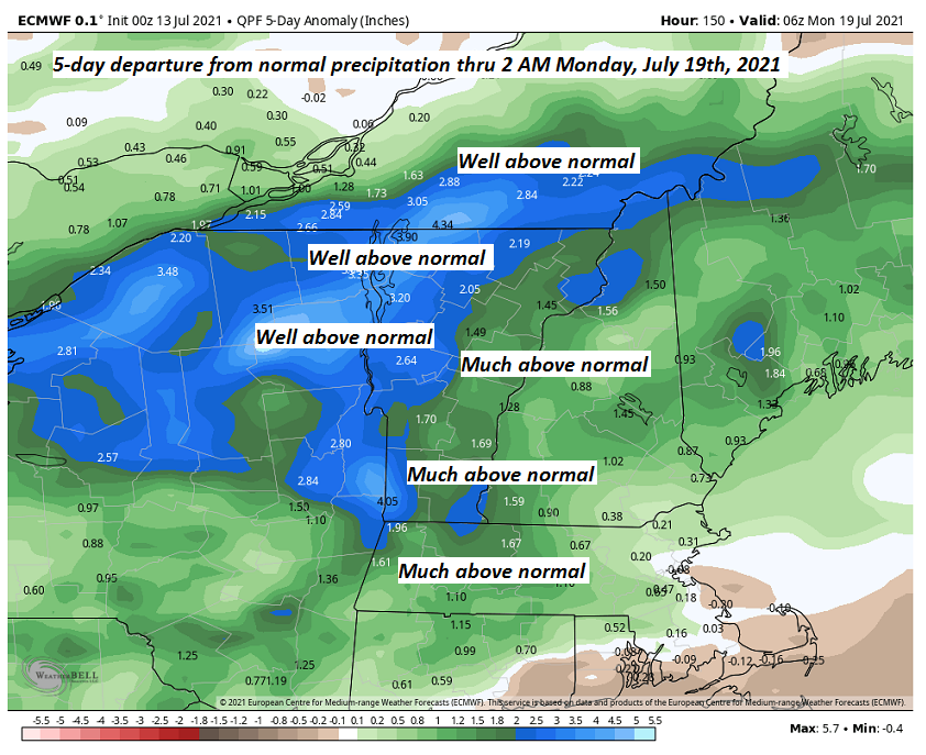
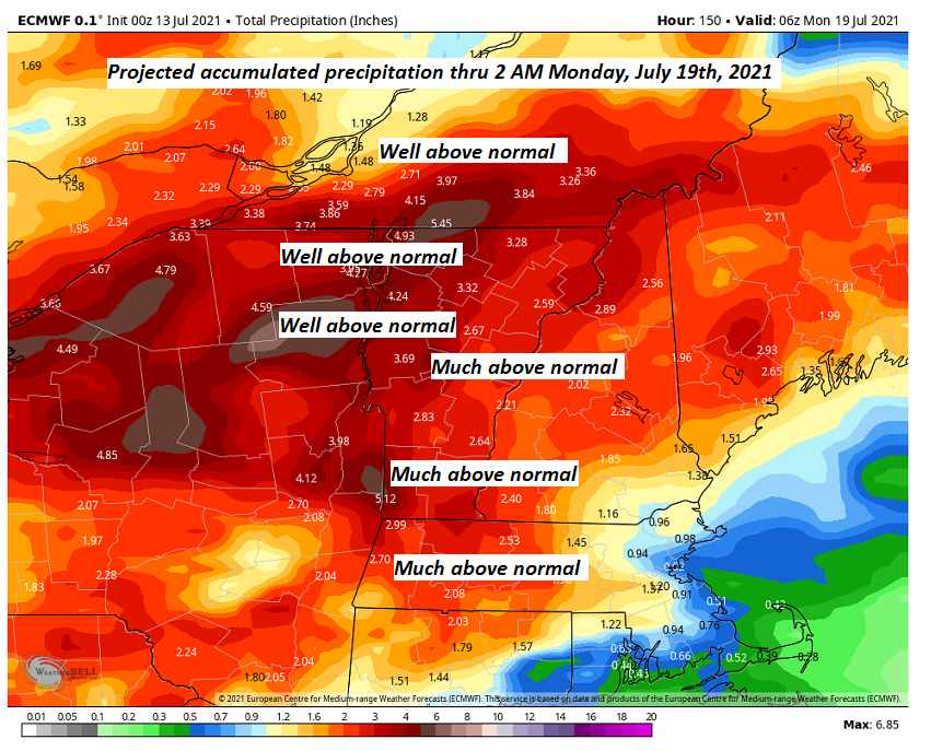
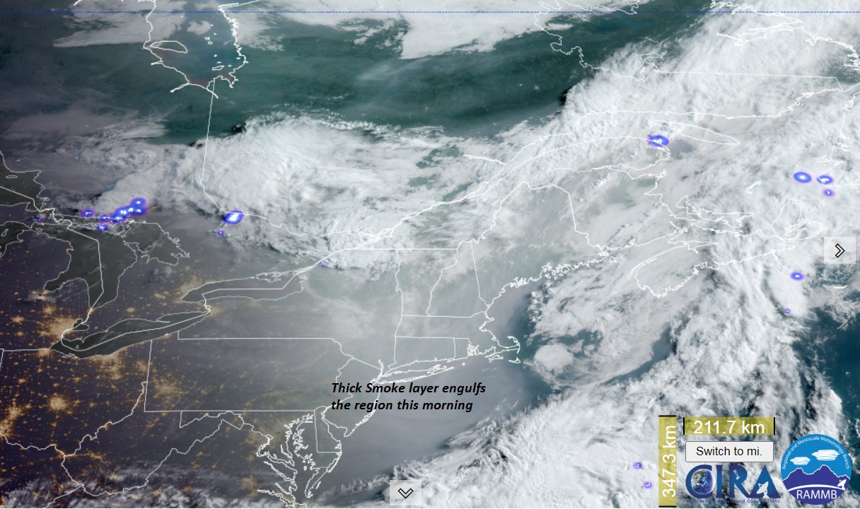
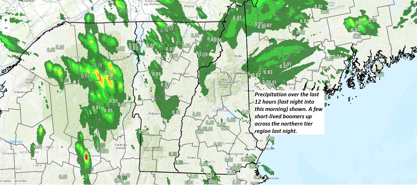
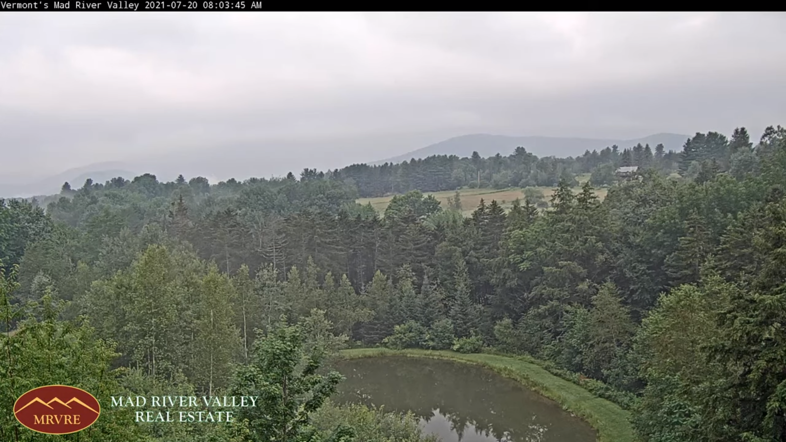
TODAY: Morning fog burns off to partial sunshine. Considerable afternoon clouds…with showers likely, and a chance for a thunderstorm.Muggy. A high upper 70s to around 80. Light west winds.

TONIGHT: Scattered showers and a few thunderstorms northern areas & western areas early evening with more toward midnight northern Vermont …some locally heavy. Otherwise mostly cloudy. A low in the low 60s. Light southwest winds.

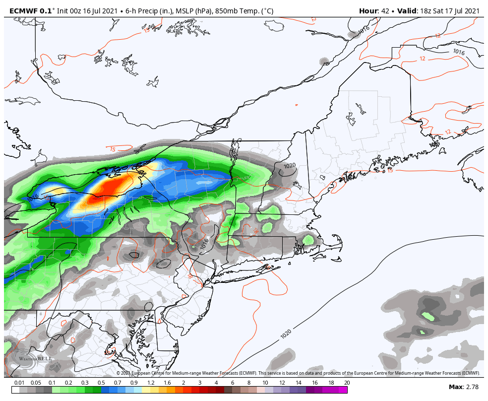
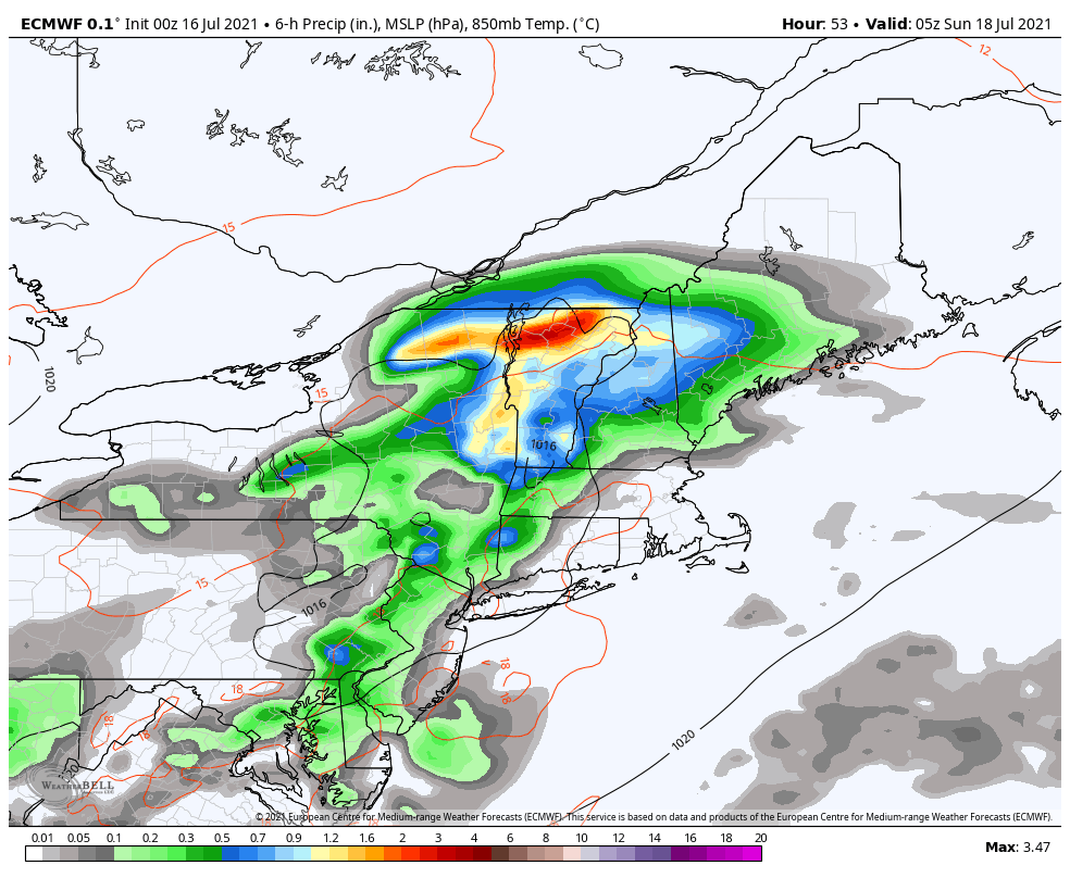
WEDNESDAY: Lots of clouds and cooler. Lingering showers likely with a rumble or two of afternoon thunder. A high 70 to 75. Wind becoming northwesterly 10 to 15 mph.

Looking further ahead…

WEDNESDAY NIGHT: A leftover early evening shower, then clearing skies. Considerable valley fog overnight. A low around 55.

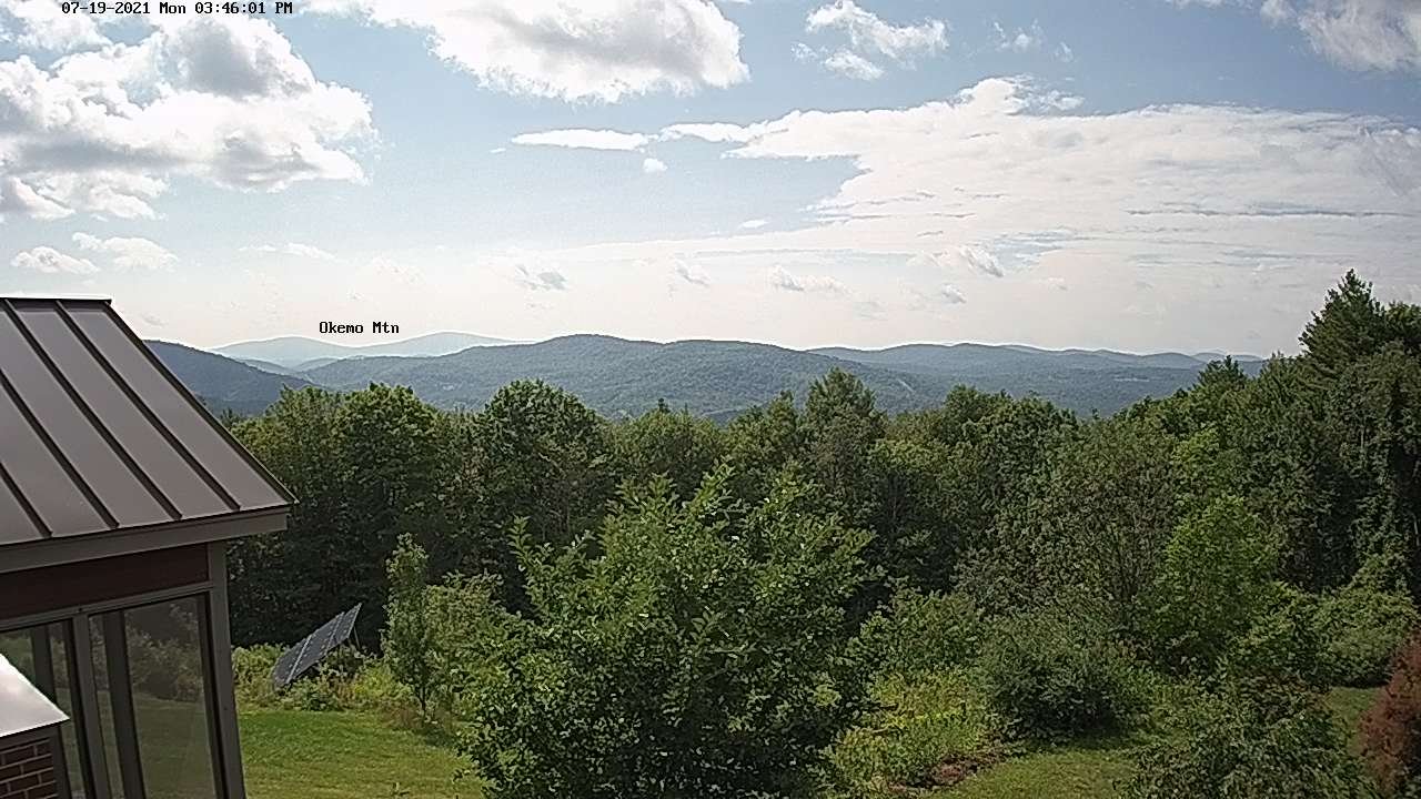
THURSDAY: Pick of the week. Morning clouds and fog especially northern areas, then partly sunny. A high low to mid 70s.

FRIDAY: Partial morning sun then afternoon clouds. Isolated to widely scattered showers in the afternoon. A low 50 to 55. A high low to mid 70s.

SATURDAY: Mostly sunny. A low 50 to 55. A high 70 to 75.

SUNDAY: Cloudy. Chance for rain or showers toward southern areas. A low in the mid-50s. A high 70 to 75.

Average low mid-50s to low 60s. Average highs in the upper-70s to low 80s.

Meteorological summer peaks approx. July 22nd based off local climatology.

RH/7-19forecast][end]

Updated Monday Evening Forecast — July 19th, 2021

TONIGHT: An isolated shower or two, otherwise becoming partly cloudy & hazy. Considerable valley fog. A low in the low 60s. Light west winds.

TOMORROW: Partial sunshine then more afternoon clouds. Showers likely northern areas with isolated late day thunderstorms northern areas. Muggy. A high upper 70s to around 80. Light west winds.

TUESDAY NIGHT: Scattered showers and a chance for a thunderstorm northern areas. Otherwise cloudy. A low in the low 60s. Light southwest winds.

WEDNESDAY: Lots of clouds and cooler. Lingering showers. A high lower 70s. Wind becoming northwesterly 10 to 15 mph.

Looking further ahead…

WEDNESDAY NIGHT: A leftover early evening shower, then clearing. A low around 55.

THURSDAY: Pick of the week. Sunshine mixed with high clouds and not so humid. A high 70 to 75.

FRIDAY: Partial morning sun then cloudy. Scattered showers. A low 50 to 55. A high 70 to 75.

SATURDAY: Mostly sunny. A low in the low 50s. A high near 75.

Average low mid-50s to low 60s. Average highs in the upper-70s to low 80s.

Meteorological summer peaks approx. July 22nd based off local climatology.

RH/7-19forecast][end]

Updated Monday Morning Forecast — July 19th, 2021

TODAY: Morning showers give wayto afew intervals of afternoon sunshine. Widely scattered showers redevelop late northwestern areas, maybe a thunderstorm. A high in the low to mid 70s. Light north winds.

TONIGHT: Isolated showers with few rumbles of thunder possible, otherwise becoming partly cloudy. Considerable valley fog. A low near 60. Light west winds.

TUESDAY: Partial sunshine then more afternoon clouds. Chance for mainly afternoon showers and thunderstorms, one or two could be strong & locally heavy northern/western areas. Muggy. A high in the low 80s. Light southwest winds.

Looking further ahead…

TUESDAY NIGHT: Scattered showers and locally heavy thunderstorms possible in the evening northern areas. Otherwise mostly cloudy. A low near 60.

WEDNESDAY: Mainly gray skies. Lingering showers…maybe a rumble of thunder. A high near 70.

THURSDAY: Pick of the week. Sunshine filtered thru high clouds. Moderately humid. A low around 55. A high near 75.

FRIDAY: Considerable cloudiness. Chance for rain or showers. A low 50 to 55. A high 70 to 75.

Average low mid-50s to low 60s. Average highs in the upper-70s to low 80s.

Meteorological summer peaks approx. July 22nd based off local climatology.

RH/7-19forecast][end]

Updated Friday Evening Forecast — July 16th, 2021

TONIGHT: Variable clouds this evening, then thickening clouds. Not so humid. A low near 60. Little wind.

TOMORROW: Overcast & increasingly damp and wet. Rising chance for showers southern areas late morning on. Showers spreading across the region early to midafternoon. Cooler, with a high 70 to 75. Little wind becoming light southeasterly.

SATURDAY NIGHT: Overcast. Periods of rain, moderate to heavy at times, maybe a thunderstorm. Areas of fog.A low near 65. Light southeast winds.

SUNDAY: Gray skies, Wet, damp and cooler. Periods of rain moderate at times. Maybe a rumble of thunder. A high around 70. Variable winds 10 mph.

Looking further ahead…

SUNDAY NIGHT: Lingering showers likely otherwise cloudy areas of drizzle and fog. A low around 60.

MONDAY: Morning showers exiting to partial afternoon sunshine. A high 75 to 80.

TUESDAY: Partial sunshine then more afternoon clouds. Chance for afternoon showers and thunderstorms, one or two strong & locally heavy. A low 60 to 65. A high 75 to 80.

WEDNESDAY: Partly to mostly cloudy. Lingering showers early, chance for a shower or thunderstorm in the afternoon. A low 60 to 65. A high in the lower 70s.

Average low mid-50s to low 60s. Average highs in the upper-70s to low 80s.

Meteorological summer peaks approx. July 22nd based off local climatology.

RH/7-16forecast][end]

Updated Friday morning forecast — July 16th, 2021

TODAY: Scattered showers this morning, transiting to southern areas and becoming isolated this afternoon. Otherwise breaks of sunshine. Muggy. A high near 80. Southwest winds this morning, shifting to northwesterly this afternoon 10 mph.

TONIGHT: Fair & dry this evening, then clouding up. Not so humid. A low 60 to 65. Little wind.

SATURDAY: Considerable cloudiness & increasingly damp and wet. Rising chance for showers southern areas late morning on. Showers in the afternoon…moderate at times. Cooler, with a high in the lower 70s. Little wind.

Looking further ahead…

SATURDAY NIGHT: Overcast. Periods of rain likely…moderate at times with a chance for thunderstorm. A low 60 to 65.

SUNDAY: Chance for a few leftover showers in the morning. Otherwise considerable cloudiness with a few breaks of late day sun. A high in the mid-70s.

MONDAY: Fair but with considerable high cloudiness. A low around 60. A high around 80.

TUESDAY: Partial sunshine then more afternoon clouds. Chance for afternoon showers and thunderstorms, one or two strong. A low 60 to 65. A high 75 to 80.

WEDNESDAY: Partly to mostly cloudy. Lingering showers early, chance for a shower or thunderstorm in the afternoon. A low

60 to 65. A high 70 to 75.

Average low mid-50s to low 60s. Average highs in the upper-70s to low 80s.

Meteorological summer peaks approx. July 22nd based off local climatology.

RH/7-16forecast][end]

Updated Thursday Night Forecast — July 15th, 2021

TONIGHT: Scattered evening clouds, then clouding up. Sticky. Chance for showers northern areas around midnight on, maybe a rumble of thunder. A low upper 60s to 70. Light south to southwest winds, stronger toward Lake Champlain.

TOMORROW: Scattered morning showers, northern, central areas exiting to isolated showers southern areas in the afternoon. Otherwise intervals of afternoon sun. Muggy. A high in the lower 80s. Winds becoming northwesterly 10 mph.

FRIDAY NIGHT: Fair & dry in the evening, then clouding up. A rising chance for showers western areas. A low 60 to 65. Little wind.

SATURDAY: Clouds mixed with intervals of sun. Threat for showers developing late morning on…remaining dry far northern areas. Not so muggy with a high 70 to 75. Light southeast winds.

Looking further ahead…

SATURDAY NIGHT: Chance for showers or periods of rain, moderate at times. A low near 60.

SUNDAY: Gray skies. Chance for periods of rain or showers…maybe rumble of thunder. A high in the mid-70s to near 80.

MONDAY: Partly to mostly cloudy. Chance for showers and afternoon thunderstorms. A low 60 to 65 A high around 80.

TUESDAY: Partly to mostly cloudy. Chance for showers and afternoon thunderstorms. A low 60 to 65. A high around 80.

Average low mid-50s to low 60s. Average highs in the upper-70s to low 80s.

Meteorological summer peaks approx. July 22nd based off local climatology.

RH/7-15forecast][end]

Updated Thursday Morning Forecast — July 15th, 2021

TODAY: Pick of the week. Morning fog then more sunshine than clouds. Warm and humid. A high near 85. Light south breeze stronger near Lake Champlain.

TONIGHT: Scattered evening clouds, then clouding up. Sticky. Chance for showers maybe a rumble of thunder overnight. A low upper 60s to 70. Light south to southwest winds.

FRIDAY: Scattered morning showers eventually exiting southeastward. Clouds mixing intervals of sun. Muggy. A high in the lower 80s. Light northwest winds.

Looking further ahead…

FRIDAY NIGHT: Fair & dry in the evening, then clouding up. A low in the lower 60s.

SATURDAY: Clouds mixed with intervals of sun. Chance for afternoon showers possibly a thunderstorm toward Rutland spreading into northern areas late. Not so muggy with a high around 75.

SUNDAY: Gray skies. Chance for periods of rain or showers…maybe rumble of thunder. A low 60 to 65. A high in the mid to upper 70s

MONDAY: Partly to mostly cloudy. Chance for showers and afternoon thunderstorms. A low 60 to 65 A high 75 to 80.

TUESDAY: Partly to mostly cloudy. Chance for showers and afternoon thunderstorms. A low 60 to 65. A high around 80.

Average low mid-50s to low 60s. Average highs in the upper-70s to low 80s.

Meteorological summer peaks approx. July 22nd based off local climatology.

RH/7-15forecast][end]

Updated Wednesday Evening Forecast — July 14th, 2021

TONIGHT: Isolated early evening showers & thunderstorms exiting. Otherwise becoming partly cloudy to mostly clear. Patchy valley fog. A low in the low 60s. Light south winds.

TOMORROW: Pick of the week. Morning fog then mixed clouds and sun. Warm and humid. A high in the low to mid 80s. Light south breeze stronger near Lake Champlain.

THURSDAY NIGHT: Scattered evening clouds, then clouding up. Muggy. Chance for showers developing overnight. A low mid-60s to 70. Light south to southwest winds.

FRIDAY: Chance for morning showers eventually exiting southeastward. Clouds mixing intervals of sun. Muggy. A high in the low 80s. Light northwest winds.

Looking further ahead…

FRIDAY NIGHT: Fair & dry in the evening, then clouding up. A rising chance for showers after midnight. A low in the lower 60s.

SATURDAY: Considerable cloudiness and rather damp. Chance for rain or showers. A high in the lower 70s.

SUNDAY: Periods of sunshine mixed with high cloudiness. A low around 60. A high 75 to 80.

MONDAY: Sunshine mixed with clouds. Isolated pop-up showers or thunderstorms. A low around 60. A high near 80.

Average low mid-50s to low 60s. Average highs in the upper-70s to low 80s.

Meteorological summer peaks approx. July 22nd based off local climatology.

RH/7-14forecast][end]

Updated Wednesday Morning forecast — July 14th, 2021

TODAY: Morning cloudiness with a leftover sprinkle, pockets of drizzle gives way to intervals of sunshine toward mid-day. Mostly cloudy skies this afternoon. Showers with widely scattered thunderstorms this afternoon, one or two possibly strong to locally severe with heavy downpours. A high 75 to 80. South breeze 10 to 20 mph shifting to southwesterly this afternoon…stronger near Lake Champlain.

TONIGHT: Isolated early evening showers & thunderstorms one or two strong & locally heavy. Otherwise becoming partly cloudy to mostly clear. Patchy valley fog. A low near 60. Light southwest winds.

THURSDAY: Pick of the week. Morning fog then mixed clouds and sun. Warm and humid. A high 80 to 85. Light south breeze.

Looking further ahead…

THURSDAY NIGHT: Partly cloudy. Valley fog. Kind of muggy. A low mid-60s to 70.

FRIDAY: Sunshine mixed with clouds. Chance for late afternoon showers and storms…possibly strong. Muggy. A high near 85

SATURDAY: Variable cloudiness. Chance for showers & thunderstorms in the morning and again late, some locally heavy. A low 65 to 70. A high in the mid-70s.

SUNDAY: Mostly cloudy. Chance for numerous showers and storms…some heavy. A low around 65. Slightly cooler. A high around 75.

MONDAY: Filtered sunshine thru high cloudiness. A low around 60. A high near 80.

Average low mid-50s to low 60s. Average highs in the upper-70s to low 80s.

Meteorological summer peaks approx. July 22nd based off local climatology.

RH/7-14forecast][end]

Updated Tuesday Evening Forecast — July 13th, 2021

TONIGHT: Mainly cloudy. Chance for a shower or thunderstorm toward daybreak southern western areas. A low 60 to 65. Southeast winds 10 mph.

TOMORROW: Mostly cloudy. Scattered afternoon showers and thunderstorms…one or two strong and locally heavy. A high in the upper 70s. South to southwest breeze 10 to 15 mph.

WEDNESDAY NIGHT: Isolated early evening showers & thunderstorms one or two strong & locally heavy. Otherwise becoming partly cloudy to mostly clear. Considerable low clouds & valley fog. A low 60 to 65. Light southwest winds.

THURSDAY: Pick of the week. Morning fog then mixed clouds and sun. Warm and humid. A high in the low 80s. Light south breeze.

Looking further ahead…

THURSDAY NIGHT: Partly cloudy. Valley fog. Kind of muggy. A low mid-60s to 70.

FRIDAY: Sunshine mixed with clouds. Chance for late afternoon showers and storms…possibly strong. Muggy. A high around 85

SATURDAY: Variable cloudiness. Chance for showers & thunderstorms in the morning, some locally heavy. A low 65 to 70. A high in the upper 70s.

SUNDAY: Mostly cloudy. Chance for numerous showers and storms…some heavy. A low around 65. Slightly cooler. A high 70 to 75.

Average low mid-50s to low 60s. Average highs in the upper-70s to low 80s.

Meteorological summer peaks approx. July 22nd based off local climatology.

RH/7-13forecast][end]